
I think this post is better understood just by watching the video (find referenced charts below):
Find the Visual Approach Chart of Toulouse Blagnac (LFBO) [PDF, 846KB] from the Service de l’Information Aeronautique (SIA). Main pages to follow the video are shown below:
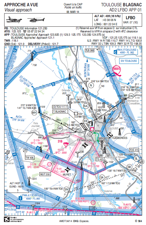
Visual Approach to Blagnac. Special attention to route followed from Lasbordes, EN – EA – EB.

Visual Landing in Blagnac. Special attention to waypoint EB (water tower) and clockwise aerodrome circuit to land on 32L.
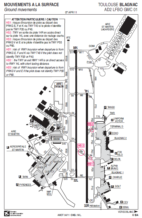
Taxiing in Blagnac. Special attention to the crossing of 32R by way of M4 and N4. Note parking Golf. Departure from 32R by way of N1.

