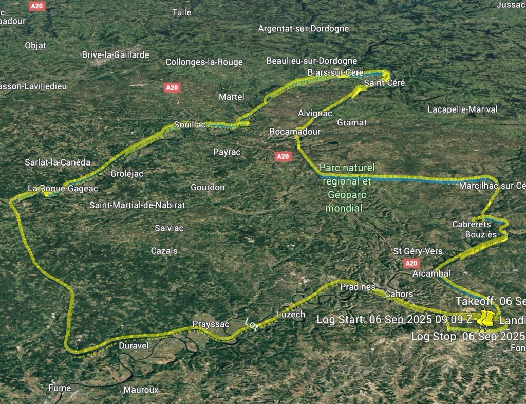
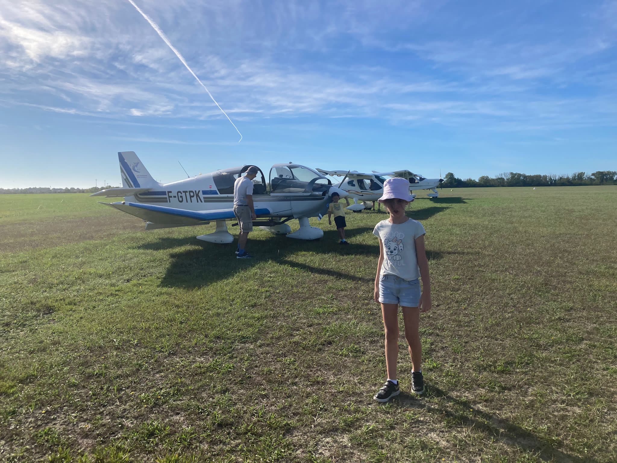
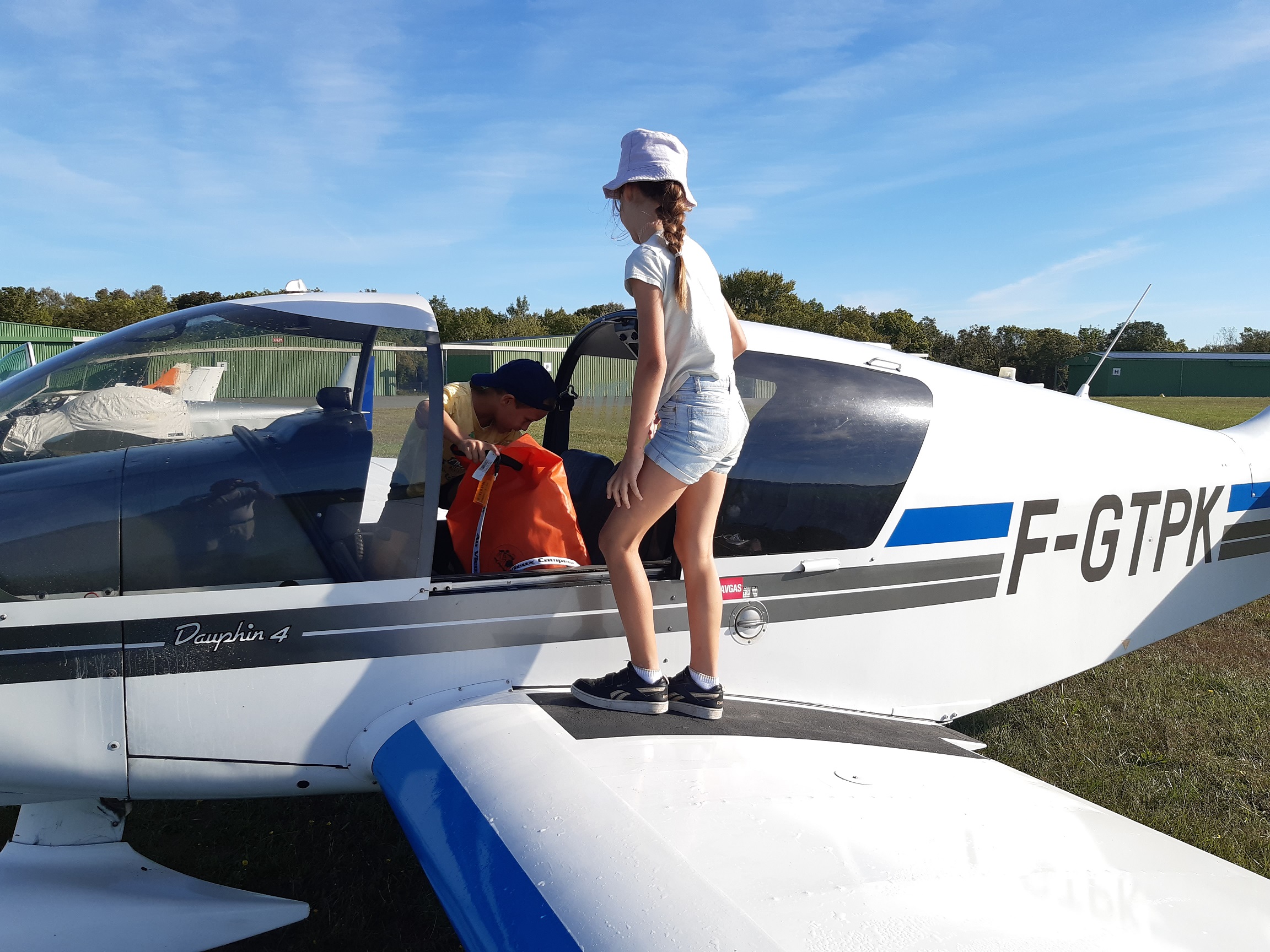
Yesterday, together with my family, we participated in a fly out excursion organized by Jean Claude and his aeroclub du Quercy for members of our Aviation Society. We came with different aircraft to meet at Cahors (LFCC) and from there, Jean Claude had prepared a closed loop circuit around the valleys of the rivers Lot and Dordogne, with several points to spot and some quizzes around the area.
Summary of the excursion
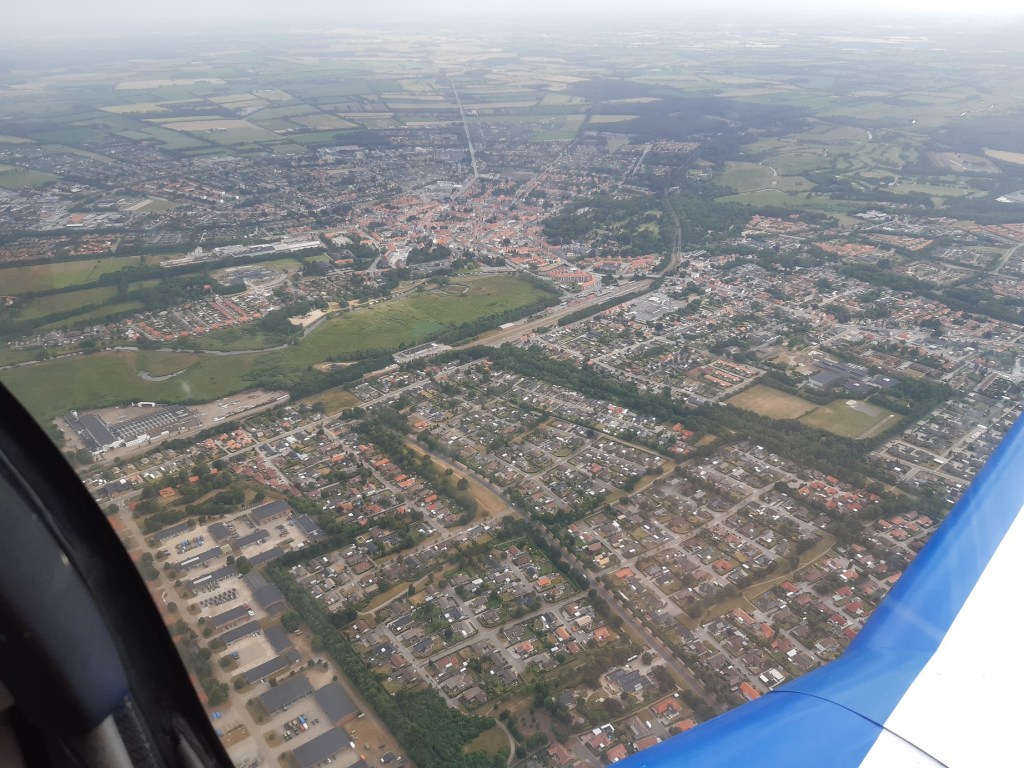
As our aeroclub is based in Toulouse Lasbordes (LFCL) we first had to fly to Cahors, a 40 minute flight.
Once at Cahors, we met different members of the local aeroclub and received a last briefing and some advice around the flight. The circuit was divided in 5 sectors.
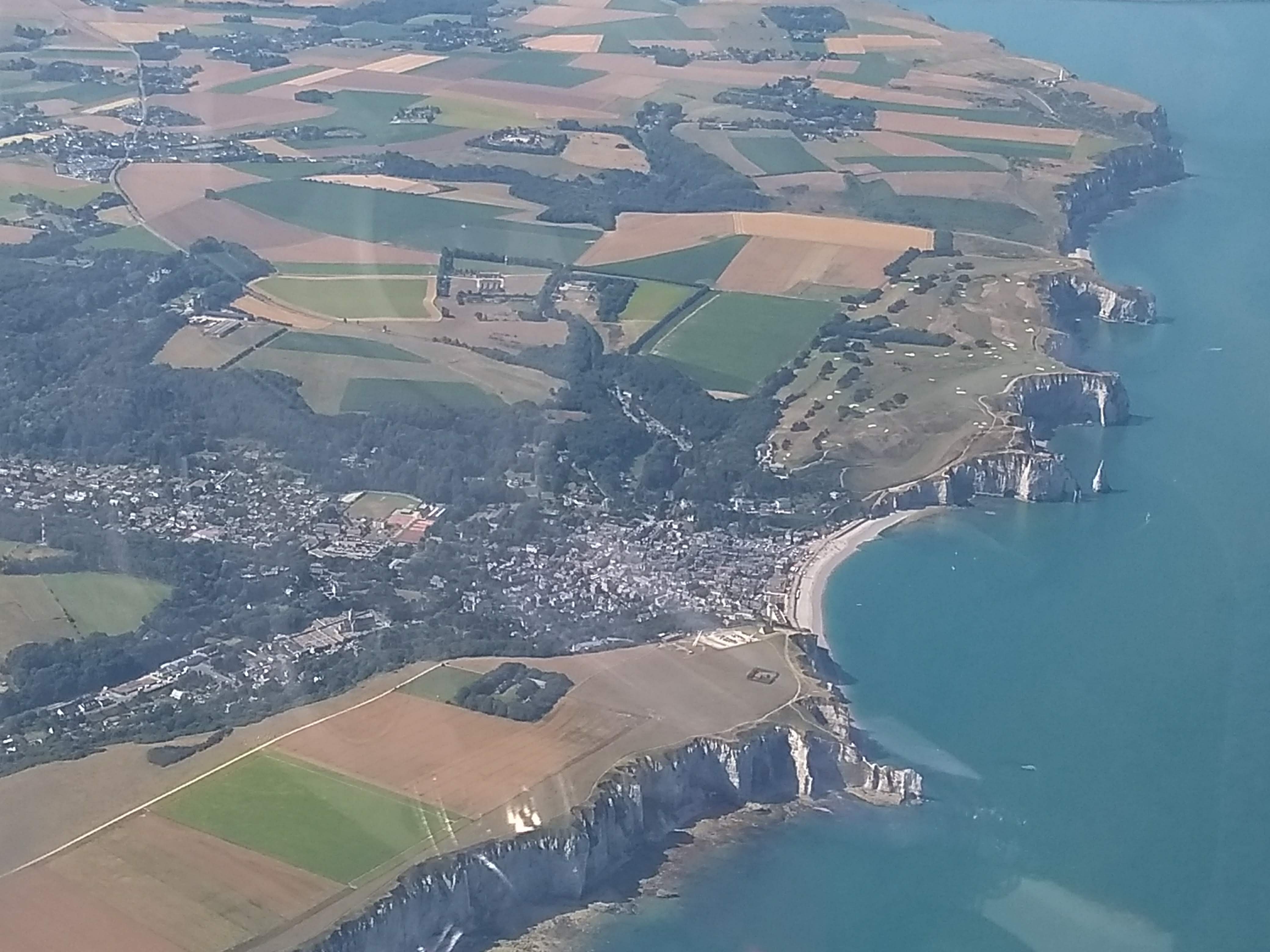
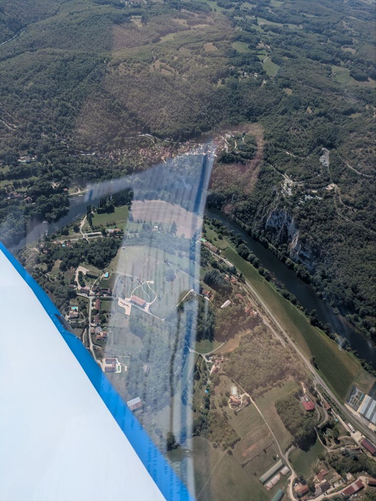
Sector 1: in this sector we had to spot castles along the Lot, including the Château de Mercués (which belonged to Georges Héreil, former manager at Sud Aviation and father of the Caravelle), the Château de Caïx (acquired by Queen Marguerite II of Denmark, as her husband, prince Henrik, came from the region), Puy l’évêque and the Château de Bonaguil.
Sector 1Château de MercuésChâteau de Caïx
Sector 2: it consisted of flying North to reach the Dordogne, by way of Villefranche du Périgord.
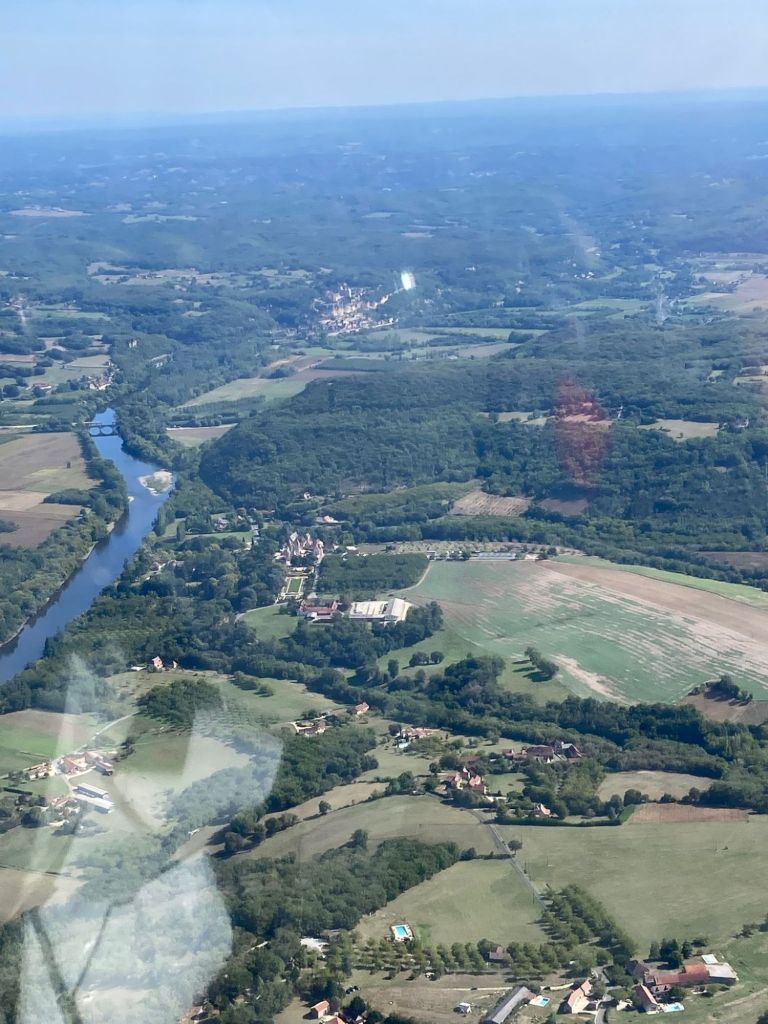
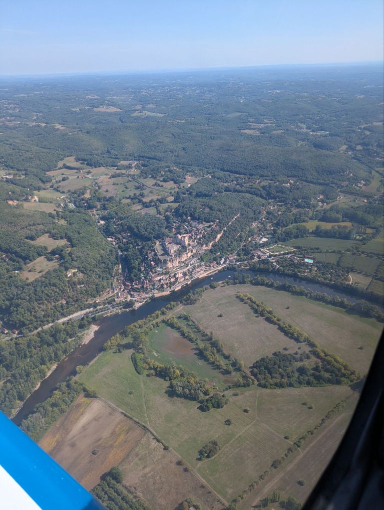
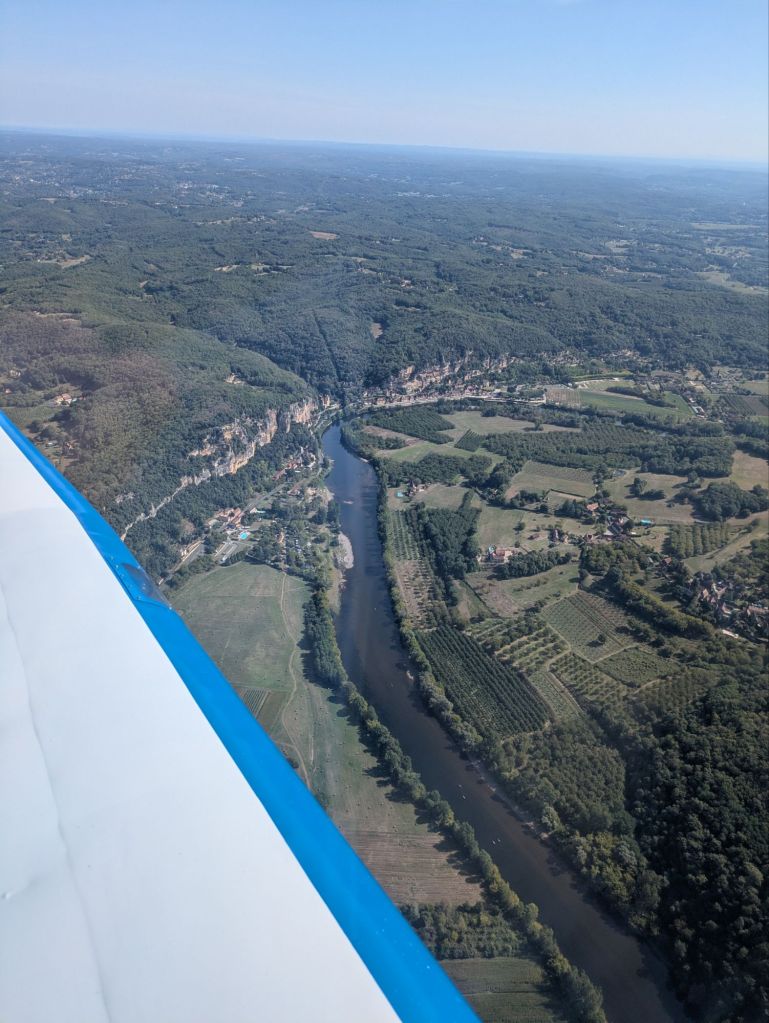
Sector 3: in this sector we had to spot castles along the Dordogne, including the Château des Milandes (which belonged to the American French singer, activist, resistance agent Joséphine Baker – whose remains rest at the Pantheon), Beynac-et-Cazenac, La Roque, Domme, Souillac.
Sector 3Château des MilandesBeynac-et-CazenacLa Roque
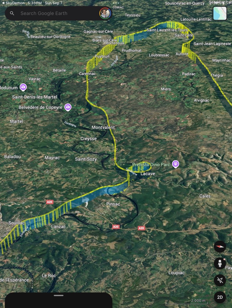
Sector 4: in this sector we had to continue spotting castles along the Dordogne, including Château de la Treyne, Château de Belcastel and Château de Castelnau Bretenoux, we then turner South to fly over Saint Céré (home of the tapestry artist Jean Lurçat), then West towards the fall of Autoire (seemed dry from the air), Rocamadour and Labastide Murat (origin of the Marshal Joachim Murat).
Sector 4Château de la TreyneRocamadour
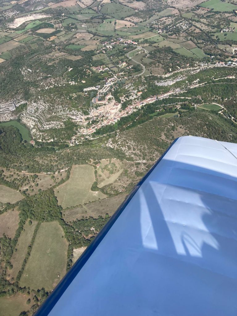
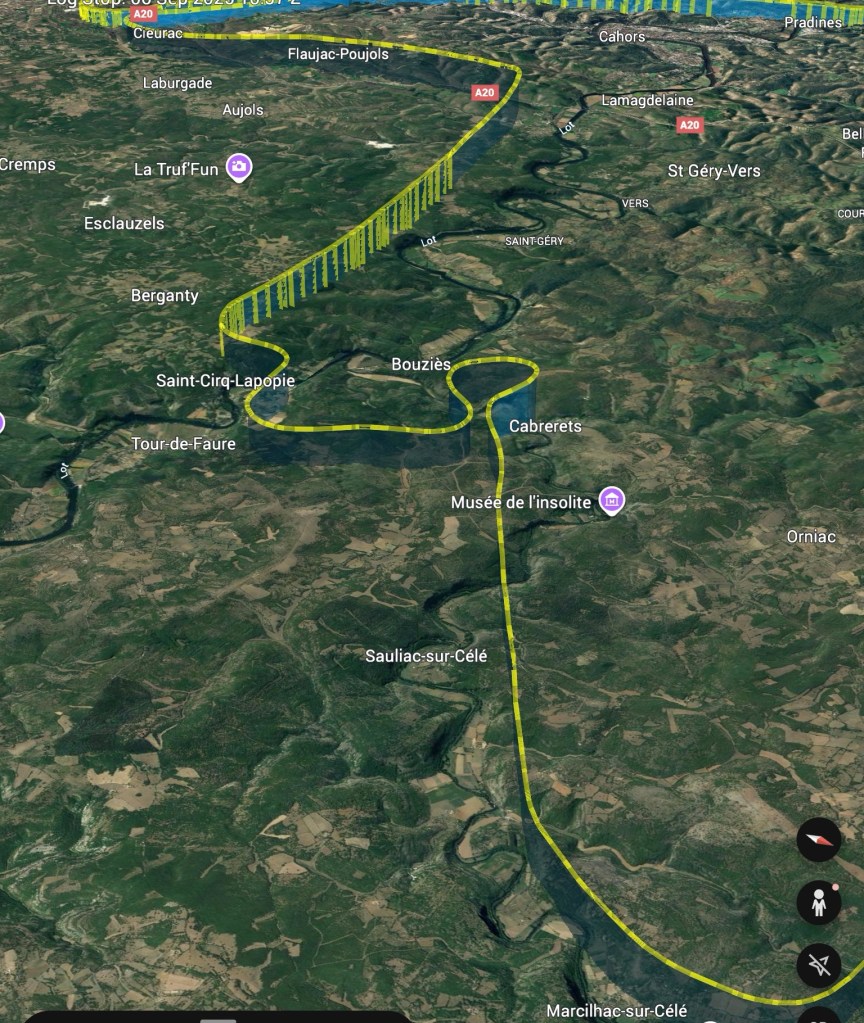
Sector 5: in this sector we went back to the valley of the Lot, by way of Marcilhac sur Célé, Cabrerets (where the Pech Merle cave is located, with its prehistoric cave paintings) and reaching Saint-Cirq-Lapopie. We then flew back to Cahors (birthplace of Leon Gambetta).
Sector 5Saint-Cirq-Lapopie
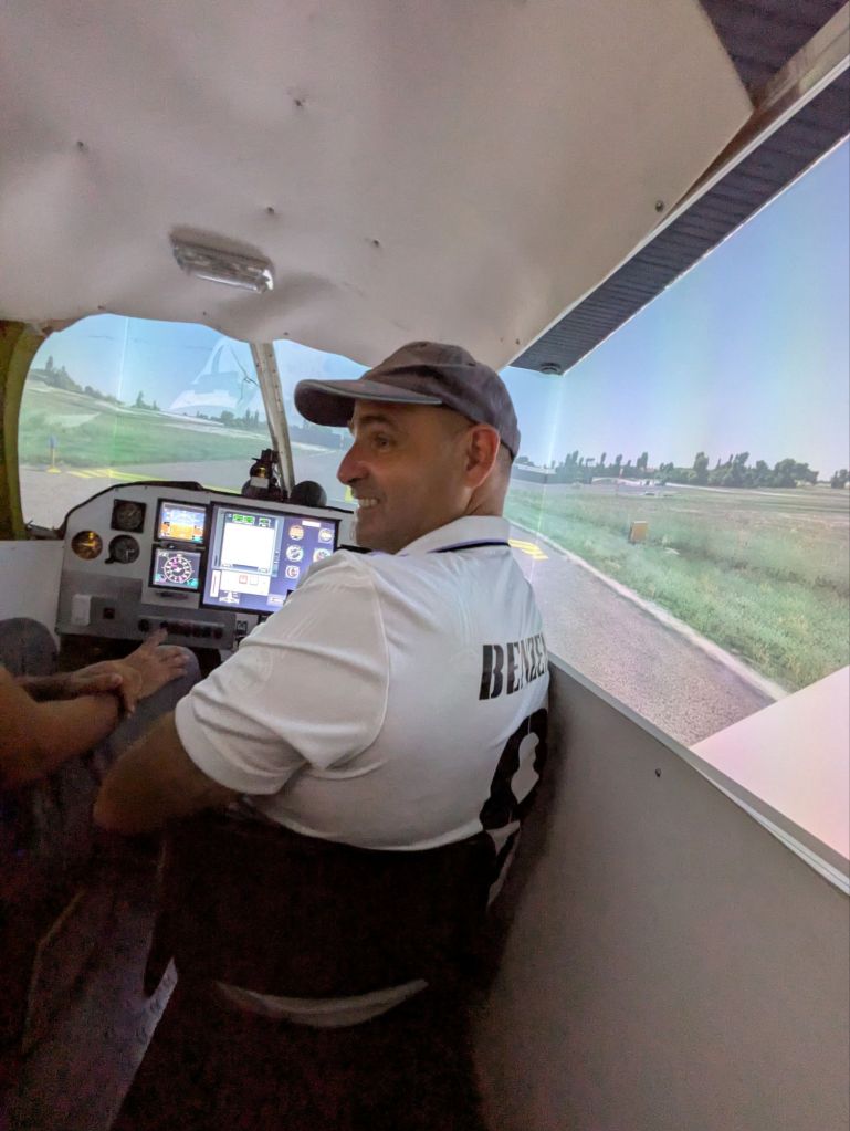
When we completed the circuit, we landed again at Cahors and shared a delicious lunch with the participants and members of the local aeroclub (very welcoming). They showed us as well the flight simulator they have developed in house to help with the training of new pilots.
Flight simulator at Cahors aeroclub du Quercy
Once, finished we bid our farewell and flew back to Toulouse.
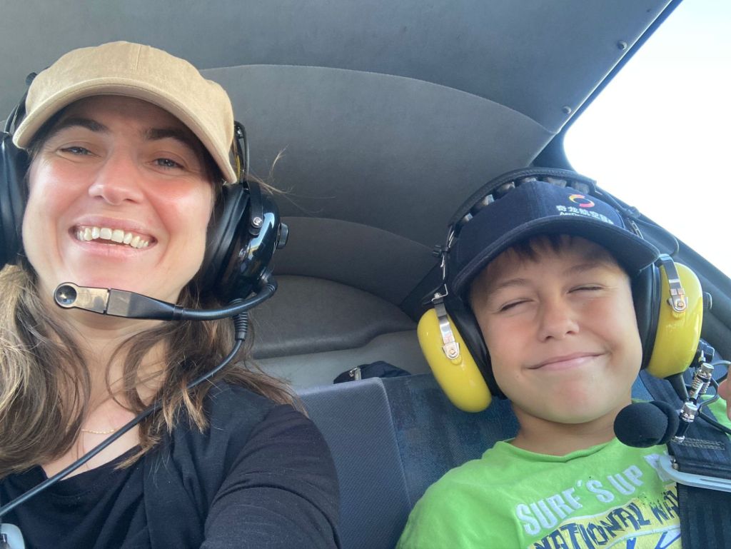
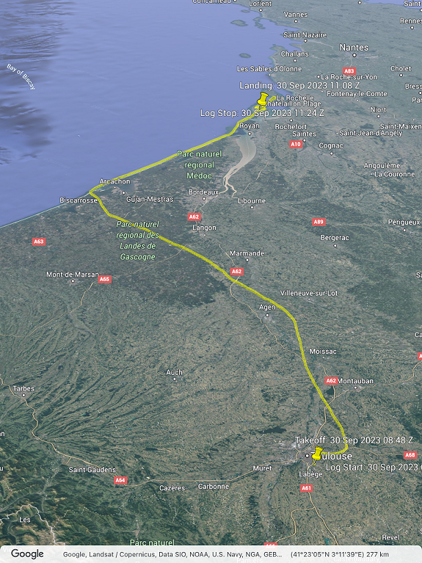
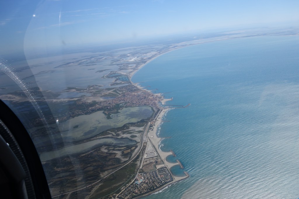
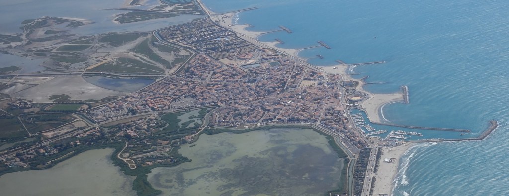
Last weekend, with Luca and our children, we took one of the aeroclub’s DR-400 to make a flight excursion from Toulouse (France) to l’île d’Oléron, a small island close to La Rochelle.
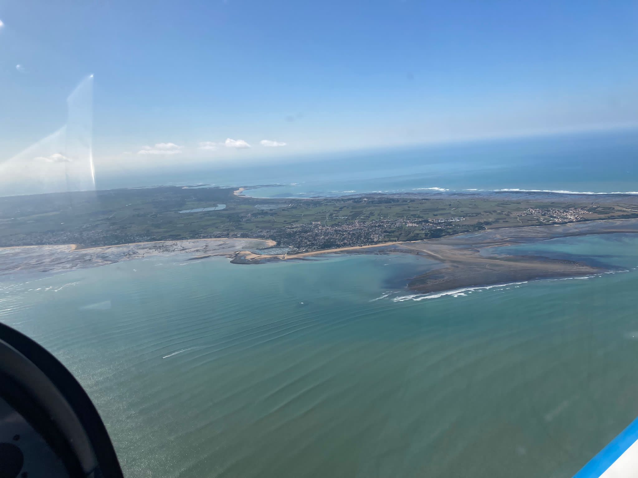
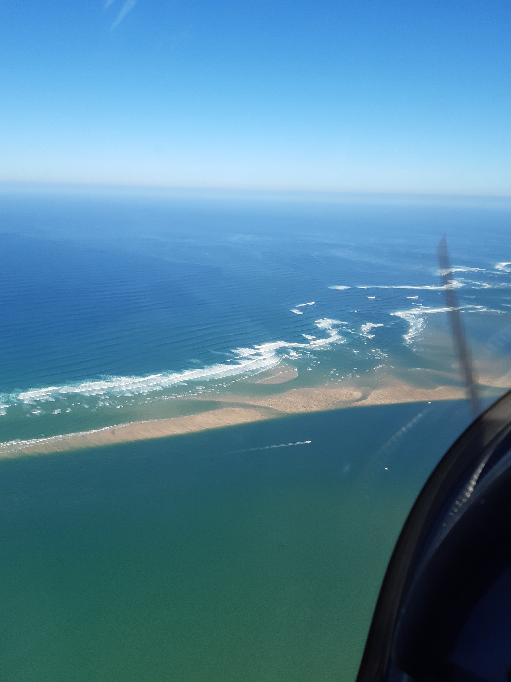
North side of l’île d’Oléron
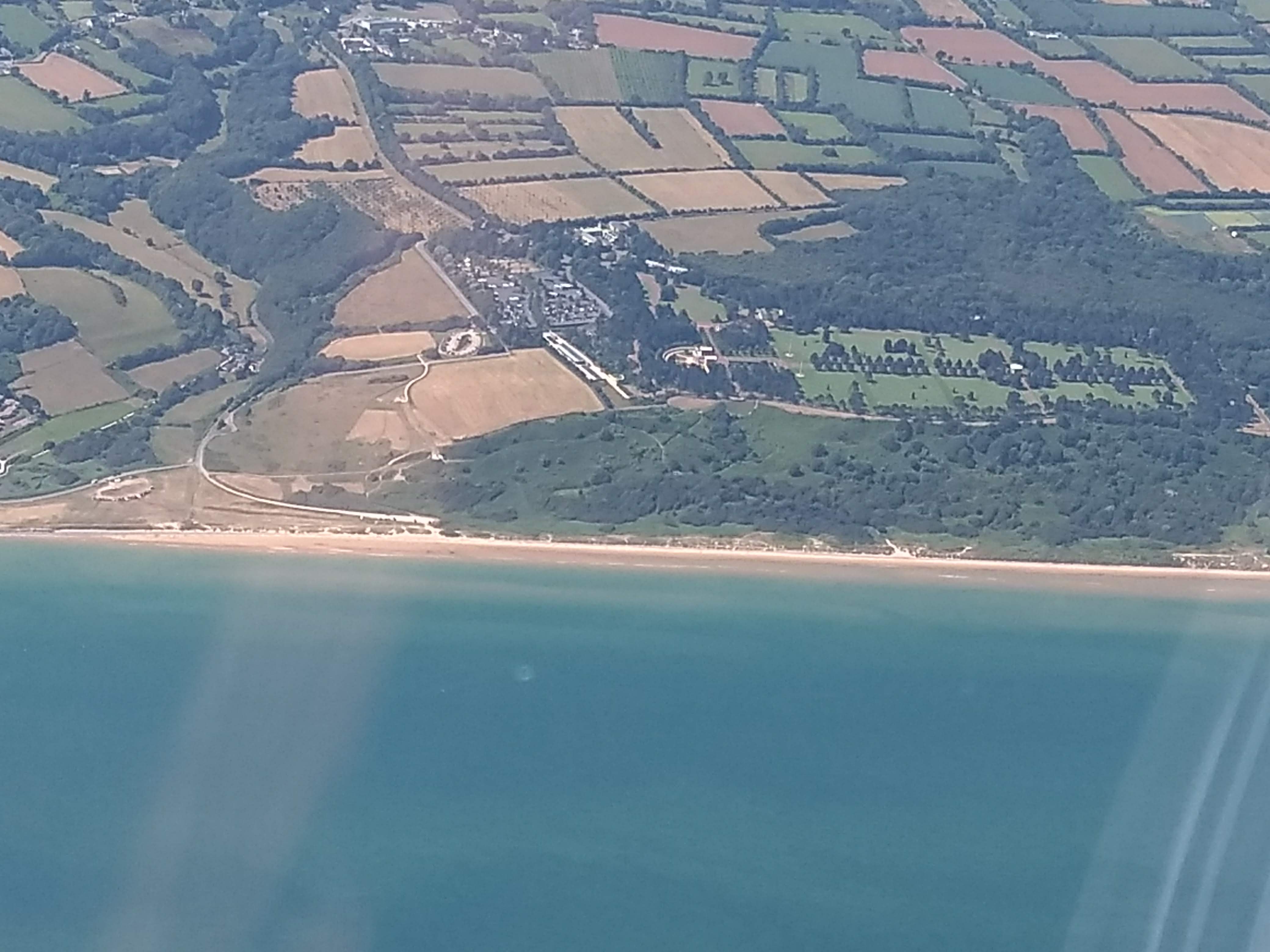
I had often heard about this destination from different members of our Aviation Society, so we wanted to give it a try as an easy plan for the weekend. We departed on Saturday morning from Toulouse Lasbordes (LFCL), flew to Saint Pierre d’Oléron (LFDP) in about 2h30′ and stayed overnight in the island, to come back the following morning.
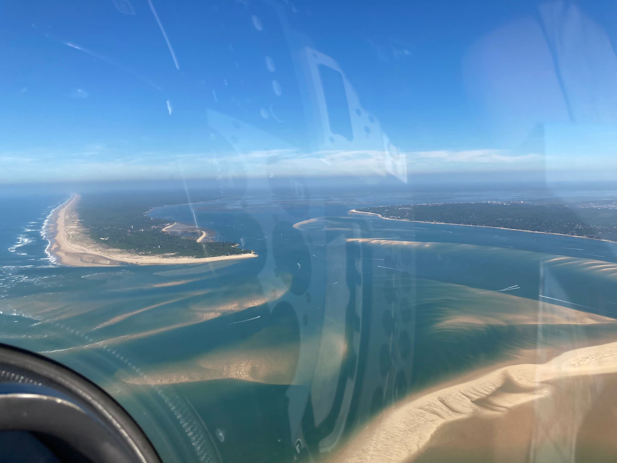
In both flights we flew by the Dune of Pilat and Cap Ferret in order to enjoy the views of the coastline from that point all the way to l’île de Ré.
Cap Ferret
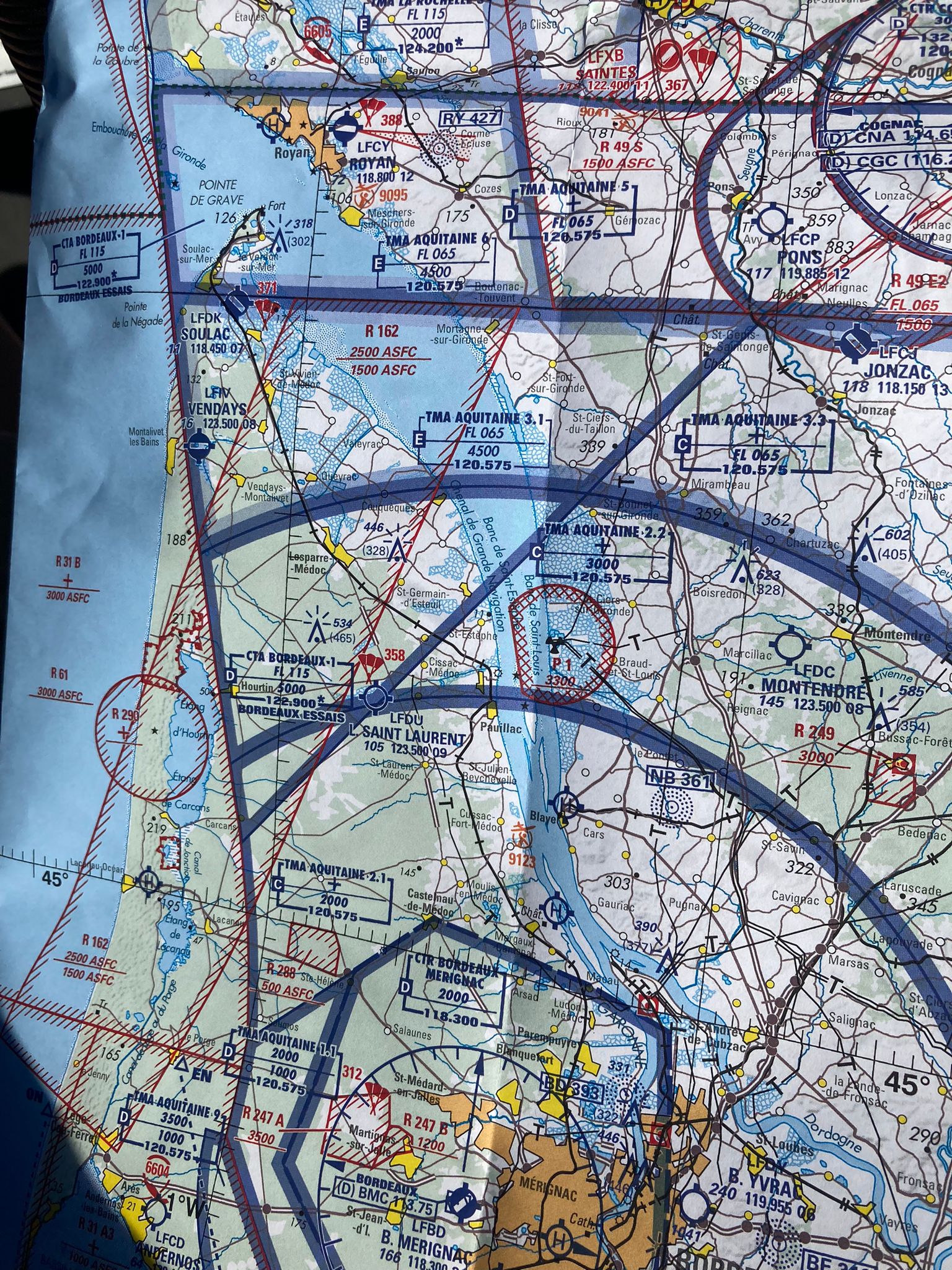
For the preparation of the flights and the navigation we relied on SkyDemon (I took again just 1 month subscription for 15€) from an iPad Mini (using an external GPS connected to the iPad). SkyDemon provides the GPS logs that afterwards can be viewed in Google Earth.
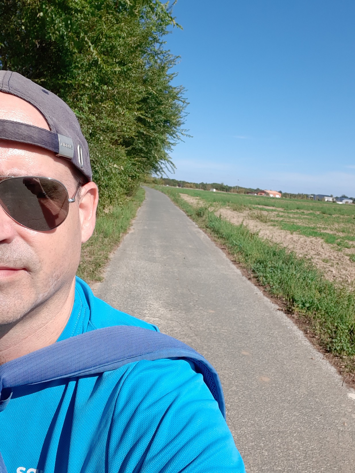
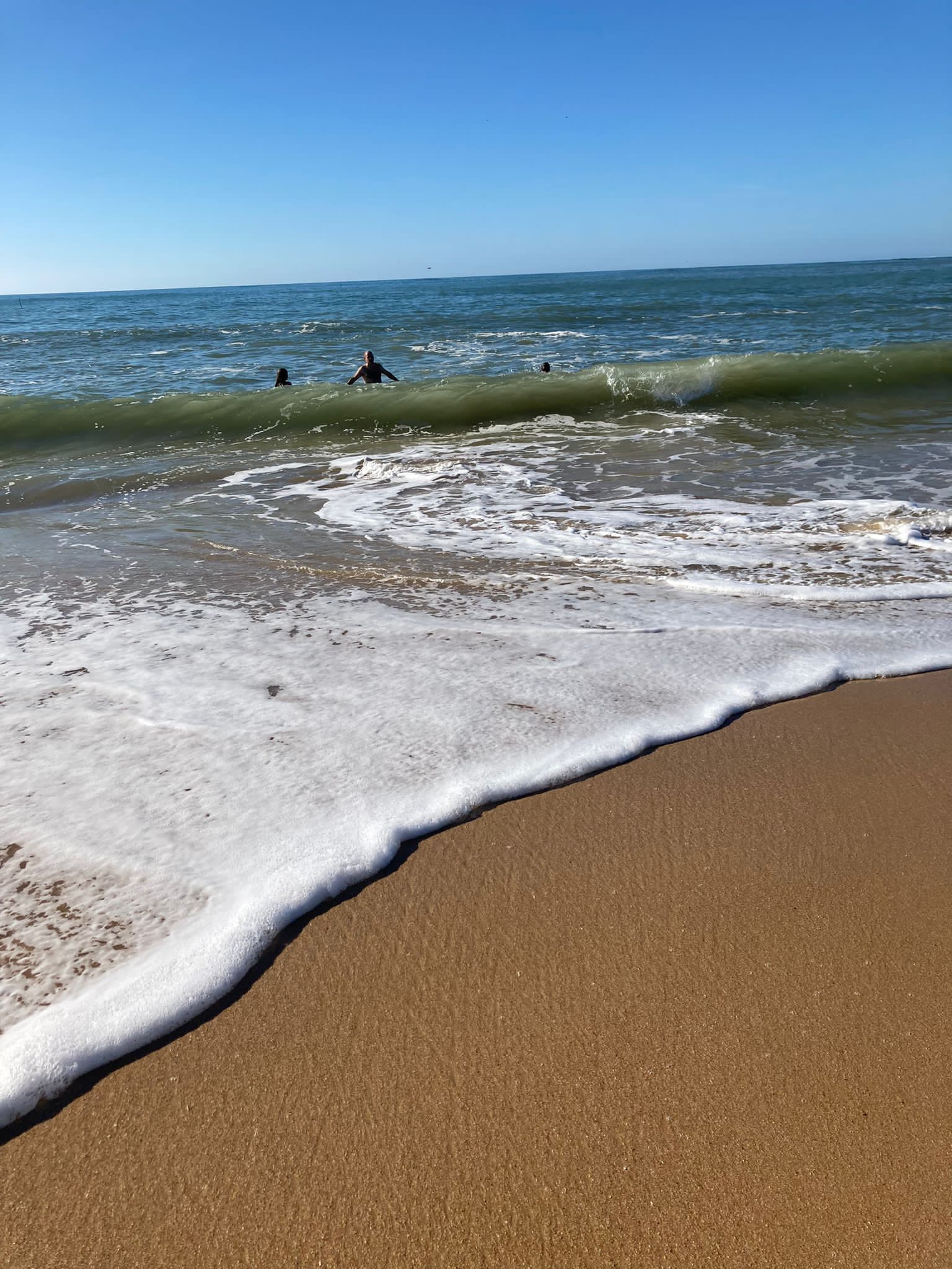
We did not reserve anything in advance, therefore upon arrival at the aerodrome we booked a couple of bikes at the aeroclub (20€ per bike per day; now I would suggest to book them in advance, as there were only 2 bikes left when we arrived) and a night at the hotell’Hermitage (very good breakfast, silent, nice warm swimming pool at the end of September and accepting payments with cheques vacances), close to the beach Sables Vignier Plage. We had packed light, just 3 light back packs, thus, we rode the bikes with the kids to the hotel and biked as well to and from the beach.
Biking to the hotel
Sables Vignier Plage
As an alternative airport I had selected La Rochelle, from which we could have taken a taxi to l’île de Ré. A third option would have been l’Île-d’Yeu which also has an aerodrome, but after a previous quick search in Booking.com I found that more hotel options with availability would be found at l’île d’Oléron. But I suggest to keep all options open, as if no hotels are found there, the other airports are at a short hop distance.
Saint Pierre d’Oléron (LFDP)
The kids preparing the airplane for the return flight
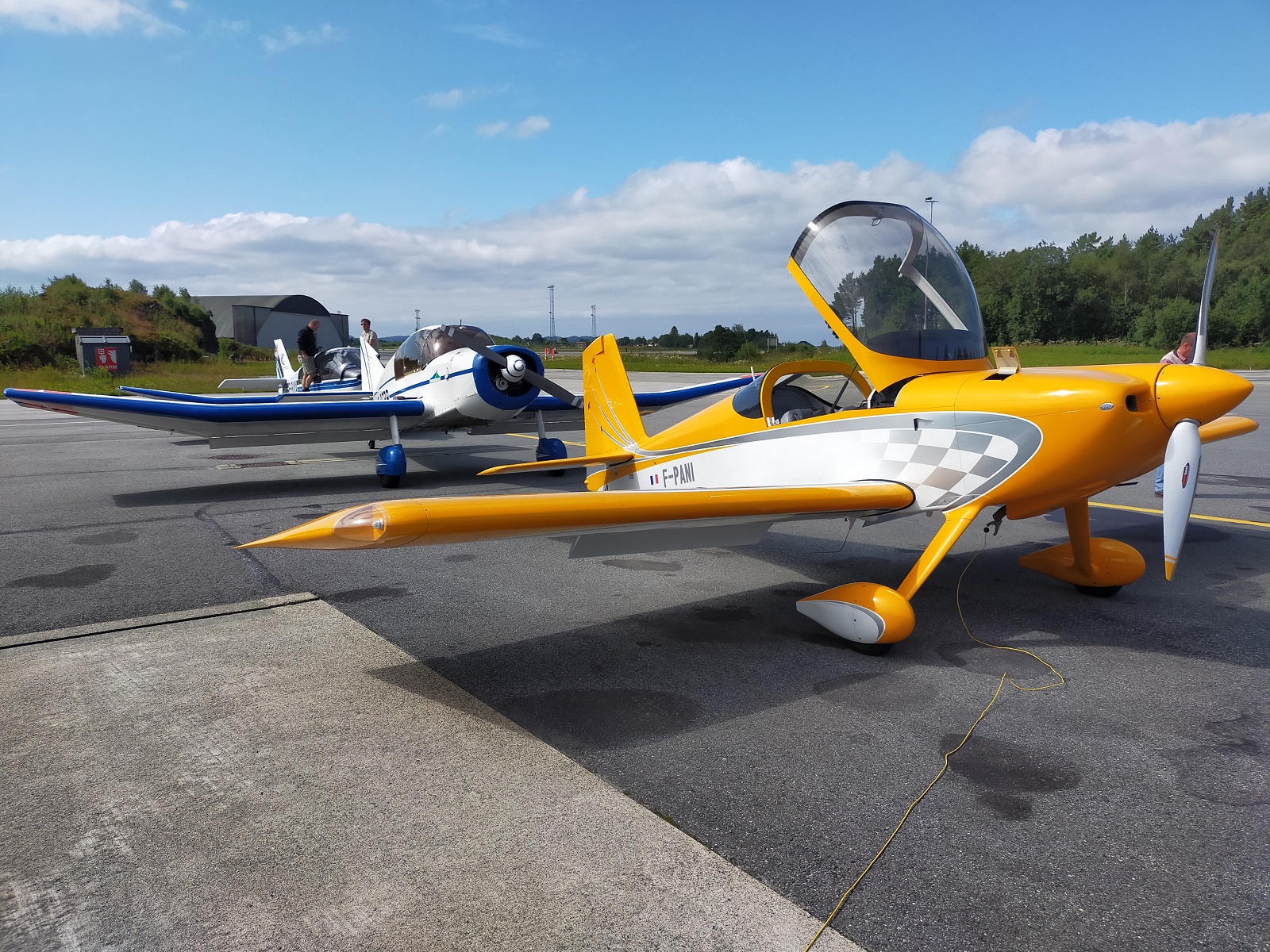
Two weeks ago, Jérémie and I took one of the aeroclub’s DR-400 airplanes (the 160hp F-GUYA) to make a flight excursion from Toulouse to the North Cape (Nordkapp, in Norway) as part of a “Fly out” organized by the Aviation Society of the Airbus Staff Council, together with 2 other aircraft, the F-BERB (with Norbert and Dominique, who organized the trip) and the F-PANI (with Anne and Nicolas).
At the beginning of the post I will focus on the different flights and share some pictures (taken either by me or Jérémie and Dominique, the ones with more quality) and at the bottom of the post I will leave some more technical details helpful for the preparation of such a trip.
We departed one day before the other airplanes to ensure that the engine hours of our airplane would not be consumed during a Saturday with good weather in Toulouse. However, North of Aurillac the weather was not so good so we waited until early in the afternoon to fly to Verdun. Even if not necessary we filed a flight plan and climbed to FL075 for most of the trip, to fly VFR on top of the clouds around the Massif Central and we just descended under the clouds some miles before the destination.
Once at Verdun we refueled the airplane, parked it for the night and booked a room at the Ibis budget hotel, which is however 5km from the aerodrome. A kind member of the local aeroclub gave us a lift to the hotel.
The morning after we did not have a transport to the aerodrome as apparently there were no taxis in the surroundings, so we had to walk to the airport; a hike that took us well over an hour with the bags and by some wheat fields.
We then made a short (~40′) flight to Doncourt, not without flying over some of the fields and memorial monuments of the WWI battle of Verdun. We then arrived to Doncourt, which has as A/A frenquency 123.500 and that was confusing as there are other aerodromes not too far using the same frequency, causing you to hear messages unrelated to the aerodrome you are about to land.
At Doncourt we refueled again and had a chat with a member of the local club. I went to pick some snacks from a local backery (less than 1km away) while we waited for the F-BERB. We then had a picnic at the aerodrome before departing for Tønder.
For the flight to Denmark we had to file a flight plan. We used a simple route based on the location of some VOR (DIK NOR BOT NDO). We were going to overfly Luxembourg and the whole of Germany. We climbed again to FL075 and were cleared (after the F-BERB) by the ATC (Langen radar) to fly through class C spaces around Cologne and Düsseldorf. Later, we listened in the radio that the F-BERB was descending to 3,000ft and below somewhere North of Bremen so we followed suit. From there and until nearly the border with Denmark the ceiling was at around 2,000ft, but since the ground is almost at sea level the flight was still comfortable. The West coastline of Schleswig-Holstein was wonderful.
Luxembourg, Essen, Duesseldorf
When we arrived at Tønder the F-PANI was already on ground and the F-BERB landed shortly after. Our flight plan had not been properly communicated and we were not expected, nor could refuel as we did not have local currency (DKK). We booked rooms in hotels in the village which was at walking distance. We then gathered at the Cafe Arthur and enjoyed our first dinner together as members of the fly out. There Dominique offered us a bottle of Saumur red wine that he had brought to celebrate that first night.
We woke up early as we wanted to be ready at the aerodrome at 7am to refuel the airplanes and had a 25-minute walk before to get to the aerodrome. The person in charge of the fuel station arrived a bit later but we were ready for departure at around 8am. We had filed another flight plan to fly to Bergen in Norway.
Flying over Denmark, despite its flatness, was nice, with the coast to the West, small crop fields and villages, including the coastal city of Esbjerg where my brother spent 2 weeks of the summer of 2002. We flew by the coast up until the village of Hanstholm (close to Thisted aerodrome) and then took a North West heading towards Norway with a transit of just above 30 minutes over the North Sea.
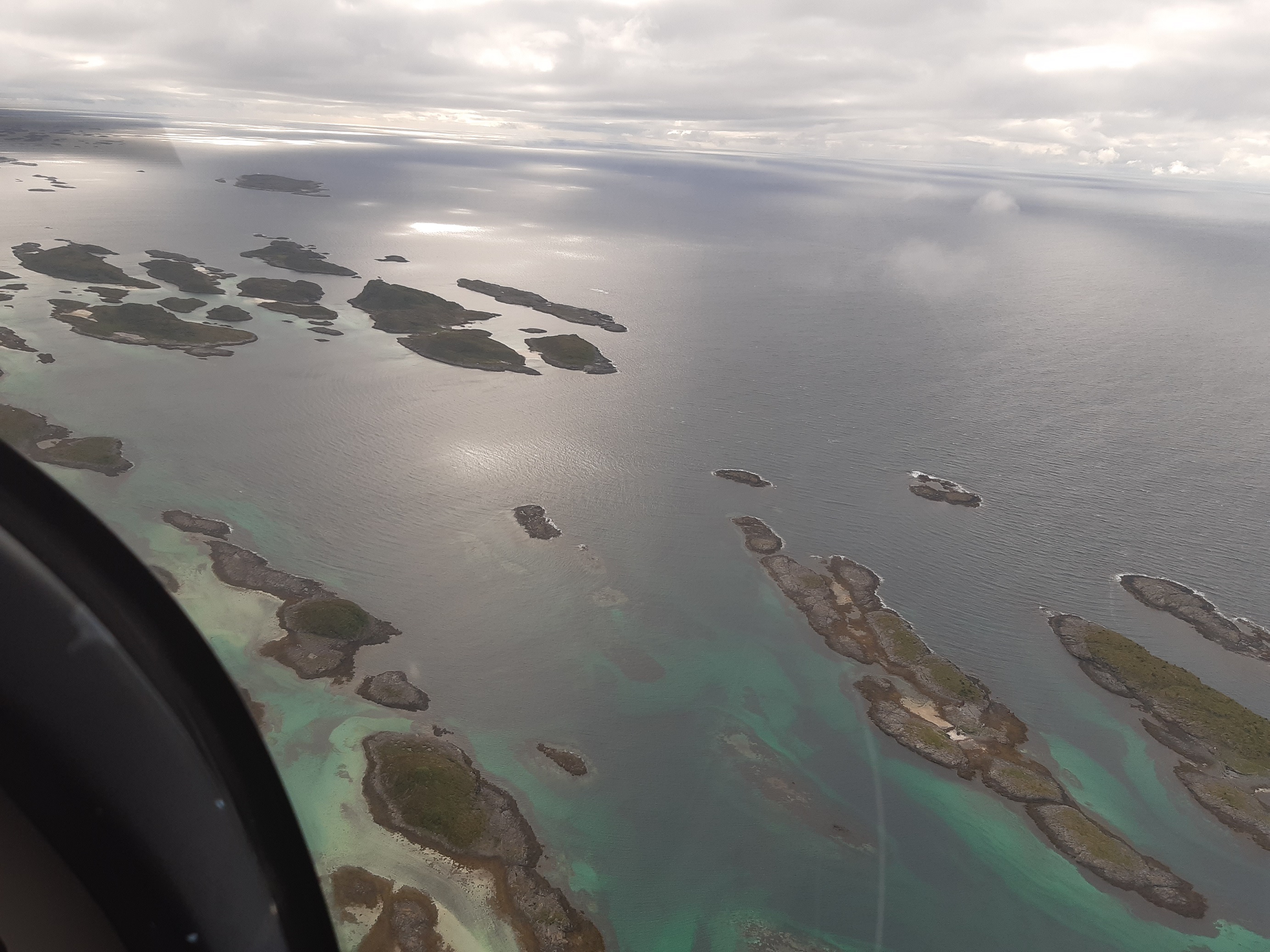
Once in Norway we continued flying along the Southern coast, overflying the airports of Farsund Lista, Stavanger Sola and Karmøy until we reached Bergen. During that flight of over 4 hours we enjoyed the good weather and the views.
At the tarmac in Bergen we spent some time between refueling and then waiting for the police to check our EU Covid-19 passport so that we were cleared to enter the country. We then purchased online the week pass covering the landing fees in all Norwegian airports, filed another flight plan and off we went for our next destination: Trondheim.
In that second flight, the sky was covered with clouds but the ceiling was not very low so it allowed for a relatively comfortable flight enjoying the views of the different islands. Once arrived at Trondheim we refueled, parked the plane, were taken in a small bus to the general aviation exit of the airport and walked to our hotel (Radisson Blu at the airport). We had dinner at the hotel restaurant and studied the weather which started to degrade.
Day 4 (July 20th) – Trondheim Værnes (ENVA) – Brønnøy (ENBN) – Bodø (ENBO) – Alta (ENAT)
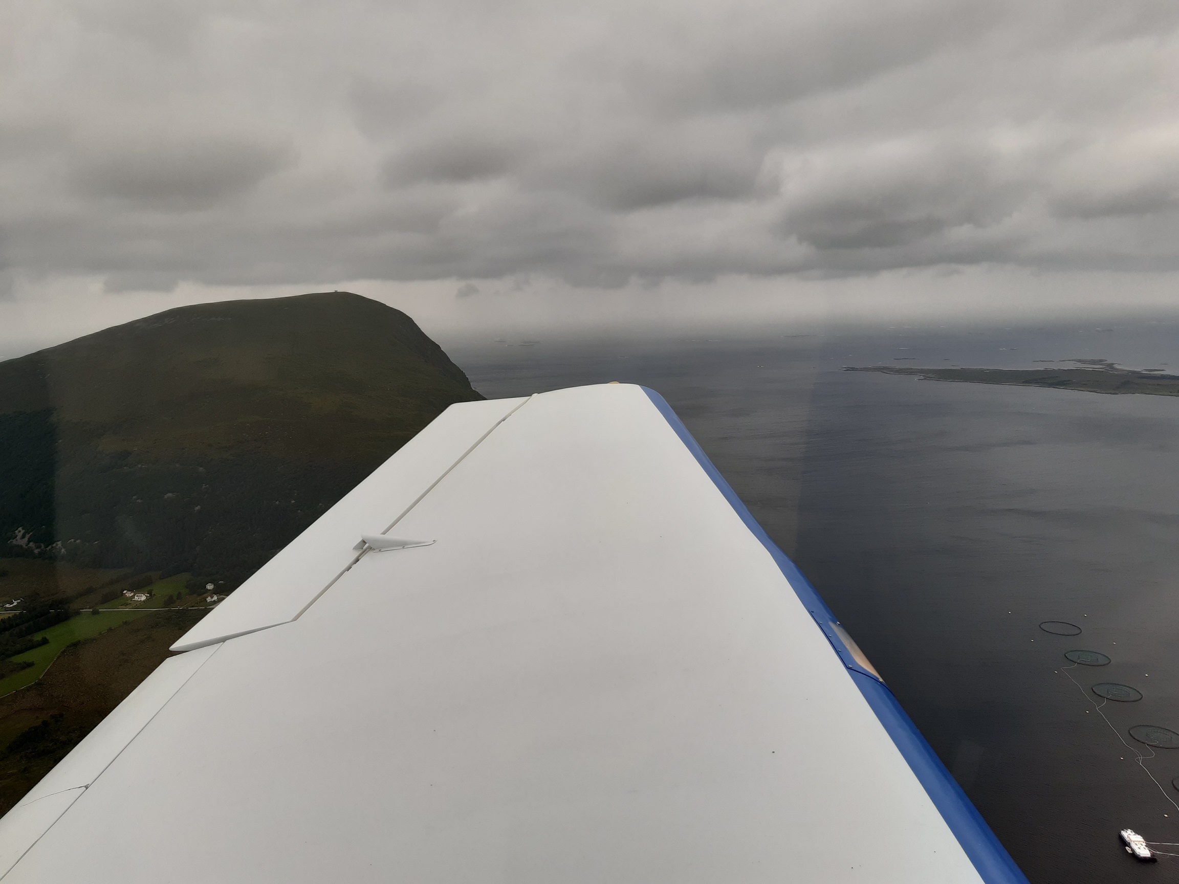
In the first flight of the day we tried to reach Brønnøy overflying some fjords in the interior and flying over Namsos but before reaching that point there was no visibility and the F-PANI and us had to take a U-turn back to the fjord of Trondheim and get to the coastline overflying Orland airport. In flight we learnt that a NOTAM had been published informing that there was no Avgas that day at Brønnøy. Despite of that we landed there, which wasn’t easy as just when arriving there were some showers, so we had to hold first at the South and then changed our plan and approached the airport from the North West. At the airport we studied again the weather to the next airport where we could refuel, Bodø, a flight of just over an hour.
During the flight to Bodø we had a lower ceiling (at around 1,200ft, flying at below 1,000ft) and showers here and there. Though just at the airport the weather was clear. We landed, refueled, quickly ate some bananas and got ready for the next flight to Alta.
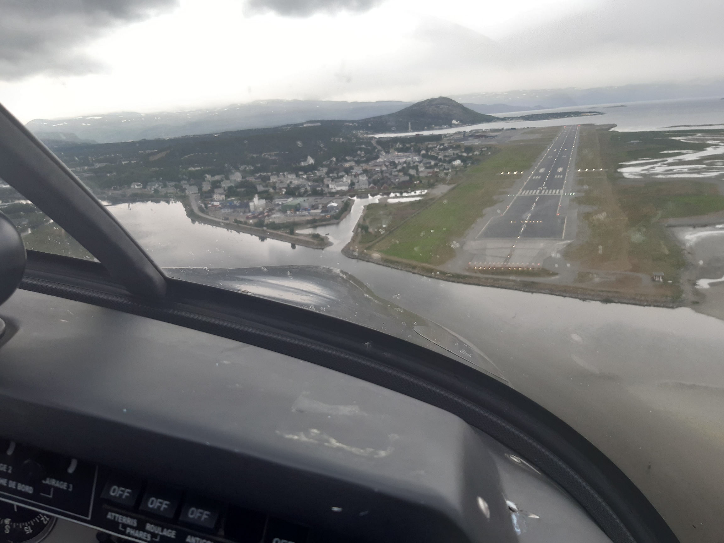
For the flight to Alta we would have liked to enjoy the view of the Lofoten islands, but seeing the weather and winds, we rather flew towards Leknes and then by the Western coastline of those islands. We passed by the West of Andenes. At that point the weather conditions were not very good, the flying was not easy. We counted with the help of the ATC and the messages exchanged between our 3 airplanes. Once we passed the latitude 70°, North of Tromsø, we got encouraging messages from the F-PANI, but as we were approaching Alta the weather was still not getting better, with very strong winds entering the Stjernsundet fjord to get to Alta. The airport in Alta was at the end of another fjord and at that point the wind was calmer and we landed.
The airport was closing so we just had time to get some help to get a taxi, book a room at the Scandic hotel and had dinner at Du Verden. The study of the weather during that dinner was not very positive, but we still gave us until the next morning to decide what to do the following day.
Day 5 (July 21st) – Alta
Before breakfast at 7am we looked at the weather and decided not to attempt to reach the North Cape that day, as the conditions were not very good with winds, rain and clouds. We booked another night at the hotel and the group split in two: Dominique and Norbert went to the airport to refuel the 3 planes, while the rest of us went to the museum of Alta to visit the Rock carvings (see related post). On the way there there was some rain but later on the sky became clear and we continued walking around for a total of more than 12km that day.
Back at the centre of the village we got some food for the plane (so we could have something to eat in the stops), we took a closer look at the iconic Northern Lights Cathedral and later met the group for dinner at a pizza restaurant, where again we studied the weather for the following morning, when we would attempt to fly by the North Cape followed by a flight to Tromsø.
Day 6 (July 22nd) – Alta (ENAT) – Alta (ENAT) – Bodø (ENBO)
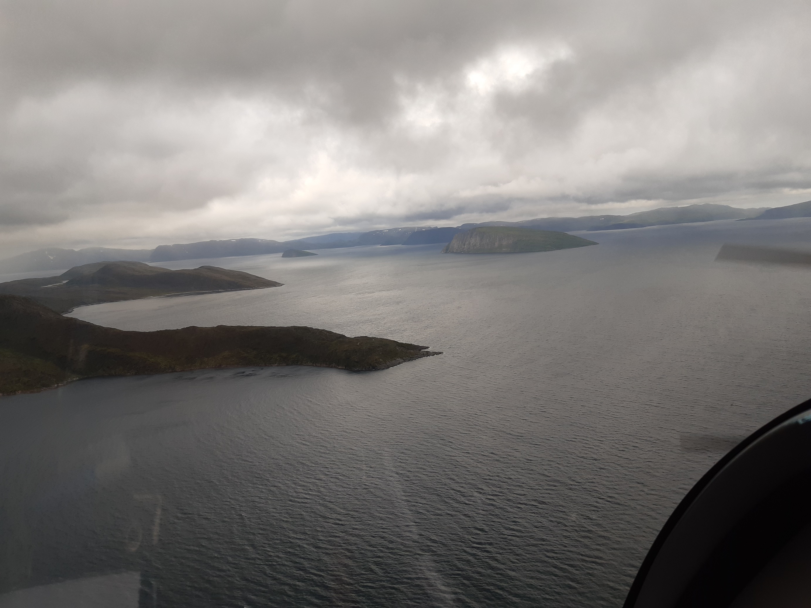
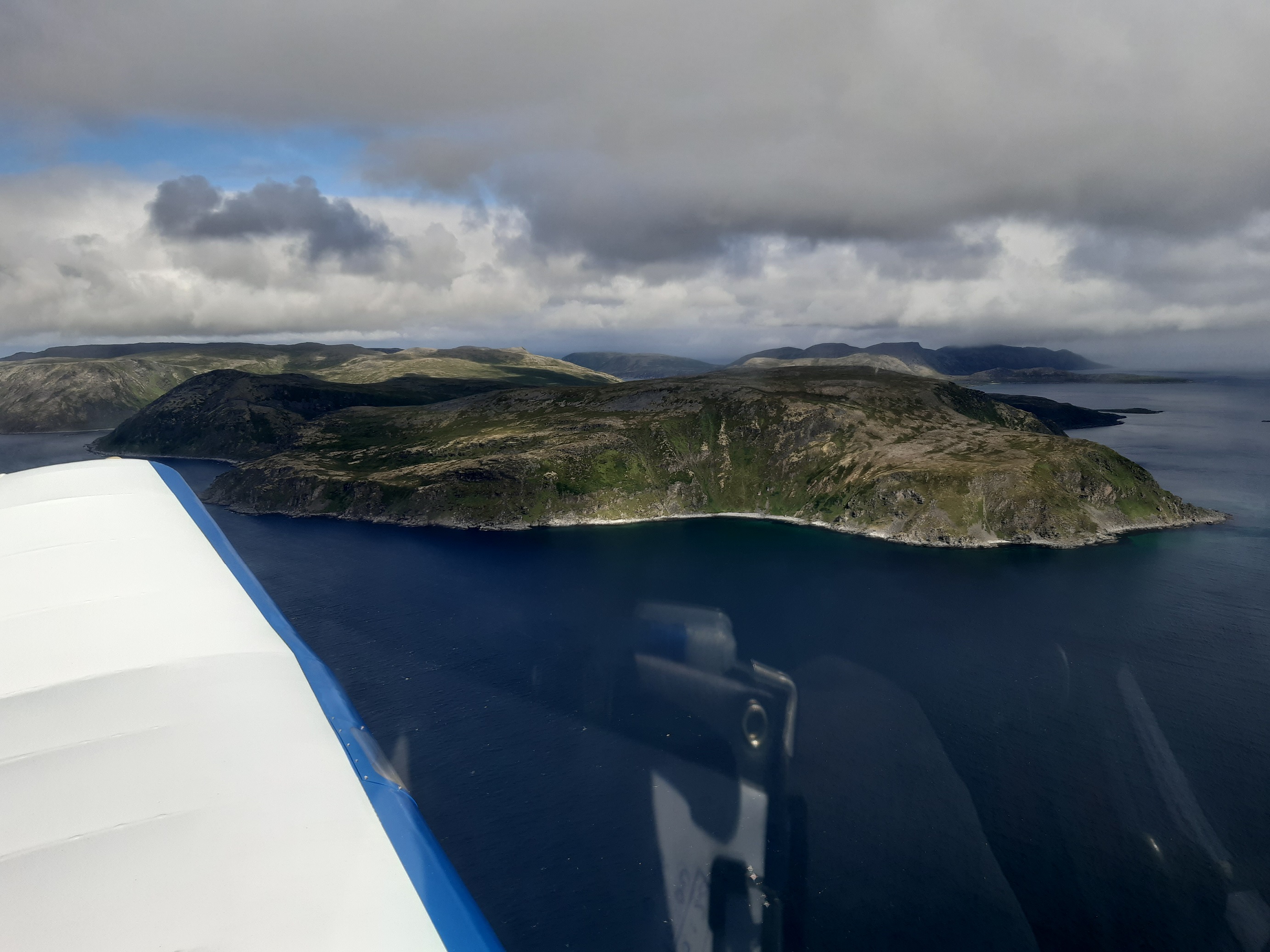
We woke up early again, took breakfast together at 7am and got ready to go to the airport and wait for the weather to become more favorable. After about an hour, the F-BERB departed first by the fjord and then flying over the terrain to reach Porsangerfjord at the East and reach the North Cape from the South. A bit later the F-PANI and us left following the fjords (flying by Hammerfest) and reaching the North Cape from the West, took some pictures of it and then took heading for the South West.
The F-PANI flies much faster and at some point they reached a situation without visibility so they took a U-turn and so we did and both airplanes flew back to Alta, where we refueled again and stayed for some more time waiting for a front of clouds and rain to pass.
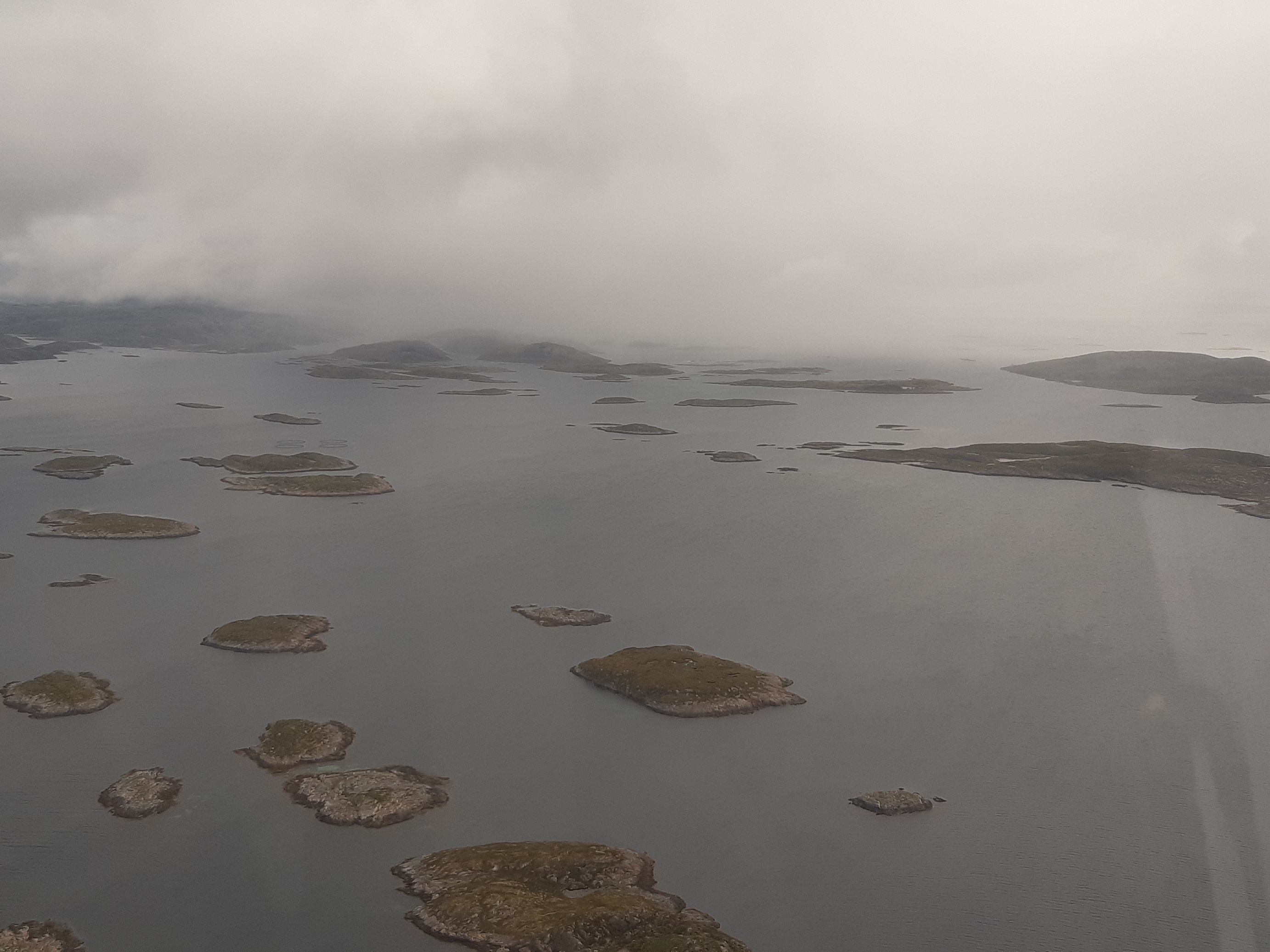
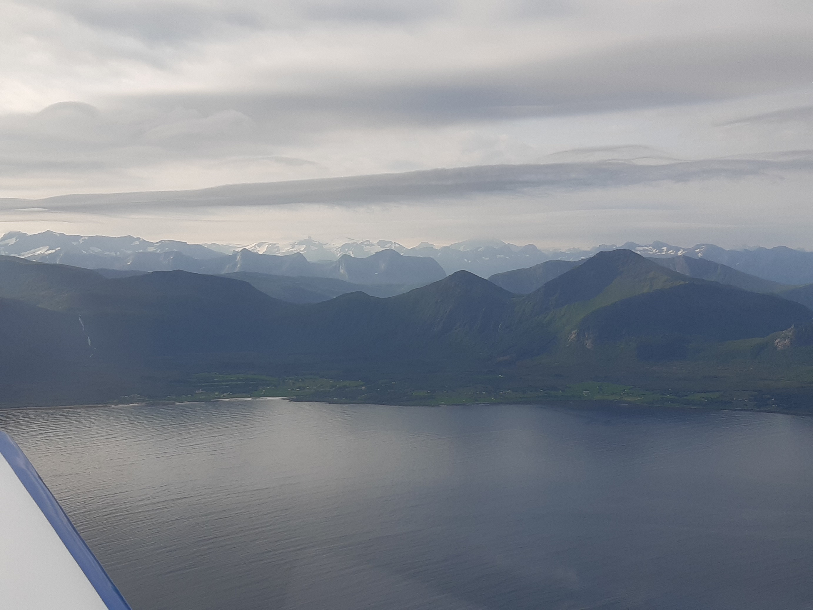
We then departed again, this time reaching the coast directly through the fjords to then follow the Western coast of the Lofoten islands on the way to Brønnøy. That flight was a very complex one. Already getting out of the fjords was difficult with very low ceiling, flying at 500ft, some showers, low visibility… flying with the help of the GPS to ascertain where the other side of the fjord or the next island would appear.
After 1h30′ the sky became somewhat clearer and just when we were going to fly West of Andenes airport we received a message from the F-BERB informing that the weather by the interior of the Lofoten islands was better and we could see some light from afar at that point so we changed plans and took heading for Evenes airport. We then enjoyed an hour of very pleasant flight over the islands and turquoise waters.
We flew past Bodø and exchanged some messages with the other airplanes about plans in Trondheim after refueling at Brønnøy only to find that some 40nm South of Bodø visibility was very bad and the ceiling very low. The difference now was that the area is full of small rocky islands, so at that point we made another U-turn and flew back to Bodø. The visibility at the airport was very low as well so we waited holding flying in circles at some 600ft for a few minutes about 20nm South of the airport until the controller offered to guide us to the airport under Special VFR.
We landed, refueled, called the tower by phone to thank the ATC for his help, booked a hotel by the harbor (Radisson Blu) and had dinner at Bjørk. Back at the hotel we studied the weather again and decided to go early to the airport to see if we could depart the following morning.
Day 7 (July 23rd) – Bodø
We reached the airport earlier than 7am to see if we could leave, but hesitated as the weather conditions were still quite degraded and were not getting better. After a couple of hours at the airport we gave up, called our colleagues at Trondheim (who then pursued their trip) and went back to book another hotel (Zefyr) and took the opportunity to visit the Norwegian Aviation Museum (see related post).
In the afternoon I went to rest at the hotel, while Jérémie went visiting around the city. For dinner we went to Burgasm (with a very comprehensive variety and customization of burgers).
Day 8 (July 24th) – Bodø
This day the weather was still pretty bad, as another low pressure front was coming from the South West and expected to hit the coast. We went to visit the Salmon centre by the harbor and then to the airport to move the airplane and align it with the strong winds that would blow later in the evening (and hopefully clear the local weather so that we could depart the following morning). That evening we had dinner at En Kopp, with very good fish dishes.
We left the hotel at 6am to try to be ready to fly at 7am and so we did. That day the weather was finally good, with just some clouds at 3,000ft around Bodø but clearing further South. We continued flying along the coast down to Brønnøy while climbing first to 4,500ft and then to 6,500ft in order to fly to the interior of the country, East of Trondheim, flying over Røros and approaching the TMA of Oslo Gardermoen from the North, flying by the East of the CTR and finally landing at Kjeller aerodrome (the first aerodrome built in Norway in 1912), where the weather was completely different, blue sky and hot temperatures.
Funnily enough, at the fuel station of Kjeller we met a local who had been in Toulouse learning to fly aerobatics and knew some members of one of the aeroclubs in Toulouse Lasbordes. We had lunch there, studied the weather again ahead of the crossing of the sea and the flight over Denmark, where storms were announced.
Shortly after we took off again from Kjeller, overflew Rygge and continued our flight to the South very close to the separation between the Norwegian and the Swedish FIR, while having the Swedish coast in sight for most of the time until we could see from afar the thin peninsula of Skagen in Denmark. This time we flew closer to the East of Jutland to avoid the storms that seemed to be more to the West. We left Aalborg to the West, then Billund and the ATC of Skrydstrup helped us in flying through some local cumulonimbus and showers, until we were finally in sight of Tønder.
At Tønder we met some of the members of the local club and later came the person in charge of the refueling station (as Norbert had called him to make sure they were aware of our arrival). This time we were able to pay in euros, so we refueled that same afternoon, before we were offered a lift to the Motel at the centre. We then went again to Cafe Arthur.
The following day would be a long one and the weather forecast wasn’t very good for Denmark or Luxembourg, but seemed OK to cross Germany. Following the example of the F-BERB we decided to go very early to the aerodrome to take off as soon as we could.
We woke up at 4:30am and left at 5:10 for the aerodrome. While walking the sky was clear, but when the aircraft was ready mist was taking over. When we were about to align on the runway we could not see further than half of it, so we went back to the parking, switched off the engine and waited a few minutes.
A bit later, when the mist seemed to have cleared a little bit and we had good visibility of the whole runway we tried again to take off and this time we went to the air leaving the low level mist below us and we continued our flight on top to the South, immediately crossing to Germany.
We flew at 4,500ft until Nordholz and then climbed to FL065 to have better visibility of the cities ahead of us. Later, ahead of reaching the class C spaces around Düsseldorf and Cologne the ATC gave us clearance and asked us to climb to FL070 to stay in VMC conditions, as around Cologne the clouds became more numerous and were quite abundant by the time we overflew Luxembourg.
Once we had crossed to the French air space we looked for a hole among the clouds so we could get below by flying down in circles making a downward spiral, and so we did, until we were below the ceiling at just around 1,000ft above ground level. We then informed the ATC of Strasbourg that we diverted to Doncourt instead of flying to Verdun, in order to land sooner instead of flying longer at that low altitude.
We then called the BRIA of Bordeaux to close the flight plan, refueled the plane, ate a little and studied the weather in France, which didn’t seem very good around the Massif Central nor West of it. After some careful study we guessed that the safest approach would be to make a small detour and fly South towards Toulouse by Dijon, Lyon, Nîmes, Montpellier and Carcassonne, and so we did.
We only encountered some showers before reaching Dijon, but further South the weather was good and we only had to watch out for some glider activity at some points around Lyon. We made a refueling stop at Alès Cévennes before getting ready for the last flight of the excursion.
Flying to Toulouse through the corridor of Montpellier – Carcassonne is something I had done a few times, so we just focused on staying alert as the day was getting long and we were becoming tired.
We finally landed at Toulouse Lasbordes, where Dominique and Norbert (who had arrived two days earlier) were waiting for us. They brought a bottle of champagne which we drank by the airplane still on the tarmac. They then helped us getting the airplane in the hangar, we said good-bye, continued cleaning the plane, filled in the papers… and savored the moment of what we had just accomplished: flying VFR all the way to the North Cape and back.
Trip preparation and tips
We flew for over 46 hours, the other plane departing from Toulouse did 43 hours. On flying days the average flying time was almost 7 hours per day, with a maximum over 9 hours the last day. We completed 15 flights.
We were stranded 3 days without flying, the other airplanes only 1, but the F-BERB in a similar excursion years ago also lost some 3 days. We also had to delay our departure by 4-5 days due to heavy rain in the North of France, Belgium and South of Germany around the targeted departure date. Thus, it would be prudent to budget in your calendar at least 10 days for the trip.
The excursion was mainly about flying, preparing flights, refueling, studying the weather (at dinners, breakfasts and refueling pauses). We only had time to visit the places when we were stranded. Thus, it is trip for dedicated aviation enthusiasts.
We opened an account at the Norwegian Avinor site. It’s free of charge and it contains all the aerodrome charts, AIP, weather information and a tool to file flight plans. In that site you’ll be able to get a week pass to cover all the landing fees for about 94€ (in July 2021).
For the preparation of the flights and the navigation we relied on SkyDemon (I took 1 month subscription for 14€) from an iPad Mini (however I used an external GPS connected to the iPad, this proved tricky for the battery management in the flights over 4 hours). The good resolution of SkyDemon was very valuable to fly along the coast when visibility was low.
Special attention needs to be paid to where you can refuel. About half of the airports in Norway do not have Avgas 100LL. Most of the ones that do have Avgas do not accept cash or credit card payment, but are divided into those which accept the Air BP card (which we had) and the ones accepting the Shell card (which we didn’t have, those part of the AFSN network – there was an AIP from just a few months before informing about that). Therefore we were effectively restricted to about one fourth of the airports (that is an element when thinking about flight planning and potential diversions, whether they may occur at the end or beginning of a flight). The best would be to depart with both the BP and the Shell cards.
All of the airports we landed were of moderate size with long runways.
The Norwegian ATC was quite helpful all along the trip and accommodated to many of our requests. When flying low sometimes we did not appear in their radar and sometimes the radio reception was poor, but those instances did not last long.
There was not much VFR traffic in the North, most of the other aircraft in the frequency were commercial aircraft from mostly Widerøe, Norwegian and SAS.
We did not make any hotel reservation in advance, only when landing at each airport in the afternoon, as we were not sure of whether we would be able to make it to the intended destination (a couple of times we didn’t). Once landed we made the reservations via booking.com.
The overall budget (including the cost of the flight hours including fuel (the largest cost by far), landing fees, hotels, meals, etc) for our plane has been around 9,500€ (less than 5,000€ per person).
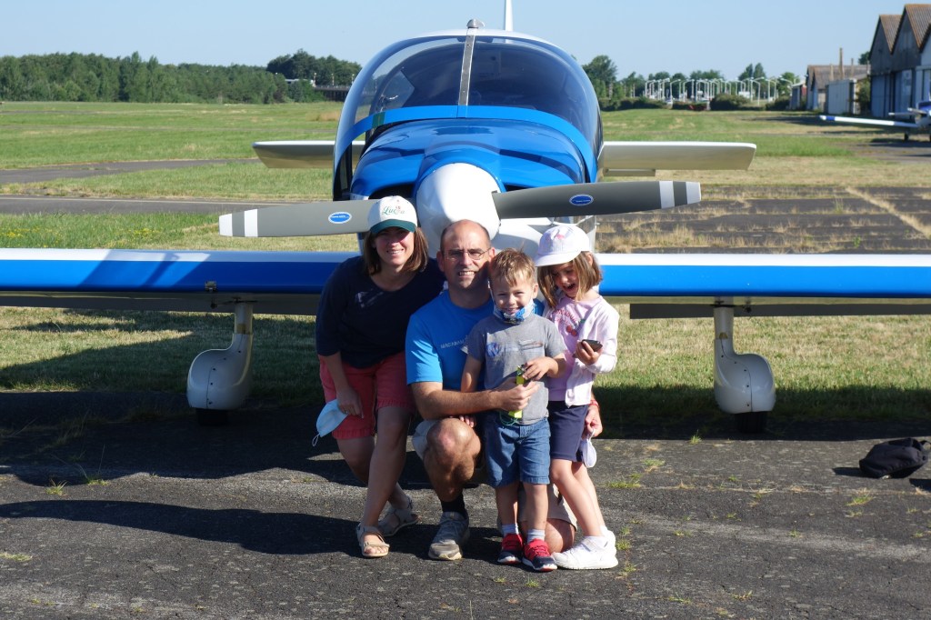
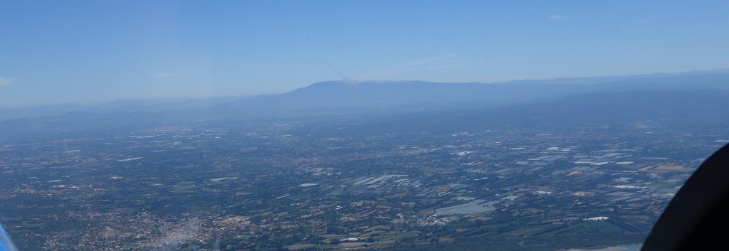
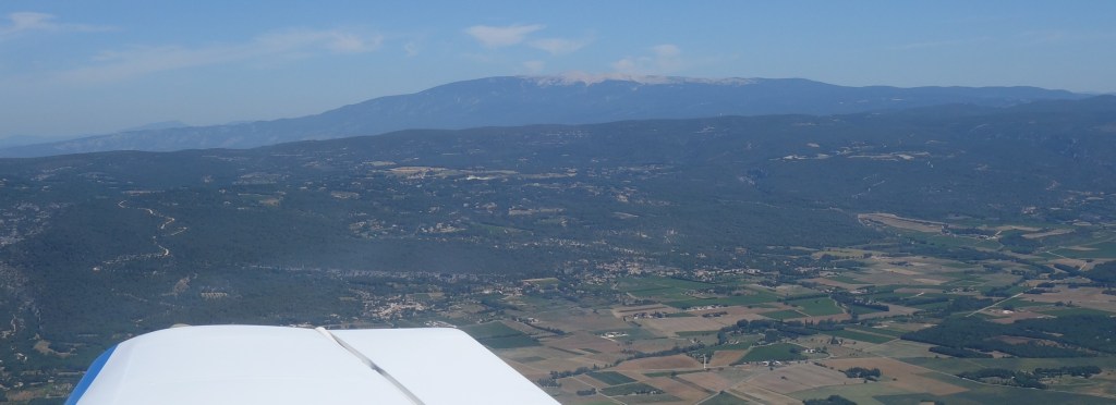
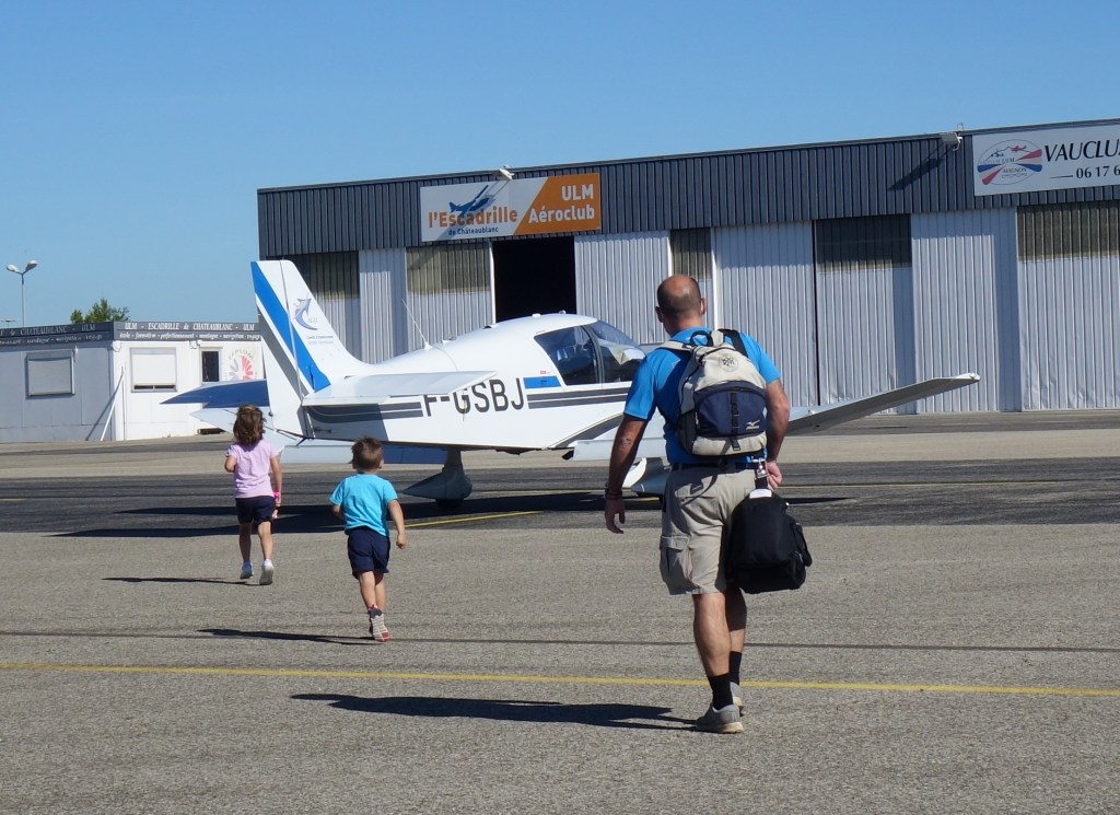
This weekend, with Luca and our children, we took one of the aeroclub’s DR-400 to make a flight excursion from Toulouse (France) to Avignon, in Provence.
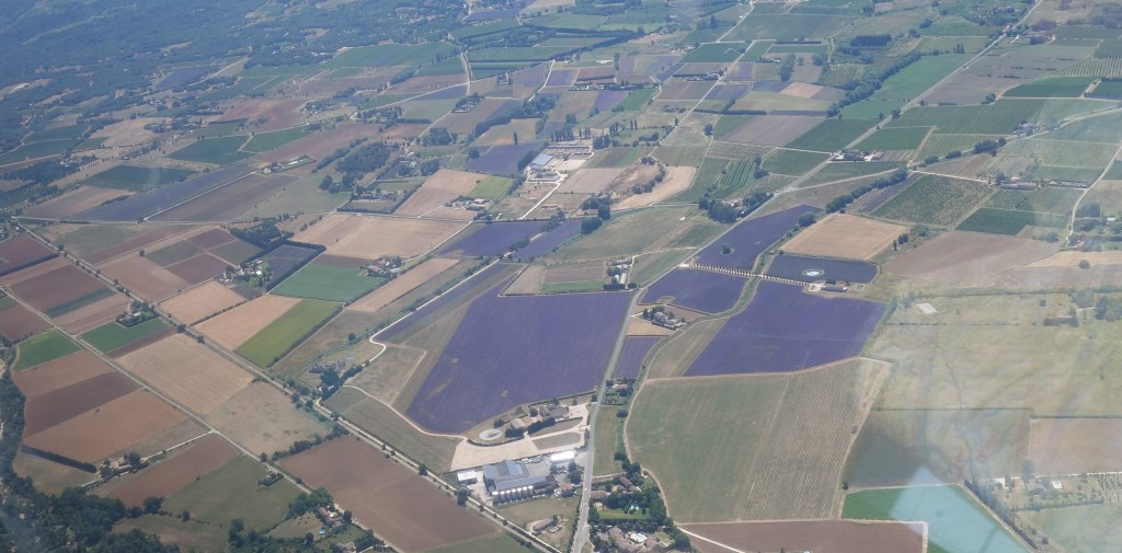
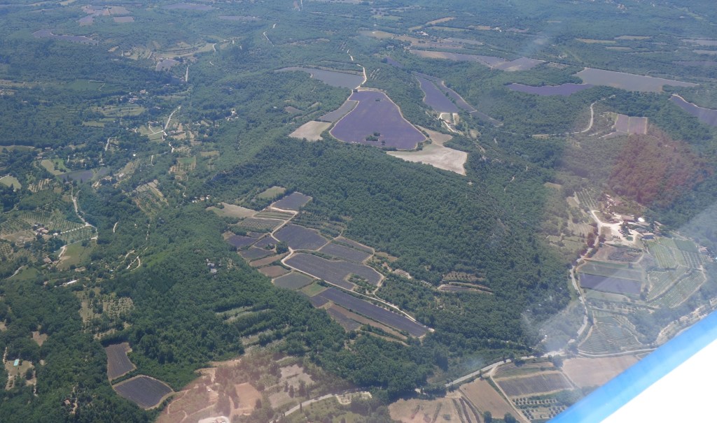
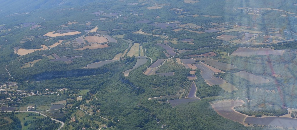
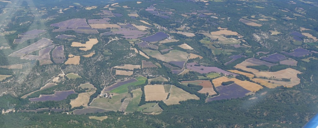
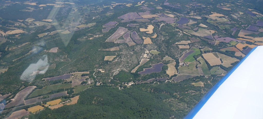
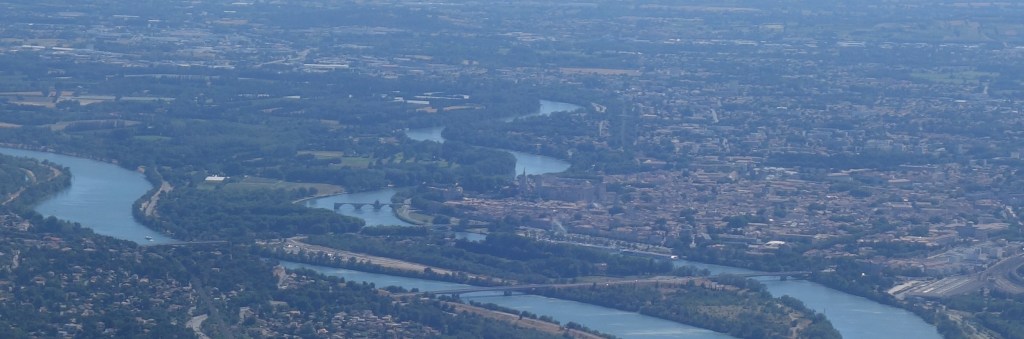
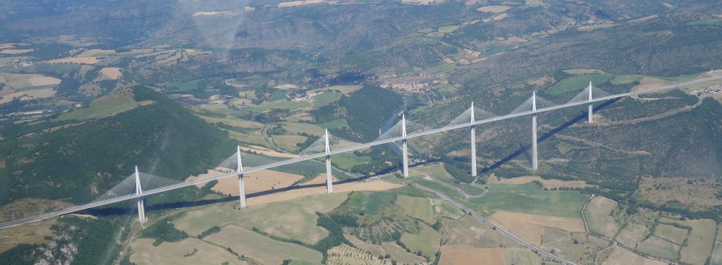
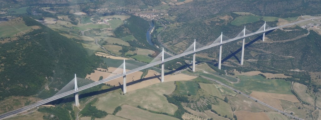
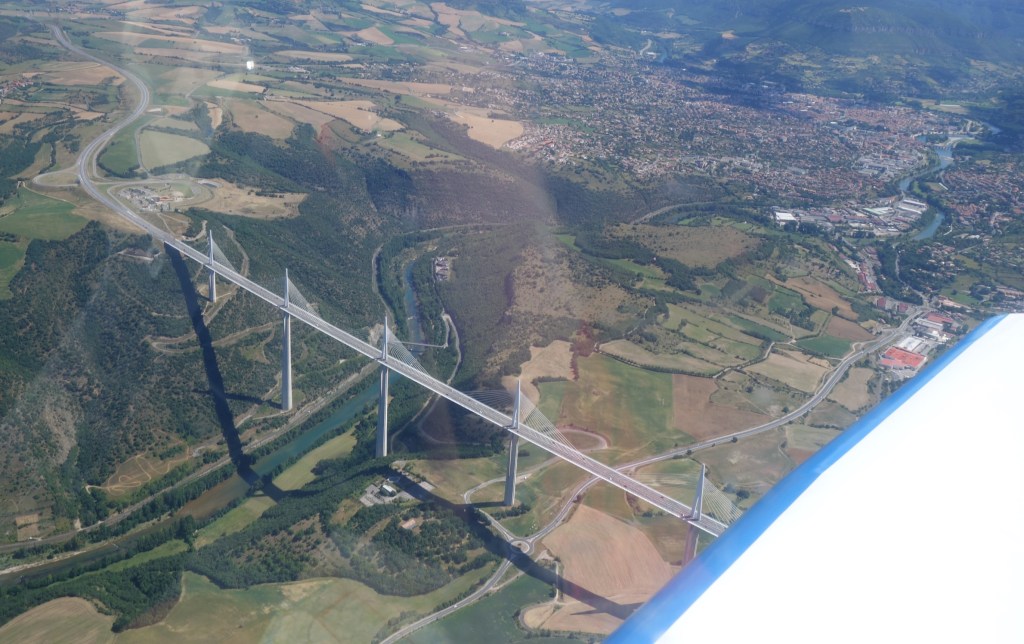
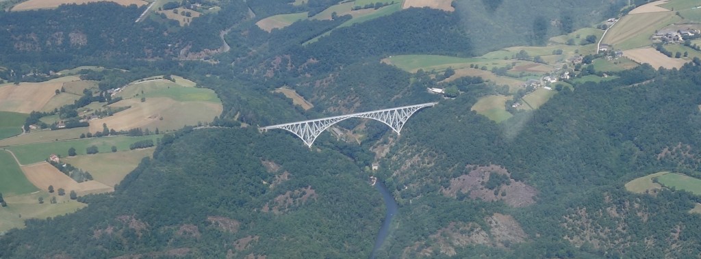
The main purpose of the trip was to fly over the flourishing lavender fields in Provence. Other highlights of the flight would be flying over the French Côte d‘Améthyste, flying over the Camargueregion with the wetlands of the Rhône delta, watching the Mont-Ventoux from up close, seeing the Pont d’Avignon (from the plane this time, no dancing), flying over the Hérault Gorges, the Viaduct of Millau, the Viaduct of the Viaur and we attempted as well to see the Pont du Garde, but we missed it (next time!).
I will be short in words in this post, thus I will first show here below all the beautiful pictures of the flight in chronological order and at the very bottom I will include a few paragraphs with the technical information of the flight in case anyone is interested in planning a similar trip.
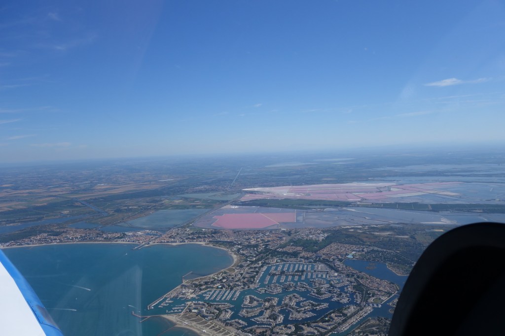
Family picture before departing from Toulouse LasbordesLe Grau du Roi, Port Camargue. Montpellier.La Camargue.Saintes Maries de la Mer.Mont Ventoux.
Lavender fields in the Parc naturel régionel du Luberon.Mont Ventoux.Final at runway 35 of Avignon.Before the return flight.Avignon. Pont d’Avignon.Viaduc de Millau.
Viaduc de Millau. Millau.Viaduc du Viaur.Sleeping…Chuck Yeager and Georges Guynemer started as airplane mechanics…Routes followed.
We made two flights. The first one from Toulouse Lasbordes (LFCL) to Avignon Caumont (LFMV) lasted 2h25′ including the excursion to the regional park of Luberon to see the lavender fields (a detour of about 30′). The return trip took us 1h59′. Both trips could take somewhat less time if the routes were a bit more direct. We started both flights with the main and supplementary tanks full (in theory up to 110 + 50 litres, thus 160l) and before the second flight we did a refill of nearly 77 litres; that would be the block fuel for the first trip (thus 31.7l per hour just a bit below the 33 indicated in the manual at maximum take off weight (1,000kg for the DR-44)).
For both flights I filed a flight plan (calling the BRIA of Bordeaux) even if not required in France (when not flying to the islands or abroad), but that eases a lot the flying through many different CTRs, class D flight spaces, getting flight information service, traffic information, etc.
In these times of low commercial traffic we requested to overfly the coast at a rather high altitude (3,500ft instead of the mandatory maximum of 1,000ft from Montpellier to Marseille in normal times) which was granted without hesitation by the traffic controllers. That alleviated a bit the buffeting of the plane on the often windy French Mediterranean coast.
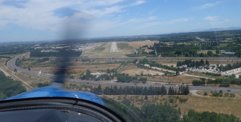
Avignon Caumont airport turned out to be a rather windy one being in the Rhone Delta. Most airports in the whereabouts had windy forecasts. We landed with winds announced by the controller of 15-20kt and on the departure the day after we had 22-32kt, though more or less aligned with the runway, 35 both times. The runway is however long (1,880m) and wide (45m). Had we had to abort the landing we had planned alternative diversion airports nearby, but most probably we would have gone away from the Delta region, all the way to Millau (thus the filling up the tank with more than double the amount of fuel we needed). The landing fees and 24-hour parking altogether cost 29.6 euros. The fuel station operated with the Carte Total.
We stayed over at the Best Western hotel by the airport at Avignon, at walking distance from the terminal (the reservation could be cancelled without charge up to 14:00 of the day we arrived, thus 2 hours later than our estimated landing time, in case we had to divert to somewhere else). We booked a family room with four beds and sofa bed with breakfast for 135 euros which could be paid in cheques vacances. The hotel has a swimming pool which was needed for the kids to relax in the afternoon. At walking distance there was as well a Courtepaille restaurant.
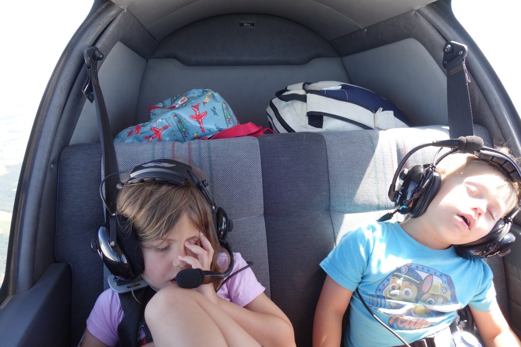
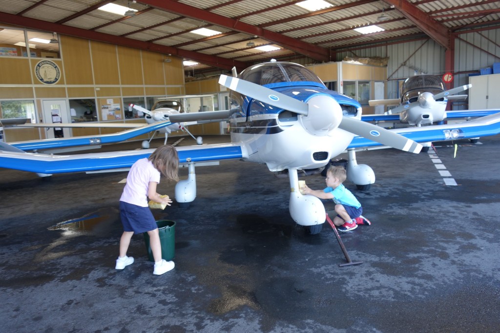
Last June 23rd, together with my friend Asier, we took part for the first time in an aviation rally (rallye aérien) organised by my aero-club, ACAT.
For starters, an aviation rally, following (more or less closely) the rules of the Aviation French Federation (FFA), is not like the sport cars’ rallies that we may be used to see. It is not about who is the fastest in a given circuit. It is rather about precision, and the purpose of organizing such rallies is to improve as pilots and increase the safety of flight, along with the competition side of it.
The rally in itself included the following parts:
A theoretical part.
An observation part
A navigation part.
In order to rank the teams, a series of penalties are introduced in each of the parts, as described below:
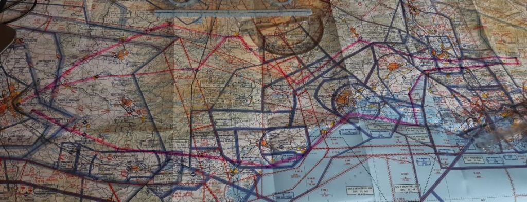
In order to discover the route of the flights, even if not subject to penalties, the different teams received a questionnaire. By correctly guessing the answers to the questions we would be able to find the route that we had to fly. For this we had a map, a ruler and pens. From that moment the flight preparation started.
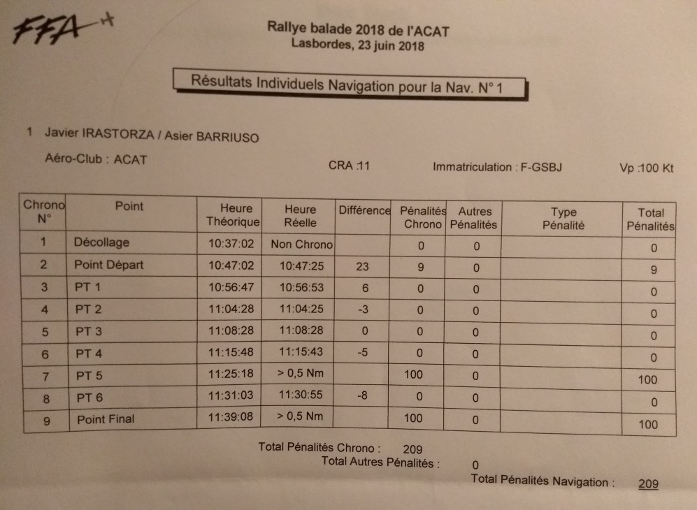
We made two flights of about 1h20’ each. In each of the flights, a part of it would be the subject of the competition, defined by a “starting” and “finishing” points that we had to closely over fly. In between those points a few turns had to be made. We had to estimate at what time we would fly over each of the points with a precision of plus or minus 15seconds. A greater deviation than that was penalized.
To correctly track the route followed and measure the time in which we flew above each of the points, we carried 2 GPS recording devices provided by the organization. With them, the organization was able to print the track of the flights as below.
The image above corresponds to the first of the two flights. In the image you can see that we missed the Final Point, in red. But in the table below you can see how we passed the different turning points. We over flew the starting point (10 minutes after take off) 23 seconds behind schedule, which carried a 9 points penalty. The following turning point (PT1) was passed in 6 seconds above schedule…
Along each of the flights we had to spot on the ground a series of images (16 per flight). For that we had some papers with small photographs taken in advance by the rally organization. When we saw an image, we had to identify where we had seen it in the map we had been given. The photographs for each of the flights were not in order, so we had to pay attention to see them. The more you saw, the less you were penalized. However, if you placed the landmarks corresponding to the photographs in wrong locations in your map, you were penalized as well.
Before the flights we had to estimate the overall fuel consumption of the aircraft for the two flights. After the flight we refueled to see how good or bad our estimate had been. In our case we had estimated 69 liters and needed 67. Not bad. But those 2 liters of deviation, carried the corresponding penalty.
As part of the theoretical side of the rally, we also completed a multiple choice questionnaire, similar to the PPL exam but shorter.
The experience was great. We had much fun and even if we did not place well in the rally, we learn quite a bit out of it: (1) to select a slower target speed to allow for wind variations and then set your speed to the targeted one instead of compensating at turning points, (2) to better prepare the reaching of the Starting Point of the circuit, (3) the lower fuel consumption to be employed when flying in with a lighter take-off weight.
I guess we will take part in more aviation rallies in the future.
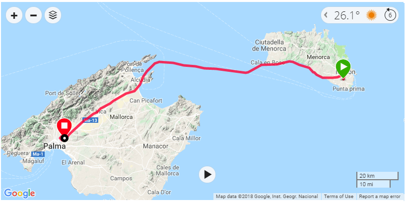
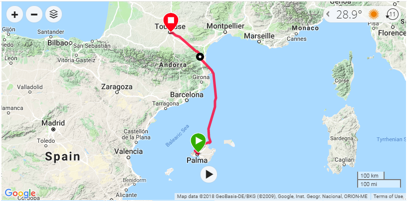
Last weekend, with Luca and our children, we took one of the aeroclub’s DR-400 to make a flight excursion from Toulouse (France) to the islands of Menorca and Mallorca, in Spain. The excursion was part of a “Fly out” organised by the Aviation Society of the Airbus Staff Council in which 5 aircraft would make the same trip.
The main purpose of the flight was to visit Menorca, and we flew to Mallorca to refuel before coming back. It is an excursion that in the Society we had been trying to make since 2015 but we have had to cancel it due to bad or uncertain meteorological conditions several times. The flight includes a leap over the sea of about 1 hour from the East of Bagur (in Gerona) to the North of Menorca and, as there are no safe landing spots in that area, you want to have more or less certain good weather along the route both the day of the departure and return flights.
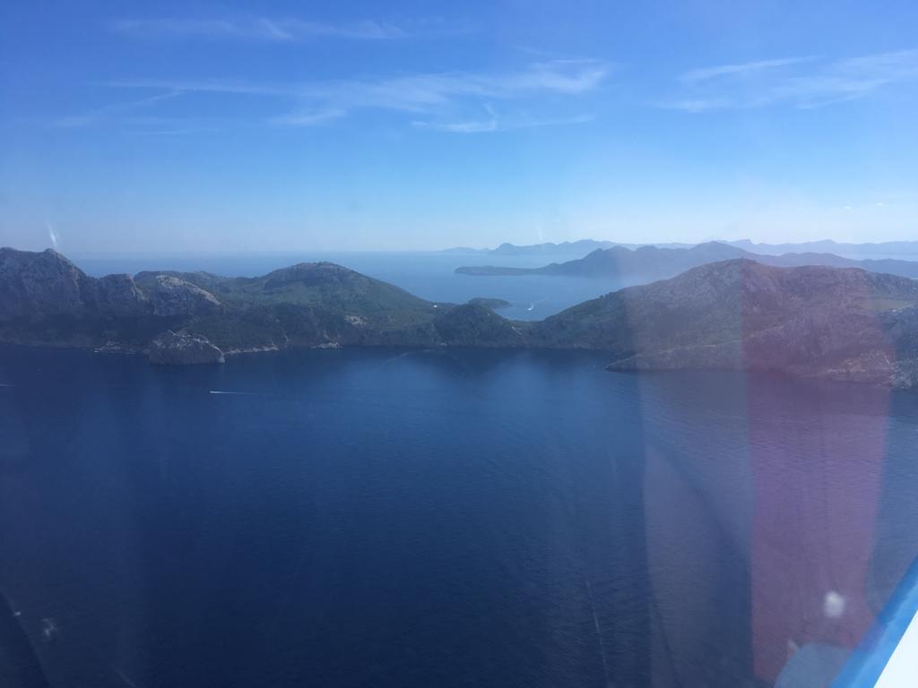
Cape Formentor, Alcudia & Cape Farrutx.
We made 4 flights.
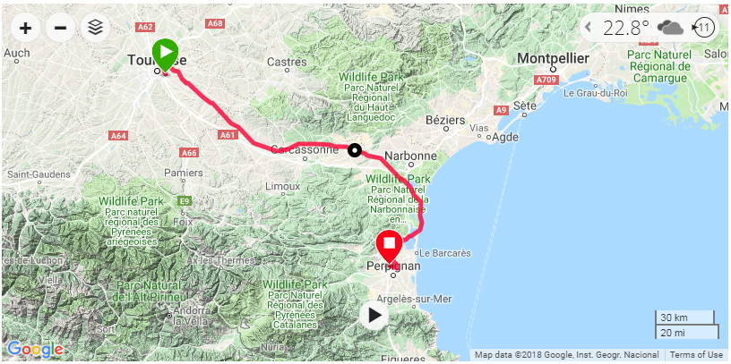
Toulouse Lasbordes (LFCL) – Perpignan (LFMP)
Flight duration: 1h11’.
We included this first stop over Perpignan just to refuel the aircraft to the maximum before flying over the sea all the way through Menorca, so in case of bad weather or any other problem at the destination we could make a comeback to France or somewhere else in the Spanish coast. We selected Perpignan instead of other viable options such as Ampuriabrava for various reasons, among them lower cost of fuel and landing fees.
In the way to Perpignan the sky was overcast (OVC) at a low level around Carcassonne, and, as I did not want to fly on top for that leg, this forced us to fly just at 1000 ft above ground and to follow the highway to Narbonne rather than taking a more direct route to Perpignan over the mountains. You can see the route we followed above.
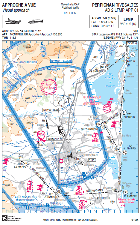
It was the first time I landed at Perpignan, but finding the field from the way points NL (in the coast) and NF was trivial. Once in the vicinity we integrated directly into the circuit for runway 31, closer to the fuel pump. There, we had a quick lunch and prepared for the following flight.
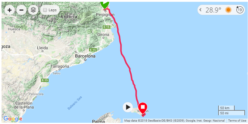
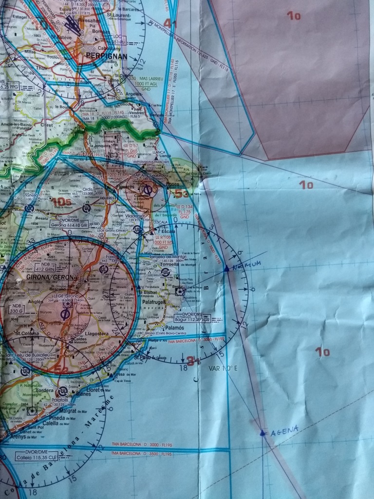
Just after the take-off from Perpignan we took a right turn towards the East and reached the coast South of waypoint EA. From then on we started climbing up to 5500 ft, the altitude selected for the flight over the sea (the highest, the better). In order to keep a high altitude you need to avoid the TMA from Barcelona, otherwise they may ask you to descend below 3000 ft. Thus, we went to the capes of Bear, then Creus and from then on South East heading to pass about 10 nm East of the VOR at Bagur. From then on we followed a series of IFR waypoints (NEMUM – AGENA – VERSO – TOSNU – SARGO).
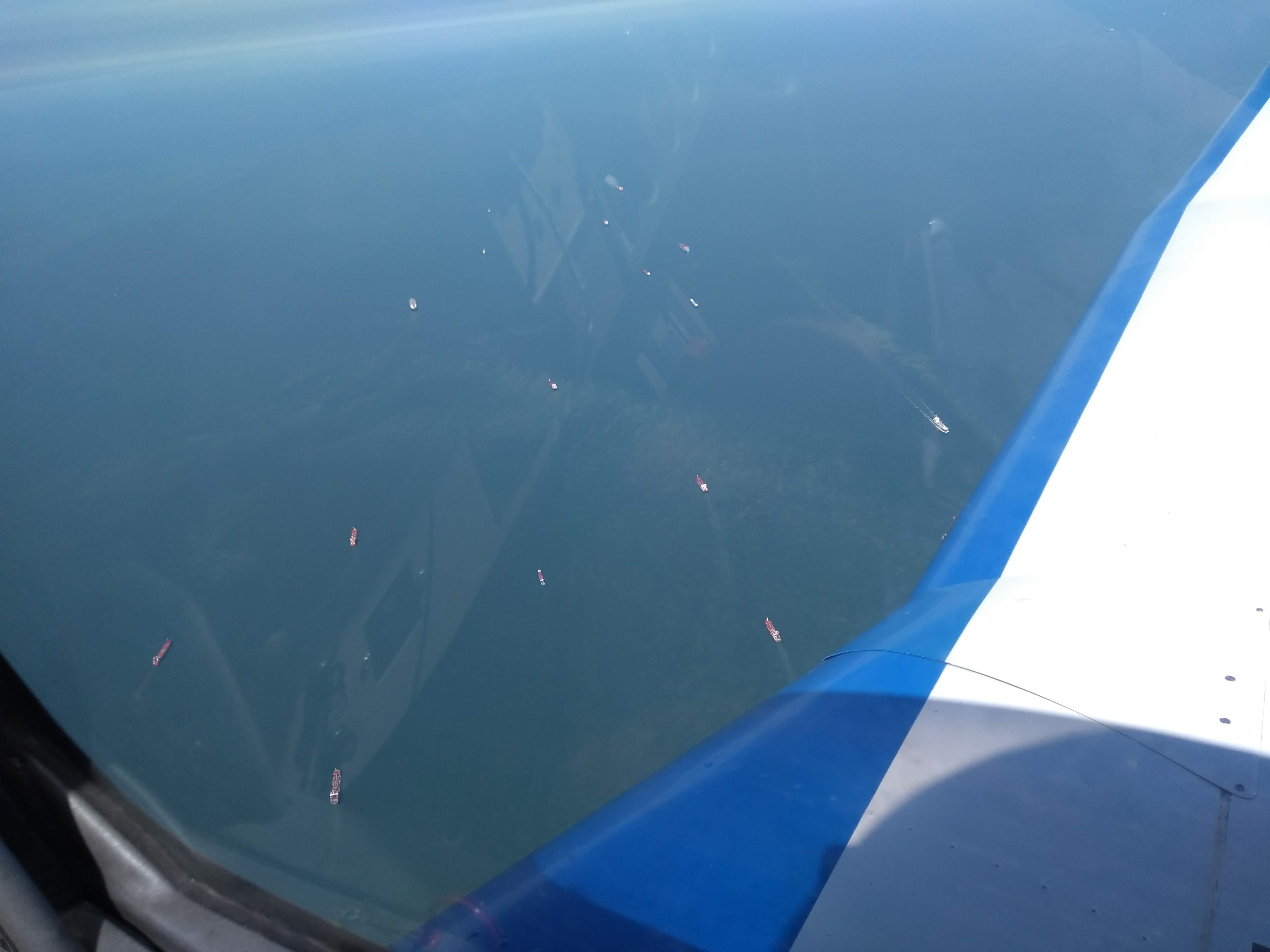
Flying above the sea is not particularly eventful. You mainly need to maintain the altitude and attitude and the heading stable, as it is very easy to loose references with the difficulty to distinguish the horizon.
As far as radio communications are concerned: we were first transferred with the Gerona traffic control and then to the one of Barcelona. The communications were held in Spanish. Easy, as long as you have a flight plan and follow the announced route. Those frequencies were mainly used by commercial flights going to/from Barcelona or Palma, mainly Vueling flights. Also good to know is that as you fly away from Barcelona at some points you may not be heard by the control; no worries, keep going and sending the messages.
About an hour later we had in sight the North of the island of Menorca, the cape of Cavalleria. But before that, approaching the way point of SARGO (about 25 nm or 14 minutes from the shore) you need to descend down to below 2500 ft, though the control will ask to go down to 1000 ft AMSL as that is the limit of the air space class A around the main airport in Menorca, Mahon.
Cape of Cavalleria.
Once in sight of the shore we requested to follow the coastal line to the East down to the East Corridor for Mahon in order to reach San Luis from the East (the control had however proposed to surround the island around the West and South).
Following that route we took the opportunity to take some nice pictures of the coast, the lighthouses and the fortress of Isabel II at La Mola.
Cape of Favaritx.
Lighthouse of Favaritx.
Vickers guns at La Mola fortress.
La Mola fortress.
Lighthouse at La Mola fortress.
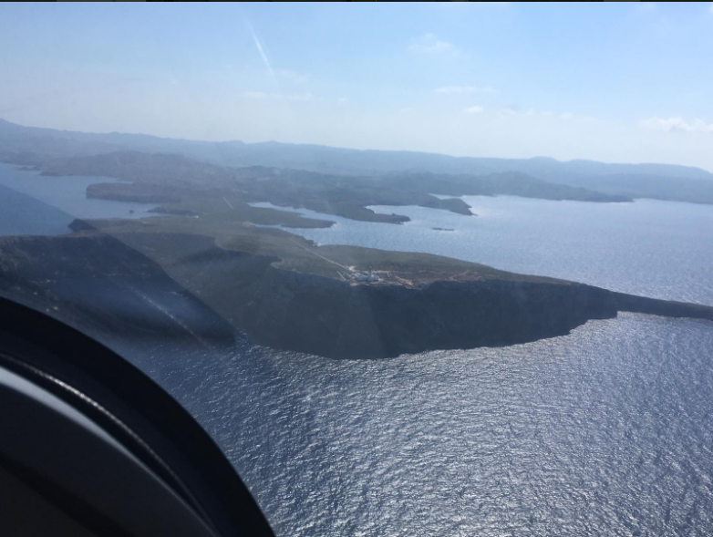
San Luis is a non-controlled aerodrome without radio. Therefore, you must stay connected to the frequency of Mahon and land at your discretion, with a circuit to the East of the runway (02/20). The aerodrome is managed by the Aero-club of Menorca. In their site you may find contacts and charts (old ones being in use). There are not official fees but a contribution is expected; 10 euros for landing, 5 for parking. These are paid at the restaurant by the apron, which serves very decent menus and where the staff will be happy to help you calling for taxi.
We spent the remaining of Friday afternoon and all Saturday enjoying the beach and the hotel’s pools, including a beer on Saturday night with the colleagues from the Society at a bar by the beach, Es Corb Mari (in Son Bou).
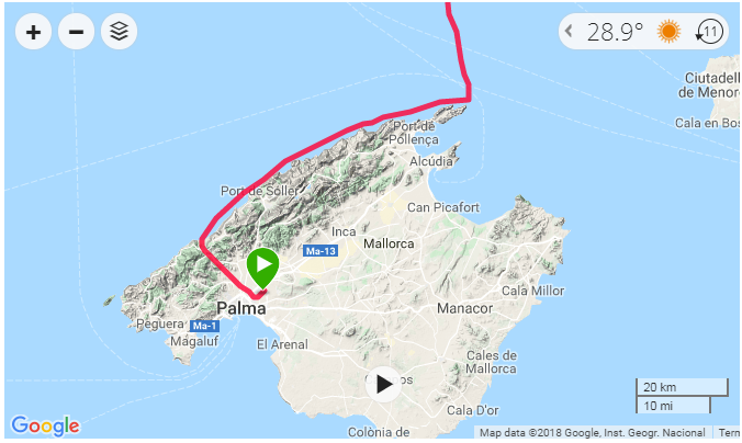
As the aerodrome of San Luis doesn’t have a fuel pump we could refuel at the main airport of Mahon, but as it requires to contract handling (with expensive fees) we preferred to fly down to Son Bonet (in Mallorca island), which landing fee is less than 7 euros, no handling contracting is required and there is free parking for a stay below 2 hours.
We filed the flight plan on the phone with Menorca airport (at this time the number for flight plans being: +34971157138). On ground, we were already connected to the frequency of Menorca and right after take-off we were cleared to turn West and cross the axis of the airport in our way to the West corridor which took us to the South coast of the island up to the cape and lighthouse of Artrutx.
At San Luis aerodrome.
Cala Coves.
Son Bou.
Lighthouse of Artrutx.
From Artrutx we flew over the sea towards the bay of Pollensa (making use of its VOR), in Mallorca, and then we flew within the inner side of the island following the road from Alcudia to Mallorca by way of Inca. When leaving Inca we passed with the frequency of Son Bonet (123.5) around which English is mainly spoken as there are quite a few helicopters flying in and out. Finding the aerodrome coming from the road was trivial and we easily integrated into the circuit for runway 23.
Inca.
At Son Bonet we paid the landing fees (~ 7 euro) and filed the flight plan at the small office by the parking. We refuelled (~3.05 euros per litre of Avgas 100LL) and had some lunch before the long flight to Toulouse.
Once we were ready at Son Bonet, we got on board and departed from runway 23 again, took a right turn to the West during the climb to fly North of Son Moix on the way to Esporles to reach the coast of Tramuntana in order to fly along it up to the cape of Formentor.
In the past, we had visited several spots along the way of this coast on the ground. The landscapes are remarkable. This time we wanted to get a view of them from the plane, which was breath-taking.
Son Moix.
Soller harbour.
Lighthouse of Cape Gros.
Cape Formentor.
Lighthouse of Formentor.
Once we reached Formentor we took a heading to the North and followed another series of IFR waypoints (KENAS – SULID – AGENA – NEMUM) to reach the East of the above mentioned VOR of Bagur, cape of Creus and enter back into French air space. This time, as the weather was clearer than during the first flight of the excursion, we maintained 5500 ft altitude until we had exited the TMA of Carcassonne.
All the navigation logs were again prepared using the tool Mach 7, and during the flight we used the help of the AirNav Pro on the mobile phone (no tablet, though it would be easier). For Spain we had 1/1.000.000 chart from AIR MILLION (Editerra) and the 1/500.000 from Rogers Data. Neither of them has the IFR waypoints marked on them, so you need to write them down yourself in advance.
VFR aerodrome charts in Spain are retrieved from the site of ENAIRE, which in my opinion is less user friendly than the French equivalent. The charts themselves are comprised of too many different documents to handle; it is better to have a simple single PDF of 2-8 pages s in the French case for VFR. On top of that, not all small aerodromes have the information in ENAIRE, try googling about them or contact the local club.
Two weeks ago, Albert, a work colleague, and I took one of the aeroclub’s DR-400 airplanes to make a flight excursion from Toulouse to Northampton Sywell, Old Warden and Duxford (England) as part of a “Fly out” organised by the Aviation Society of the Airbus Staff Council, in which 6 aircraft would make the trip.
The main purpose of the flight was twofold:
Visit the Shuttleworth collection and their evening flight display on Saturday 14th July.
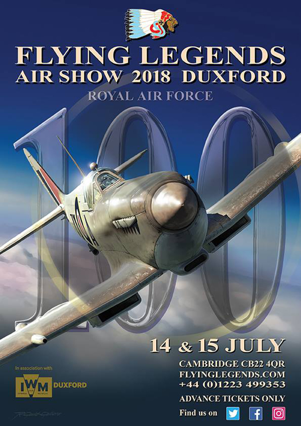
Visit the Flying Legends airshow at Duxford, hosted at the Imperial War Museum, on Sunday 15th July.
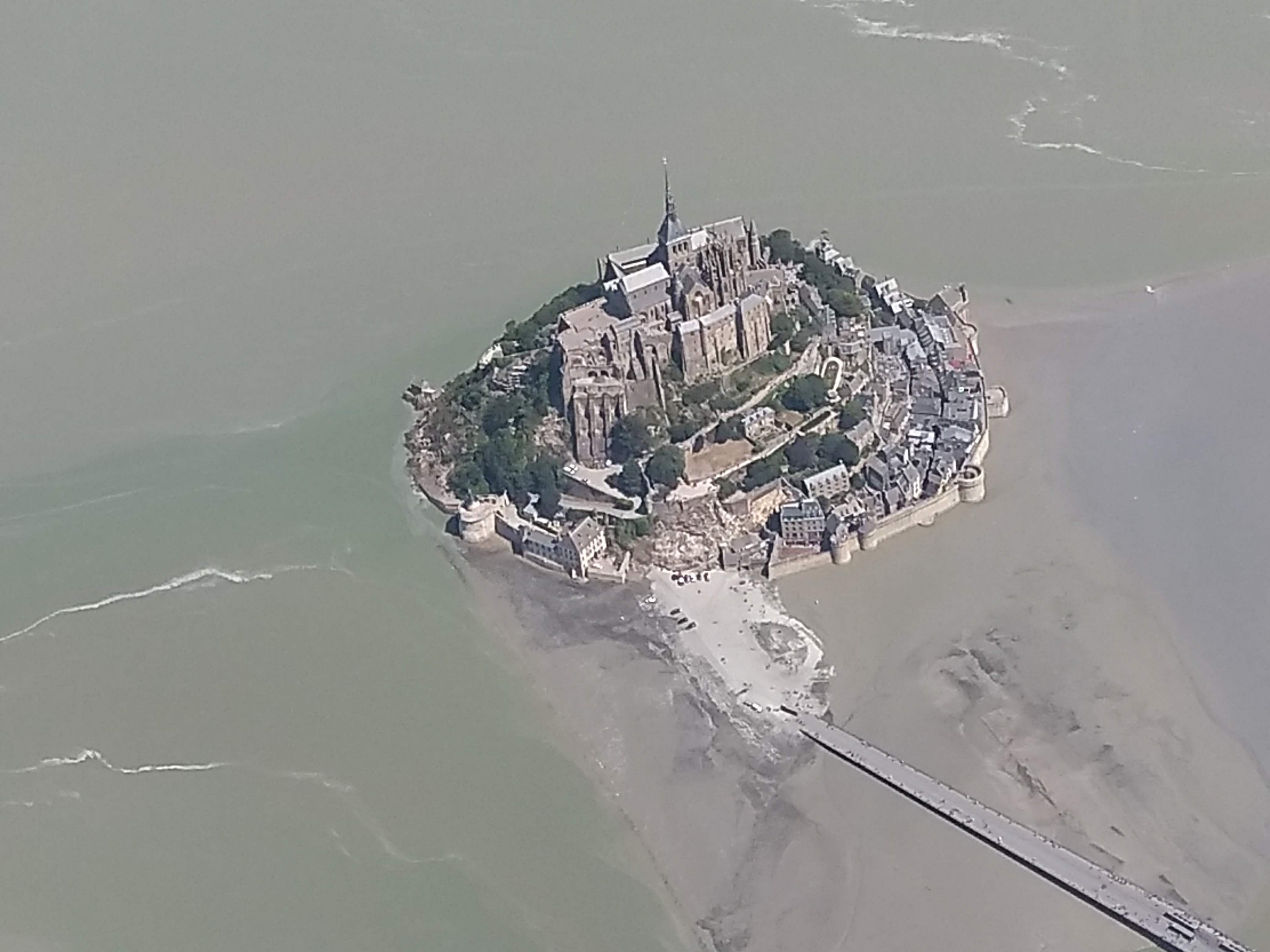
Mont Saint Michel.
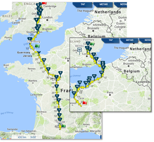
During the trip we were to make 6 flights: Toulouse Lasbordes (LFCL) – Cherbourg (LFRC), Cherbourg – Sywell (EGBK), Sywell – Old Warden (EGTH), Old Warden – Fowlmere (EGMA), Fowlmere – Laval (LFOV), Laval – Toulouse Lasbordes. In all about 14 hours of flight time, which we split among the two of us, together with sharing the navigation and radio communications workload.
We prepared the flights using Mach 7 online tool, with which we generated the flight logs and routes for GPS, which could only be charged onto Albert’s smartphone, I replicated them in my Air Navigator app on my phone as well, however we did most of the navigation by way of following the paper charts.
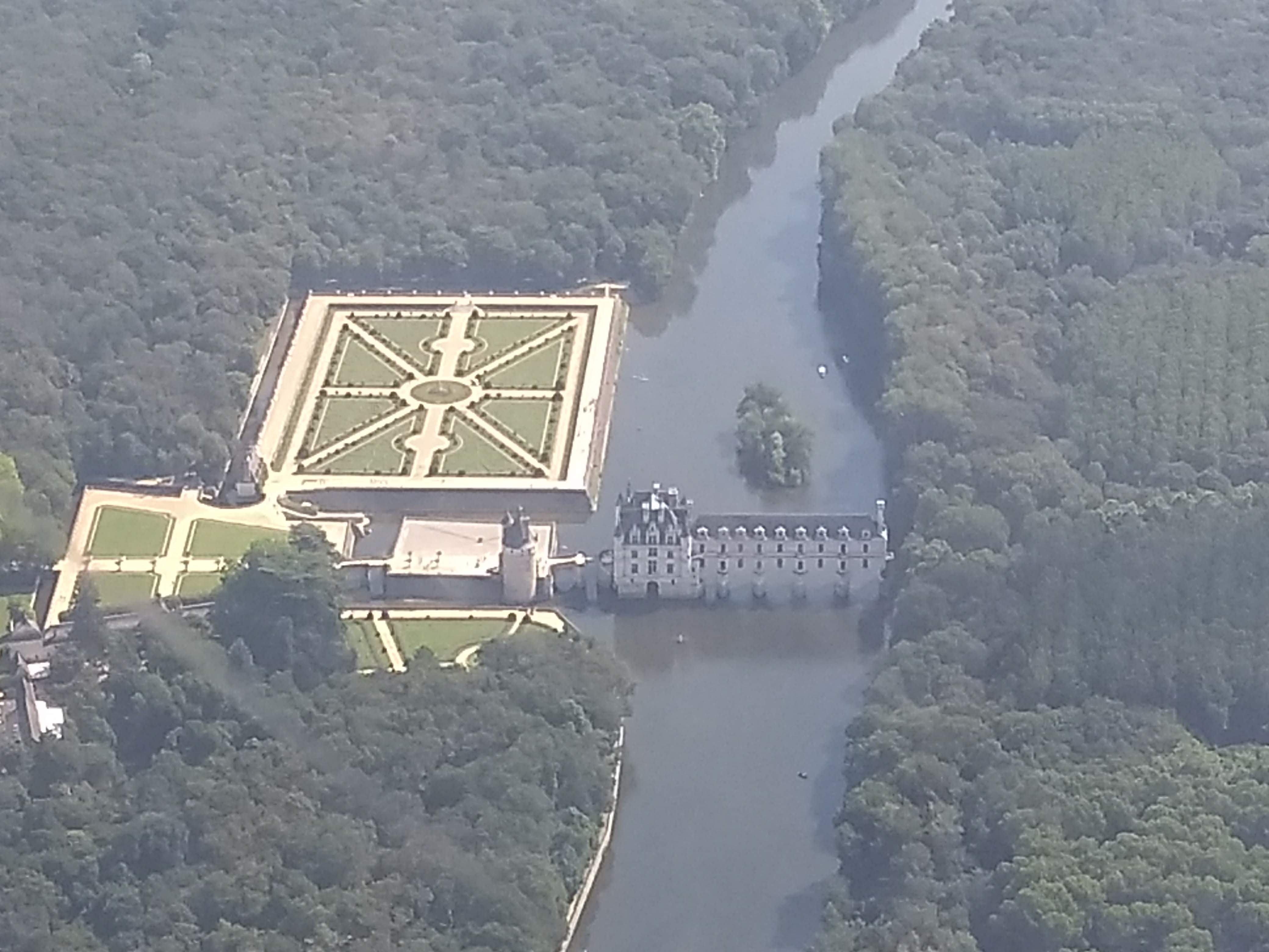
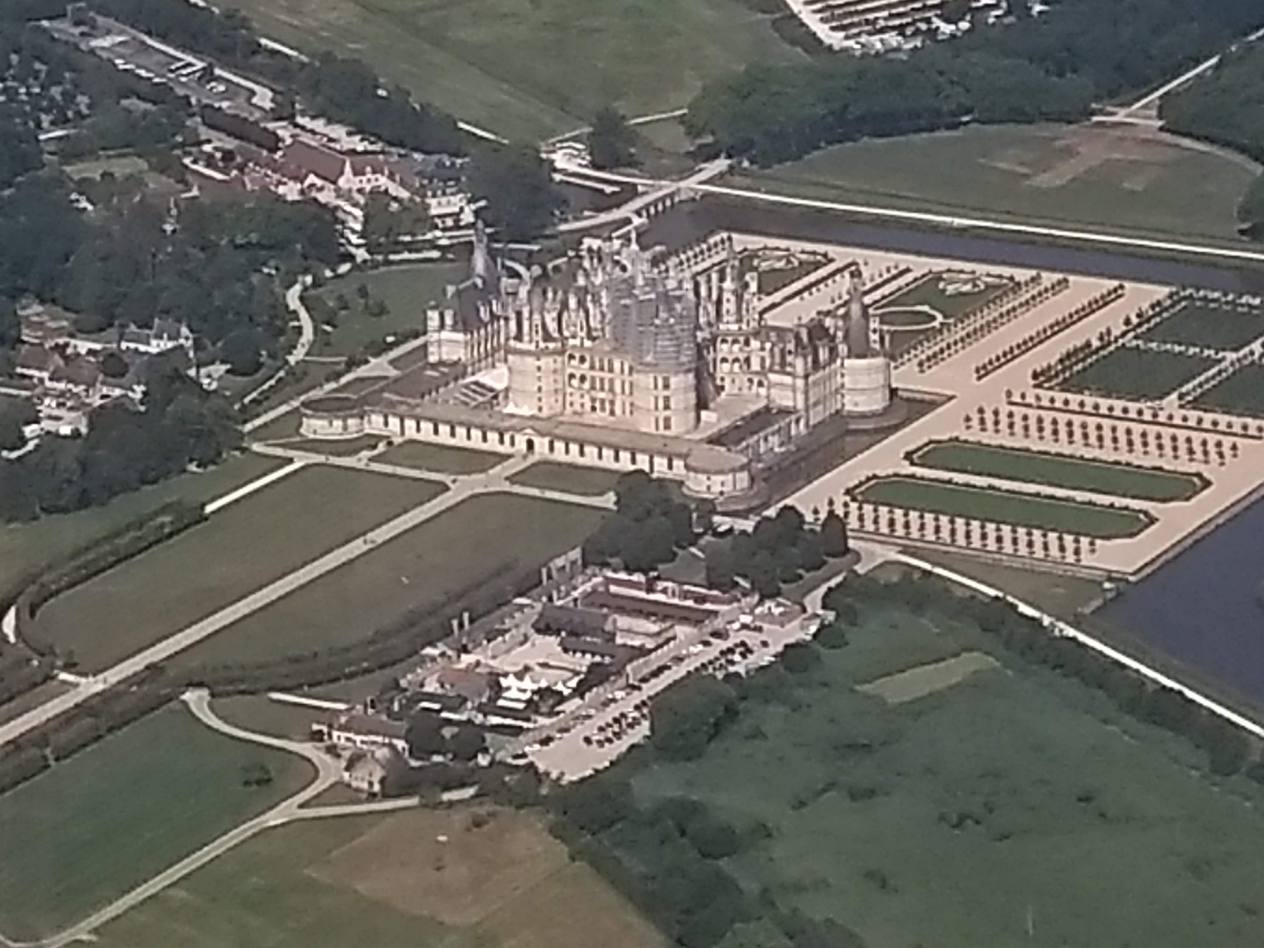
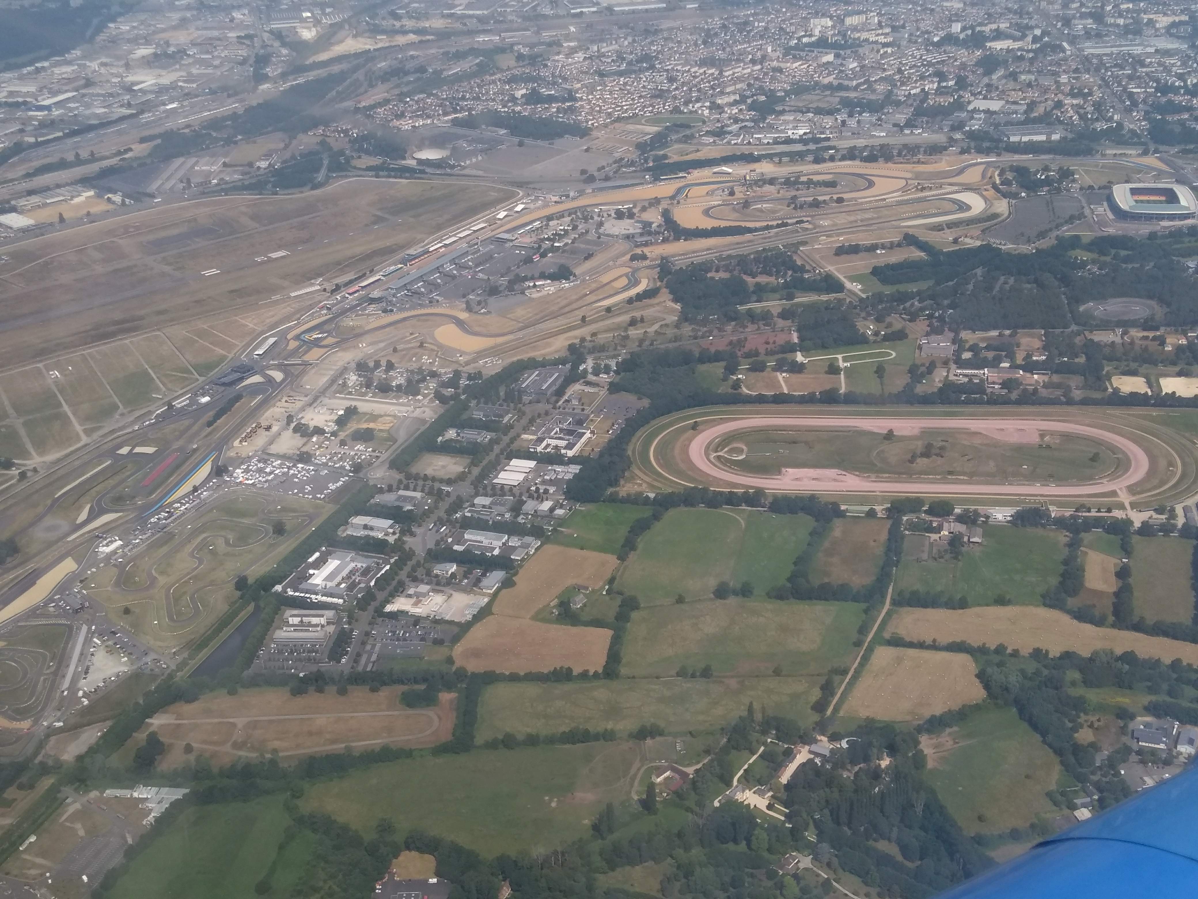
Having to fly most of France from South to North, we decided to overfly some castles of the Loire Valley (Chenonceau, Cheverny and Chambord), the racing circuit of Le Mans and Omaha beach in Normandy (which we couldn’t see well due to the presence of clouds at the time we passed). See below some of the pictures we took of those places (with the smartphone, no pro cameras on board).
Château de Chenonceau.
Château de Cheverny.
Château de Chambord.
Racing circuit of Le Mans.
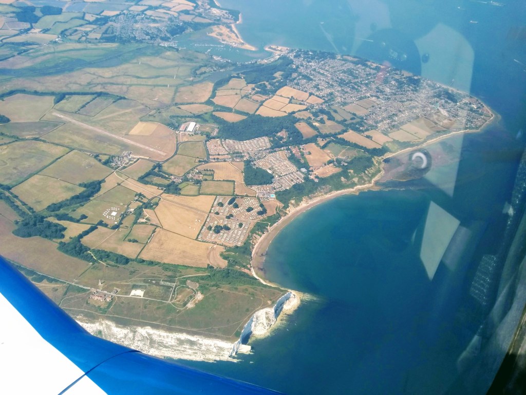
We then made a stop, refuelled the airplane, ate some energy bars and departed for England. The weather seemed uncertain and there were several air traffic restrictions due to the Royal International Air Tattoo going on at Fairford, preparations for Farnborough air show, and the visit of Donald Trump, staying at Buckinghamshire. However, our colleague found a corridor through which we could fly smoothly past 15 h local time. We over flew the English Channel (La Manche) and approached the islands by first flying over the Isle of Wight (where I stayed one month during the summer of 1999 working at Camp Beaumont in Bembridge, at the eastern corner of the island, pictured below), the Hayling island leaving Portsmouth to our left, then up North by way of Winchester, Reading, Oxford and then Northampton. But as you can imagine, as there are not sign posts in the sky we were flying following the instruments and different navigation references close to those places. We took the opportunity to over fly Silverstone racing circuit.
Isle of Wight.
Silverstone racing circuit.
We then landed at Sywell, where we stayed for a night at the Aviators hotel, by the aerodrome, an ideal place to make an overnight stop.
The following morning we made a short flight to Old Warden, a small grass aerodrome where the Shuttleworth collection is based.
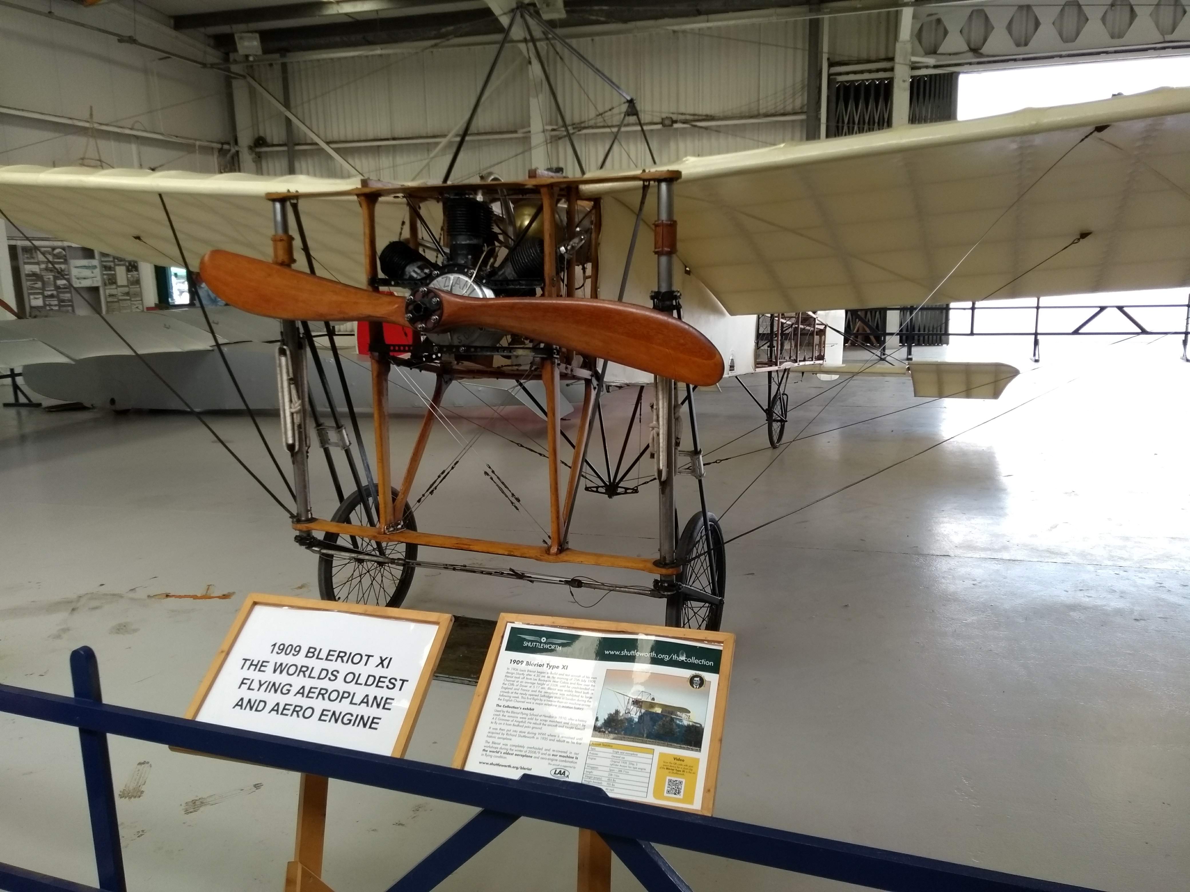
I found about the Shuttleworth collection some years ago in Twitter and started following their account (@Shuttleworth_OW). They happen to have arguably the largest collection of flying aircraft from the 1910s and 1920s. They do have the oldest flying machine in airworthy condition, a Bleriot XI from 1909. Rather than introducing the collection with a few paragraphs, I share here this video from their site:
For me, visiting the collection was a dream come true, moreover on a day in which they would fly most of their airplanes. See below a few pictures.
1909 Bleriot XI. The original oldest airplane in airworthy condition.
1920s biplanes (DX60X Moth, Southern Martlet).
Bristol Boxkite 1910 replica flying.
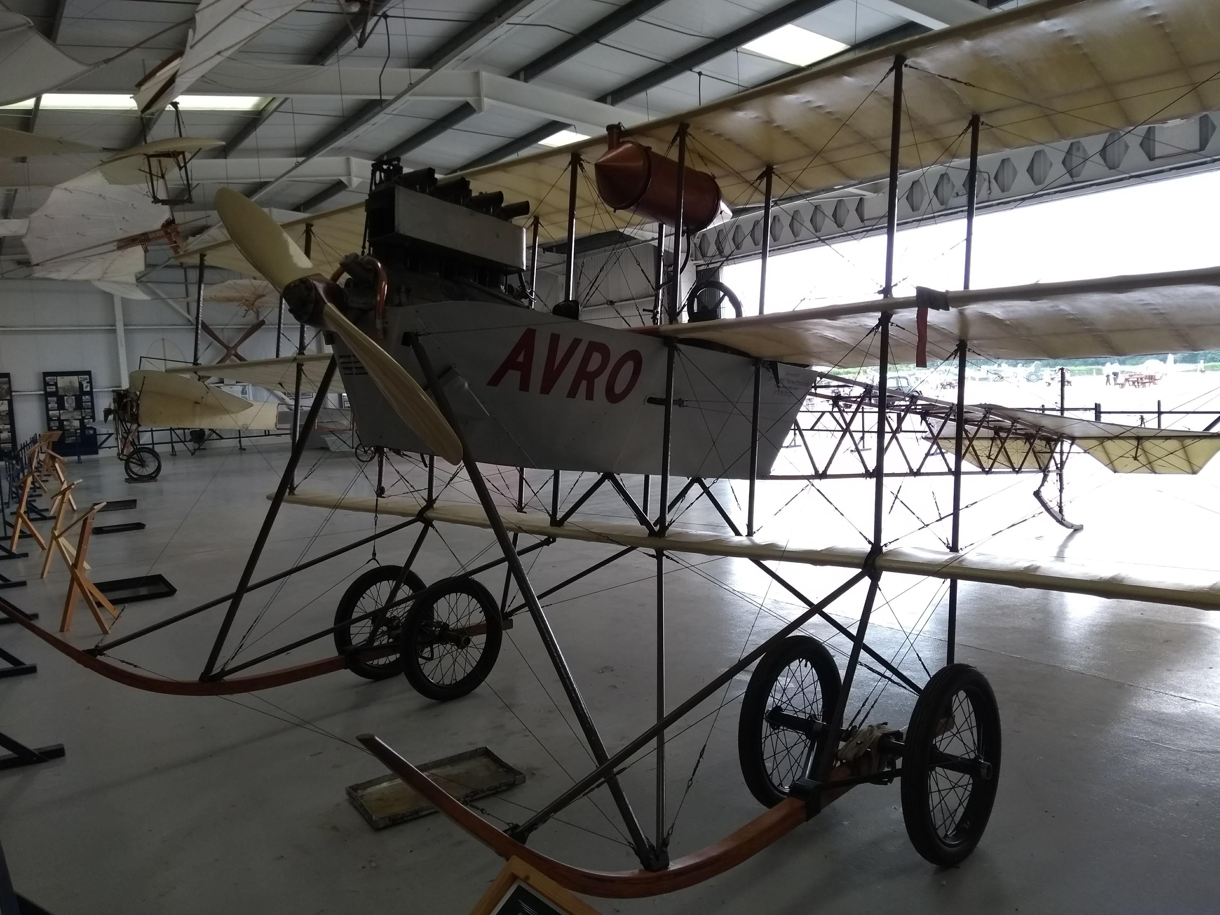
Avro Triplane 1910 replica.
I wanted to share a short video I took of the Bristol Boxkite 1910 replica flying just after taking off (a replica built in 1965). It took its time to gain some altitude, always at quite low speeds. It never went much higher than 50 ft. It was wonderful to see it flying.
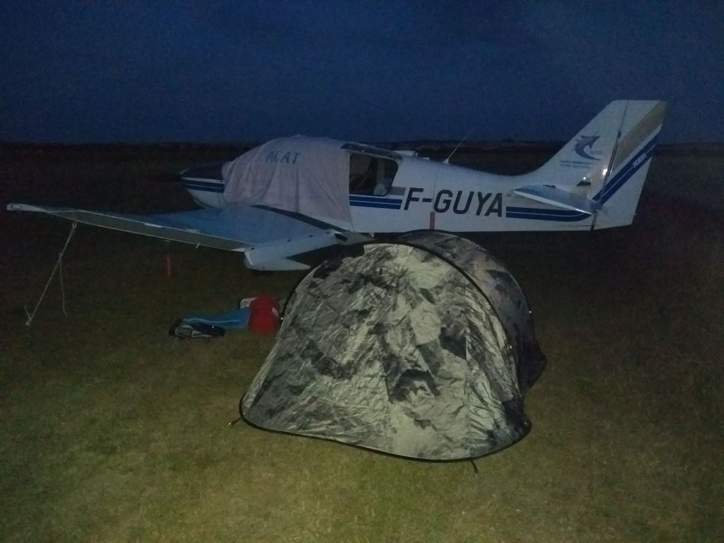
We stayed the night over at the camping by the aerodrome and in the morning we departed for Fowlmere, another grass aerodrome a few miles from Duxford. The taxiway at Fowlmere was fully packed of small airplanes (including the Antonov An-2 coming from Germany that you can see below) and tents of pilots that had been camping the previous night or would camp the following one, as we did.
We got a faboulous breakfast at the airfield and then drove to Duxford to attend the Flying Legends air show and visit the Imperial War Museum.
Our Fly out was organised by a fellow British colleague, Derek. He recalled how being brought to Flying Legends as a child by his father had been a marking moment. He only came again decades later. The air show is one of the biggest and best classic aviation events in the world. If you have the chance to visit it once, do not hesitate, go.
This year the show commemorated the 100th anniversary of the Royal Air Force and the 50th anniversary of the filming of “Battle of Britain“ which had Duxford as one of the locations and some of those very airplanes as main characters of the movie. Other locations of the filming were the Tablada airfield in Seville (where Airbus Defence has facilities), the coast in Huelva passed as Dunkirk or San Sebastian as if it was Berlin.
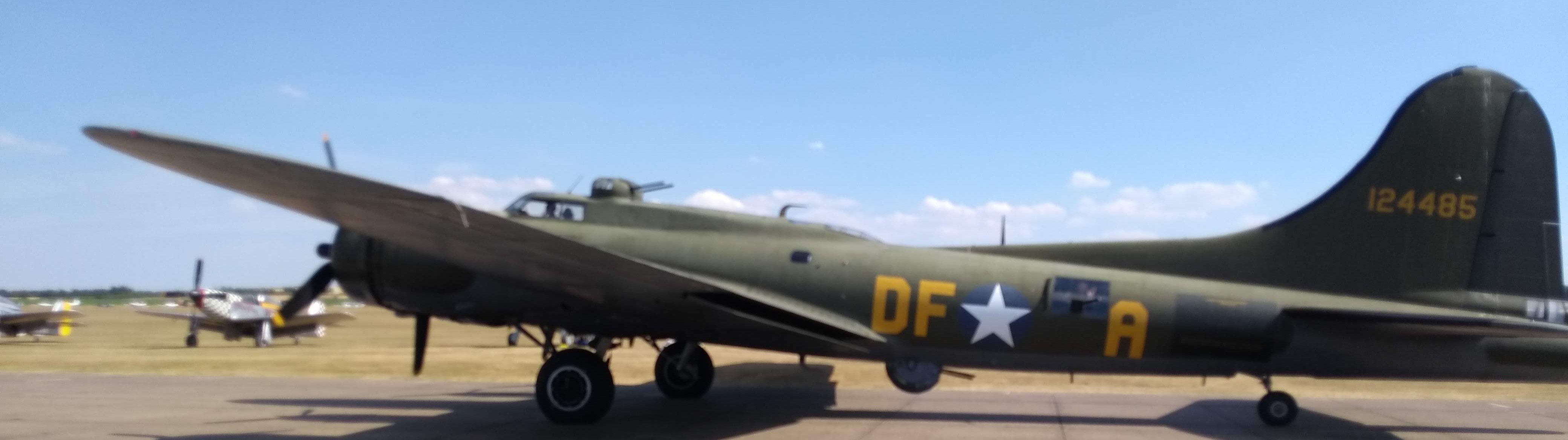
There are plenty of aircraft to see up close, from the flight line, many exhibitors come with books, models, clothing, memorabilia, etc., you’ve got the museum in itself (!) to visit, you have literally dozens of WWII birds flying, among them: Supermarine Spitfire (we saw a formation of 11 of them flying), Hawker Hurricane, North American P-51 Mustang and resident Boeing B-17 Flying Fortress Sally B (only B-17 in flight in Europe)… By the end of the day you will be more than overwhelmed, exhausted, but with that smile of wonder when watching those jewels fly up in the air while you hear the engines roaring, the music and the explanations from the commentator of the show.
Boeing B-17 Flying Fortress Sally B.
Boeing B-17 Flying Fortress Sally B.
See this short video of the Balbo formation flight at the end of the display with 25 single engine WWII birds flying…
After the show we headed back to Fowlmere where we had dinner with three other colleagues (French and German) before walking to the airfield to camp by our airplane, which felt as the aviation of the beginning of the XX century.
Monday 16th July, feeling exhausted and overwhelmed, was the day to come back to Toulouse. The weather seemed good in England and to cross the channel but not so in France, so we took it with calm. We flew through the East of London, crossed the channel and then overflew all the coast of Normandy down to Omaha beach, then we headed South West to the Mont Saint Michel and then to the airport of Laval. There we rested for a couple of hours, ate more energy bars, studied the meteorological conditions to go further South and finally departed back to Toulouse Lasbordes.
The airshows and visits were totally worth it. Dreams come true.
Over flying those castles, circuits, beaches, historical landscapes… you can imagine, breathtaking.
Radio communications: much easier than expected, in England as well (even if the there were lots of radio frequency changes to be made around London). French in France, English in England.
We made ourselves follow in each air space. It forces you to interact more with the control but it adds to the safety of flight (traffic information overflying Saint Michel or the castles is advice-able).
Flight plans: in France they are not required for the long flights we did South-North flying spaces E and G. But we filed them. It allows the control to better follow you. They know your plans, they give clearances for D spaces without hesitation.
All the terrains we visited in England required PPRs (a colleague took care of this).
To fly into England a GAR report must be submitted in advance.
We didn’t touch a single sterling pound in the four days, credit cards almost did the trick for everything. A colleague had to pay for a taxi and a meal. We could have avoided that by selecting alternatives which accepted credit card payment.
We had to divert due to the meteorological conditions when arriving to one of the destinations. Clouds and fog were closing our visibility. We found ourselves with no more than 3-4 km of visibility and flying very low, so we turned back. The two diversion aerodromes we had initially selected would not do the trick (in the middle of the cloud region). We had to look for a third one in flight. That was stressful. Luckily we were two pilots on board: one keeping the airplane on air, the other navigating, looking for a suitable aerodrome and downloading the aerodrome chart (we carried about 30 on board, but not the one we finally needed). Lessons learnt: never spare charts, you may need them; ensure you’ve got batteries and chargers on board (you may need them in the worst situation), if you are the only pilot on board, but have passengers with you, try to get one of them briefed in advance of what can he or she do if something happens.
After this excursion I have completed just above 120 flight hours, and I am quite happy with the flight training provided by the aeroclub and system in France. Before the excursion we had some uncertainties about some aspects of the flight. In the end all of it was much easier than expected.
Last Sunday, yet again, we took one of the aeroclub’s DR-400 airplanes to make another family flight excursion.
On the occasion of the previous excursion, last week, I introduced the phares aéronautiques, i.e., aeronautic lighthouses that were set up in 1920s to allow night flight navigation for l’Aéropostale courriers. Last week we spotted a couple of them to the South East of Toulouse. This time, we wanted to spot a couple of them to the North West of Toulouse, on the way to Bordeaux, in the villages of Canals and Malause.
Last week, we prepared quite well the spotting, checking in Google maps different views of what we would try to see from the airplane so that we could easily recognise them. This time, we prepared less, just marking a cross in the map with the approximate location of the phares and hoping that we would identify the lighthouses on the ground.
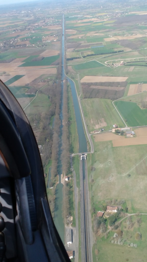
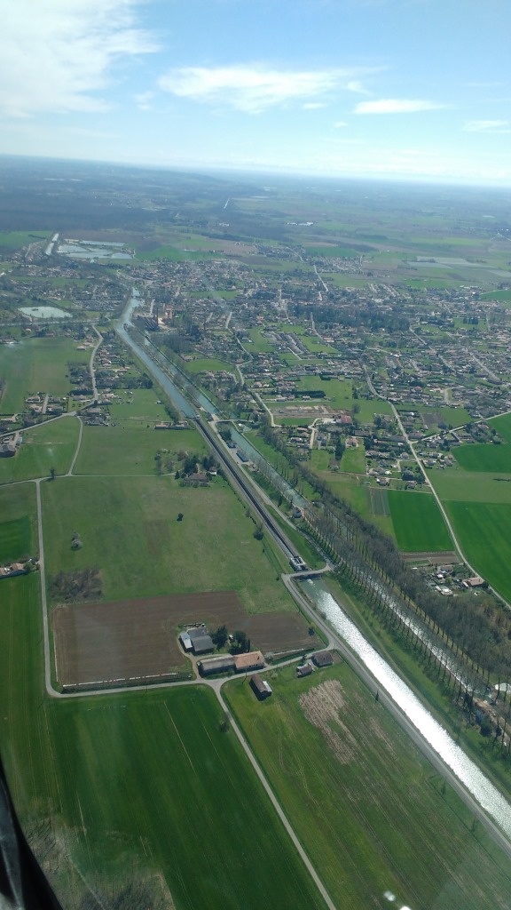
Well, the task proved as difficult as finding a needle in a haystack. We missed the phare of Canals in the first leg. We then continued over flying the Canal Lateral up to the water slop of Montech (1).
The navigation of this flight was rather simple, as once over the Canal Lateral we kept flying over it northward up to the Pont-Canal to the East of Moissac (2).
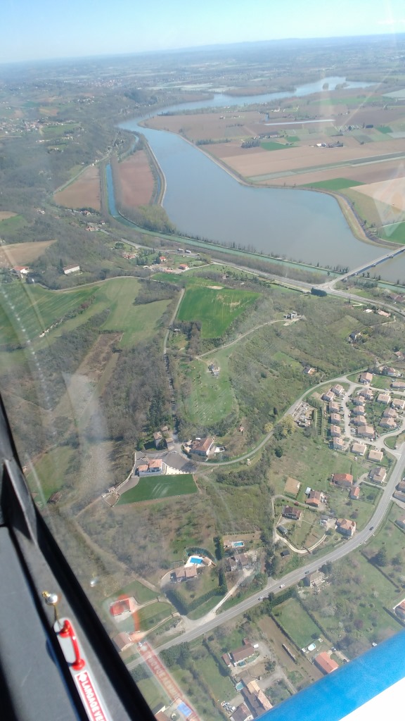
We then flew along the river Tarn until it flows into the Garonne and then the Garonne until Malause. We then knew that the phare would be to the North of the river, the canal, the railway and a secondary road. See it below.
If you haven’t been able to spot it, it’s OK. You’re not the only one. We didn’t spot it at first sight. We flew in circle to have a second chance. I reduced the speed from 190 km/h to 150 km/h, to see if at a slower speed we would see it better.
Saw it already? Not yet? Don’t worry, I didn’t either. But you see, I was at the controls, at the left side of the cockpit. But you… you have here a frozen picture, you’ve got no excuse not to see it. In fact, you’ve got the picture because Luca is starting to be a hell of a spotter.
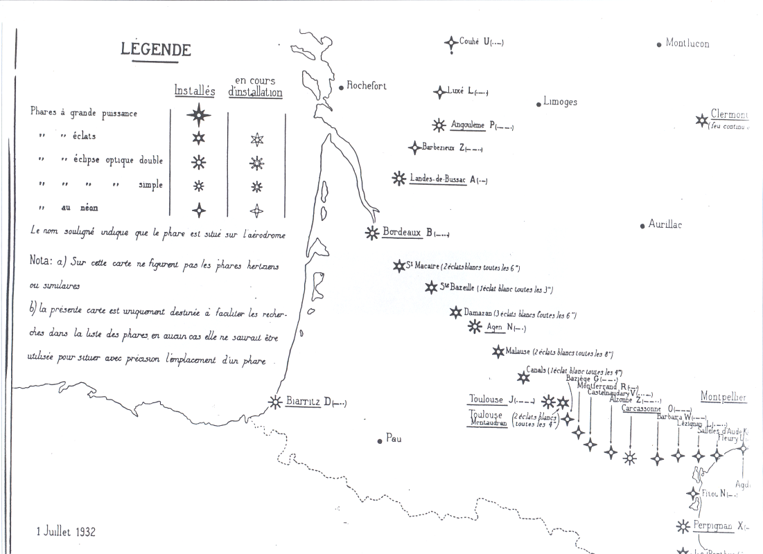
Once at home, I researched a little bit and found this local website about the phare(in French), with a couple of pictures, some data, history of these phares and a nice chart from 1932. It explains that the lighthouses started to be built in 1923 and that by 1932 there were 140 of them across France. This one at Malause was operated by the family Jolly until 1948/1949.
On the way back to the aerodrome of Toulouse-Lasbordes we passed by Moissac and Montech again and failed to spot the lighthouse of Canals again. Next time.
Finally, see below the navigation chart with the route followed marked on it. The total engine running time of the excursion: 1h15′.
—
(1) See here a post in which I described the concept of the water slope and a post about another flight excursion in which we took some more pictures of it.
Last Sunday, we took one of the aeroclub’s DR-400 airplanes to make another family flight excursion.
This time the purpose of the flight was twofold: (1) we wanted to spot a couple of phares aéronautiques, i.e., aeronautic lighthouses that were set up in 1920s to allow night flight navigation for l’Aéropostale courriers, close to Toulouse, and (2) we wanted to take benefit from a sunny day around Occitanie to make a tour around the snow-covered Pyrenees, something we already did about a year ago when we completed the route of the Cathar castles (see here a post about it).
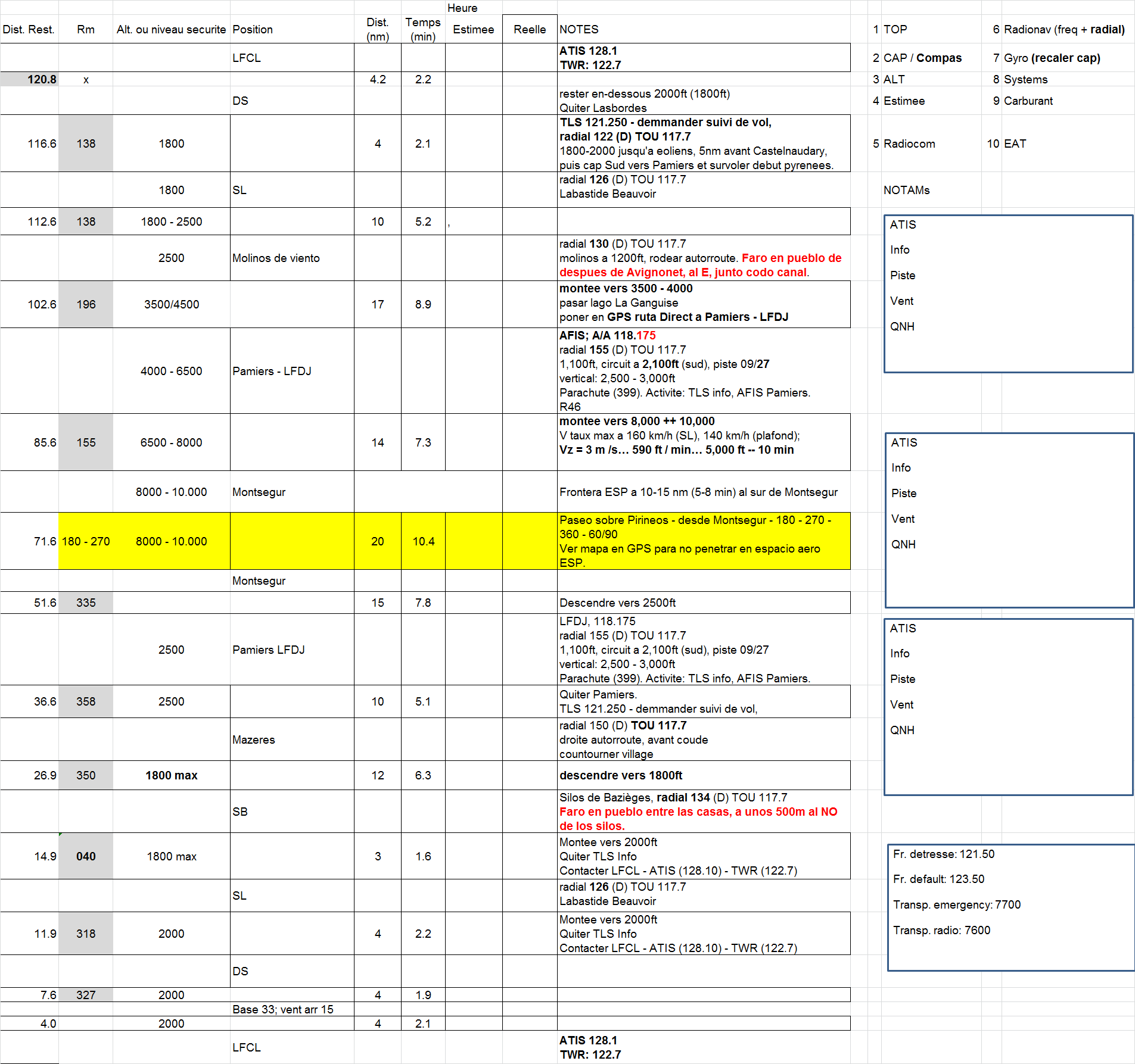
See below the quick reference paper navigation log prepared for the flight.
A few months ago, a friend of Luca, Tijmen, tipped us on the existence of these aeronautic lighthouses. See in this website a map with the precise location all of them had, including those still standing.
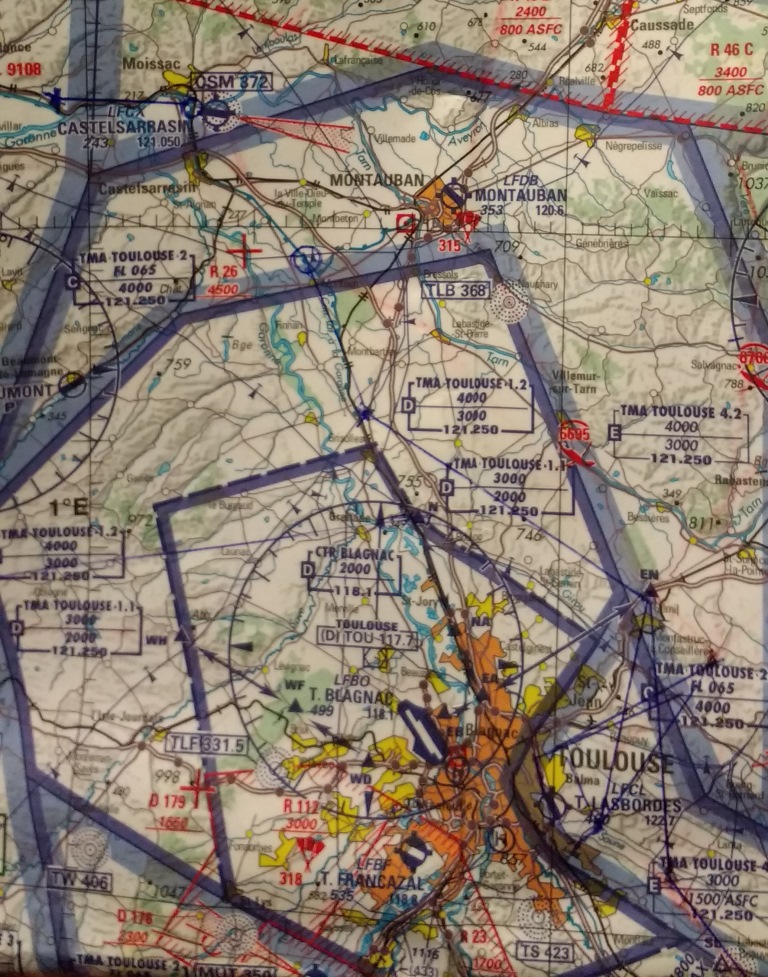
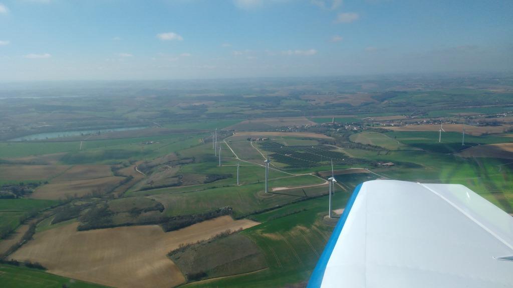
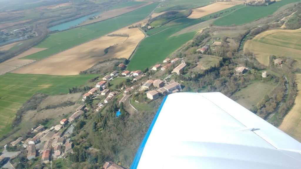
We succesfully spotted the 2 phares closest to the East of Toulouse-Lasbordes aerodrome, located in Montferrand (just to the East of the wind turbines by the A61) and Bazièges (just to the North of the silos marking the waypoint SB). See a picture of the first one below (2 houses to the left of the wing blue tip).
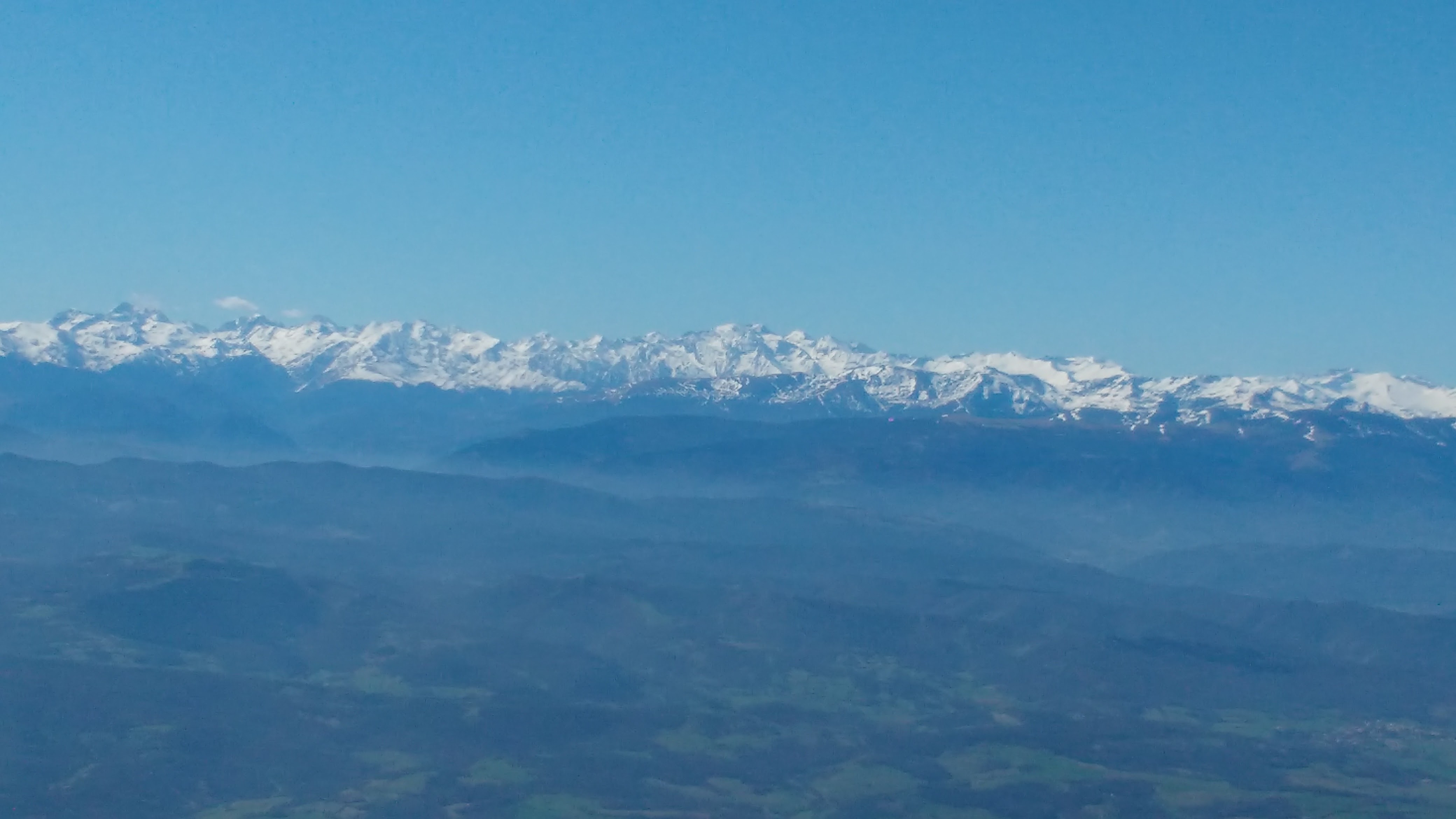
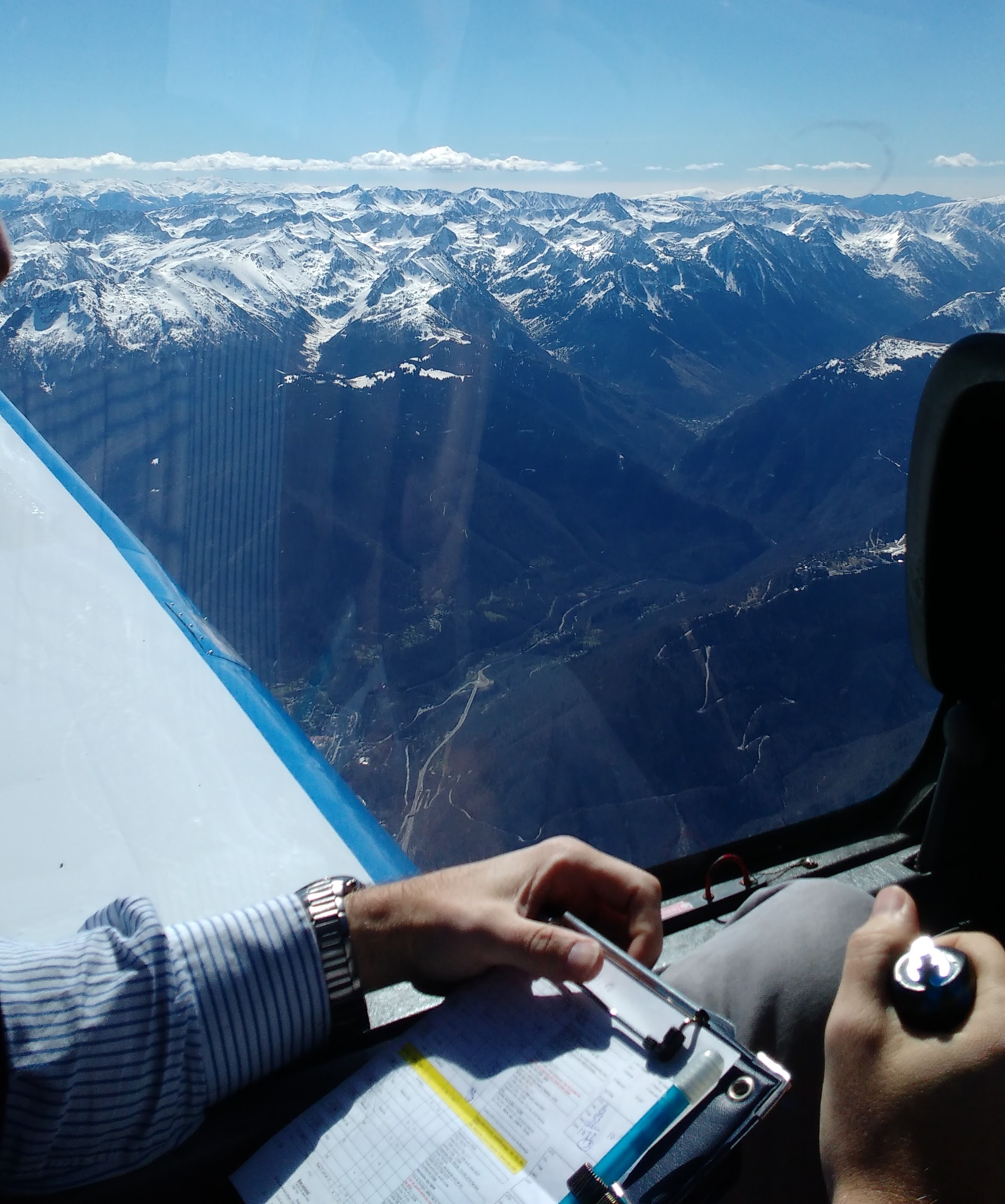
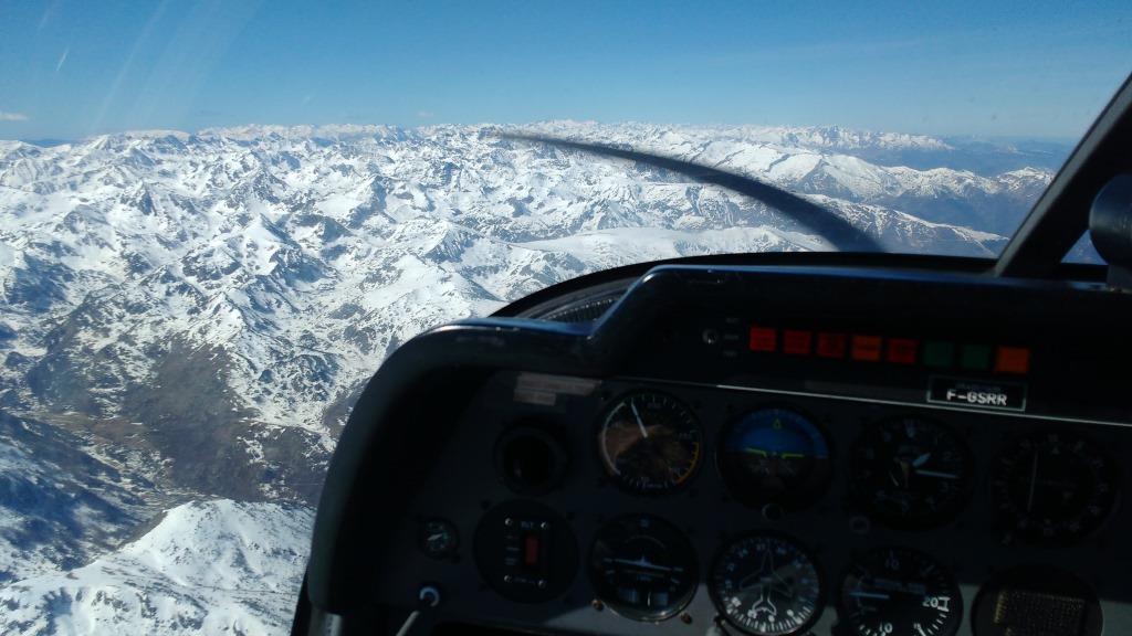
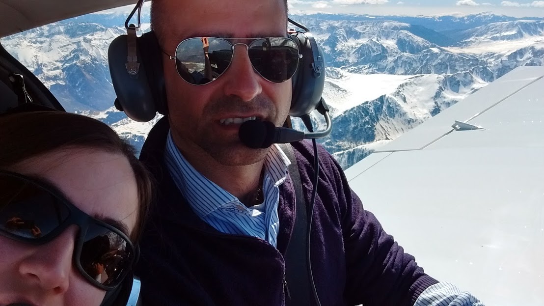
Once we had spotted the phare in Montferrand, we took to the South to start the climb to above 10,000 ft in order to fly over the Pyrenees.
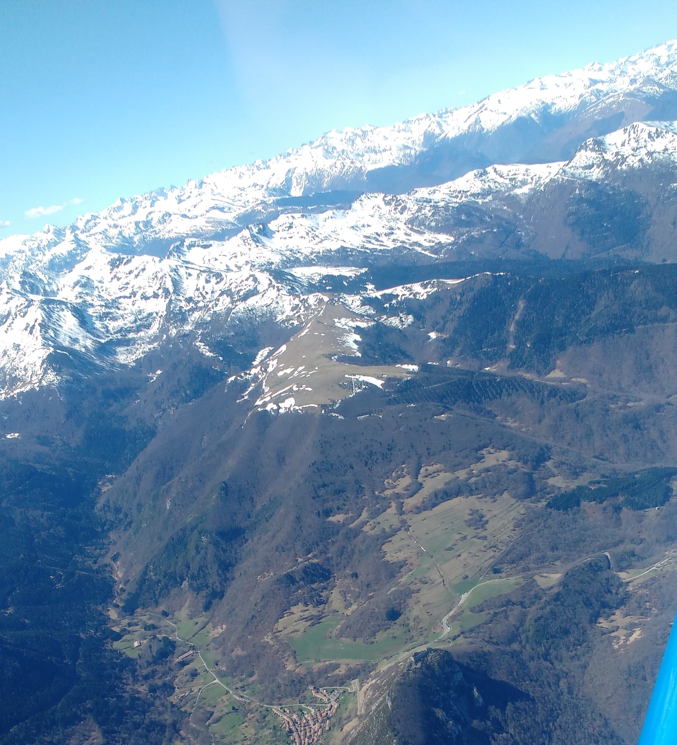
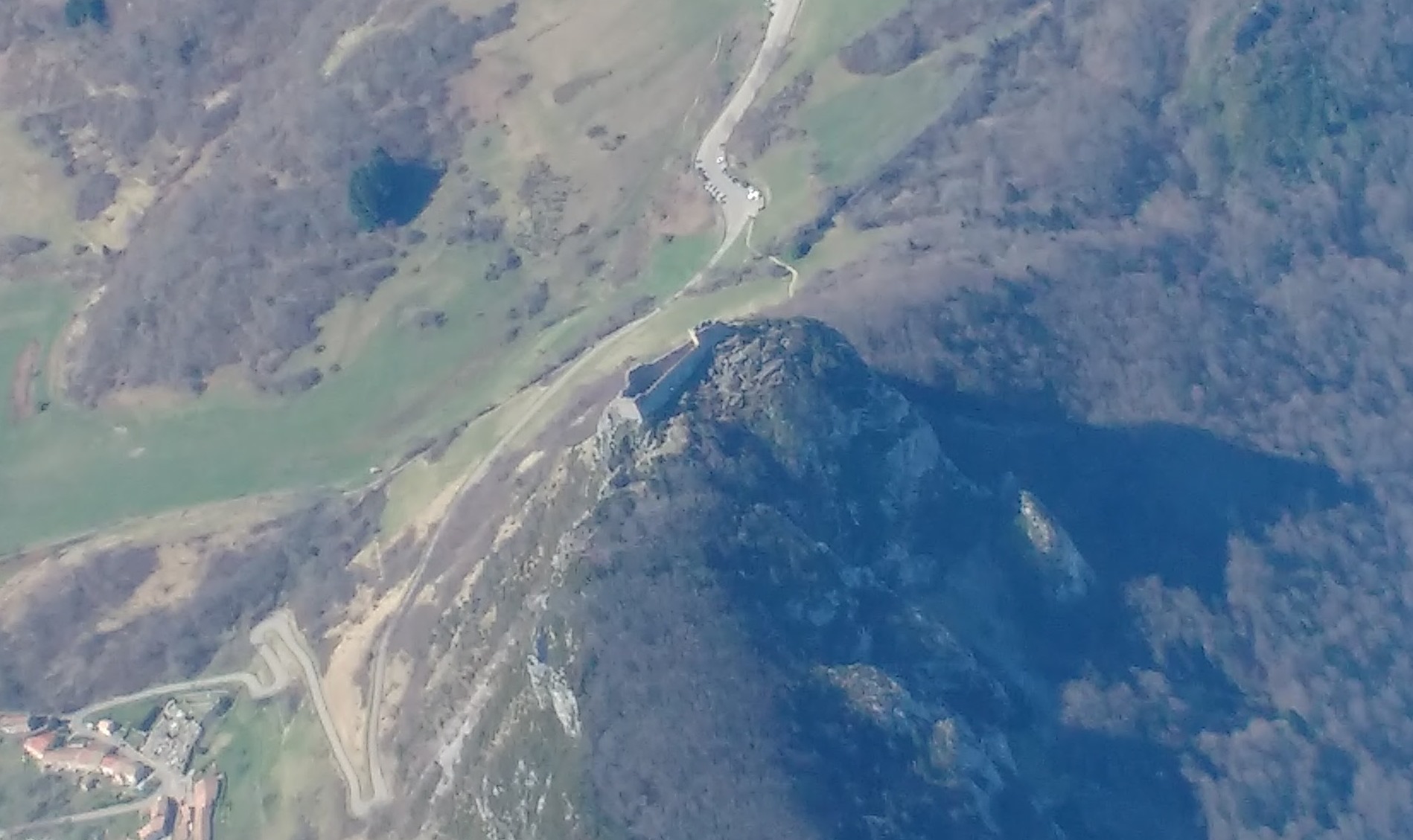
Approaching the Pyrenees, we flew over the old castle of Montsegur, which we had already seen before when we flew over the Cathar castles. See below a couple of pictures, in context and in detail.
Once up there, we just enjoyed some minutes of flying around, spotting skiing stations, seeing possible routes through the mountains towards Andorra and Spain, enjoying the breathtaking views, taking a few pictures…
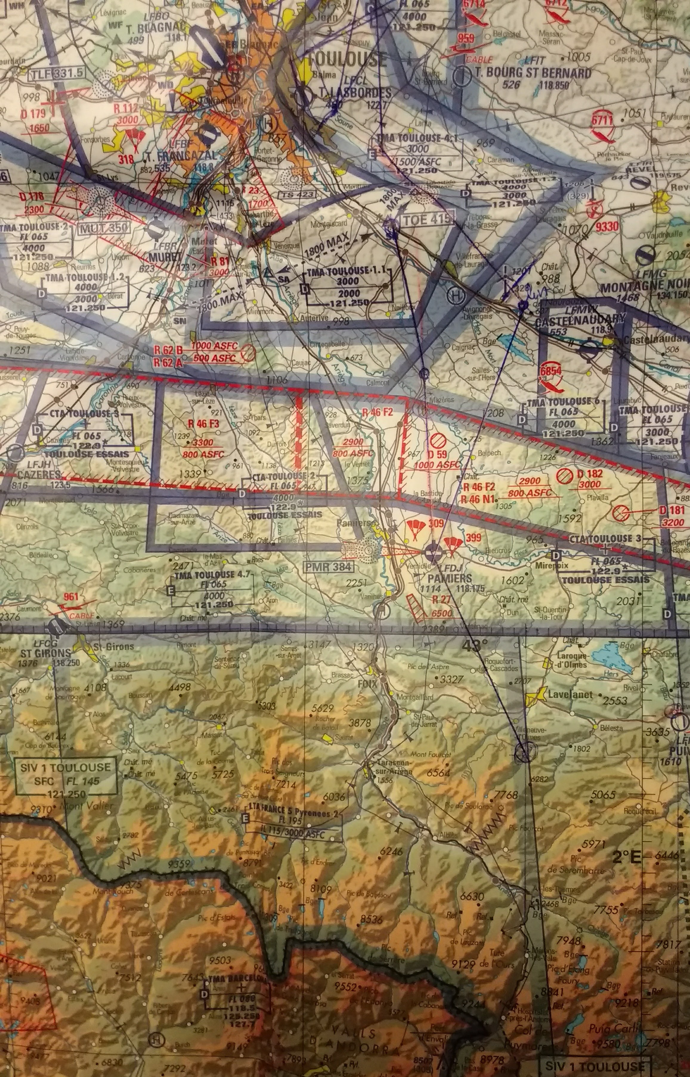
Finally, see below the navigation chart with the route followed marked on it and the navigation log as used. The total engine running time of the excursion: 1h28′.
La semaine dernière j’ai passé le contrôle de compétences linguistiques langue anglaise (FCL.055) VFR (1). Je m’avais mis cet objectif au début de l’année et au moment de démarrer avec la préparation j’avais un peu de difficulté à voir comment préparer l’examen. C’est la raison d’écrire ce petit article, pour partager les quatre ressources que j’ai utilisé.
Le site du « Ministère de l’environnement, de l’énergie et de la mer » (2) offre quelques bonnes exemples de comme le contrôle se déroulera (un exemple de vol fictif et deux exemples de écoute de bande). Je conseille de les reviser, surtout celui du vol fictif pour voir comme le scénario va être présenté au candidat.
Autres exemples d’écoute de bande. Le magazine de la Fédération Française d’Aviation, Info Pilote, a depuis des années une page dédiée à l’utilisation de l’anglais dans les communications aéronautiques.
La compilation des enregistrements de ces bandes se trouvent sur le site « Anglais pour voler ».
Des versions PDF de chaque page dédiées aux communications en anglais des différents numéros d’ Info Pilote pendant des années peuvent se trouver ici. (c’est utile si tu n’étais pas abonné au magazine il y a 10 années ou si tu ne gardes pas les vieux magazines).
Avec ces deux dernières ressources tu peux bien préparer l’exercice d’écoute de bande et voir des différents niveaux de difficulté.
Finalement, pour voir des exemples des situations inhabituelles avec des traductions proposées de français à anglais, cette autre site, Cockpitseeker, a un bonne répertoire (+300 situations).
Effort. Je m’étais mis des horaires pour étudier rigoureusement. Finalement, je n’ai pas suivi ces horaires que dans la moitié de la moitié des jours avant l’épreuve, mais j’ai bien étudié entre 12-15 heures de lecture et écoute de bande, avec un bon résultat à l’examen.
—
(1) Ancienne FCL1.028.
(2) Le nom du ministère peut changer assez suivent, je suggère de cliquer sur les liens ou faire un petit recherche sur l’internet.
(3) Pour l’inscription à l’examen, toute est bien expliqué sur le site du ministère, et la mise en œuvre d’un site internet dédié, OCEAN.


 Our Fly out was organised by a fellow British colleague, Derek. He recalled how being brought to Flying Legends as a child by his father had been a marking moment. He only came again decades later. The air show is one of the biggest and best classic aviation events in the world. If you have the chance to visit it once, do not hesitate, go.