Last Sunday, we took one of the aeroclub’s DR-400 airplanes to make another family flight excursion.
This time the purpose of the flight was twofold: (1) we wanted to spot a couple of phares aéronautiques, i.e., aeronautic lighthouses that were set up in 1920s to allow night flight navigation for l’Aéropostale courriers, close to Toulouse, and (2) we wanted to take benefit from a sunny day around Occitanie to make a tour around the snow-covered Pyrenees, something we already did about a year ago when we completed the route of the Cathar castles (see here a post about it).
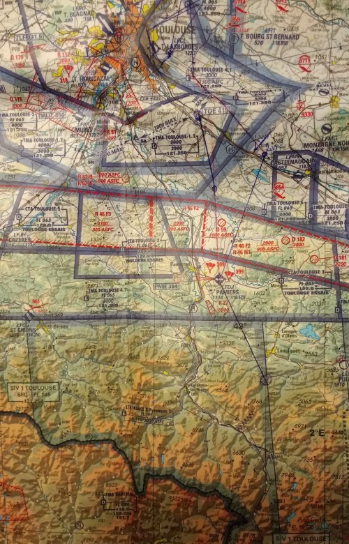
See below the quick reference paper navigation log prepared for the flight.

A few months ago, a friend of Luca, Tijmen, tipped us on the existence of these aeronautic lighthouses. See in this website a map with the precise location all of them had, including those still standing.

We succesfully spotted the 2 phares closest to the East of Toulouse-Lasbordes aerodrome, located in Montferrand (just to the East of the wind turbines by the A61) and Bazièges (just to the North of the silos marking the waypoint SB). See a picture of the first one below (2 houses to the left of the wing blue tip).


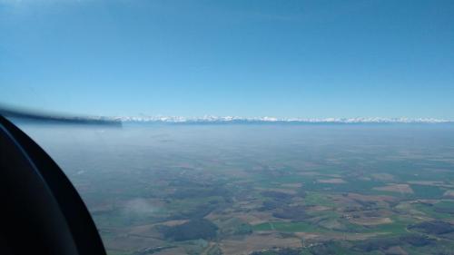
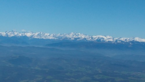
Once we had spotted the phare in Montferrand, we took to the South to start the climb to above 10,000 ft in order to fly over the Pyrenees.
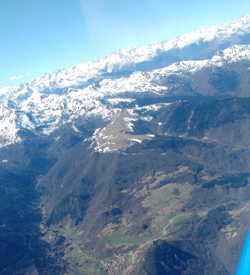
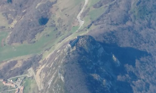
Approaching the Pyrenees, we flew over the old castle of Montsegur, which we had already seen before when we flew over the Cathar castles. See below a couple of pictures, in context and in detail.
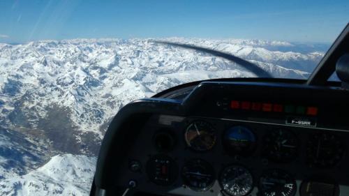
Once up there, we just enjoyed some minutes of flying around, spotting skiing stations, seeing possible routes through the mountains towards Andorra and Spain, enjoying the breathtaking views, taking a few pictures…


Finally, see below the navigation chart with the route followed marked on it and the navigation log as used. The total engine running time of the excursion: 1h28′.