Tag Archives: Montech

Flight excursion to Biscarrosse, Dune du Pilat and Cap Ferret

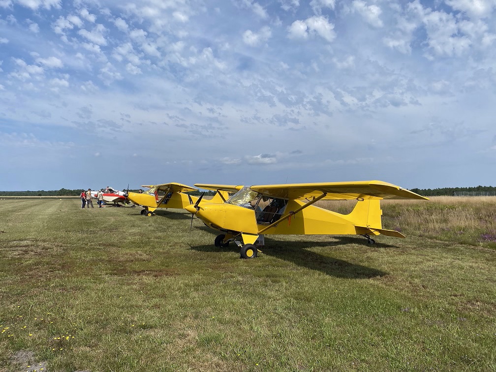
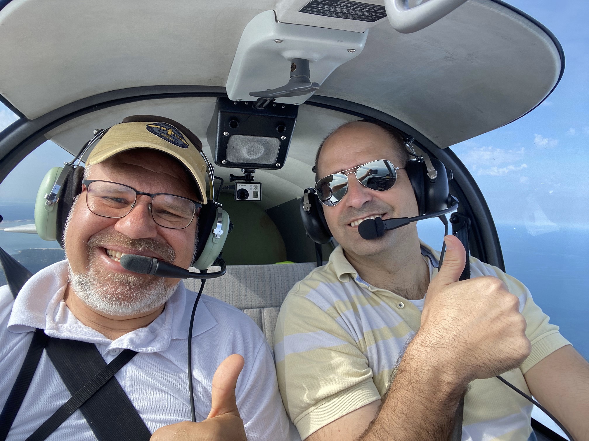
This weekend, with my work colleague Thomas and other 7 airplanes of our Aviation Society, we made a day-long flight excursion to Biscarrosse (~60km South West of Bordeaux), in order to visit its Seaplane museum (Musée de l’Hydraviation).

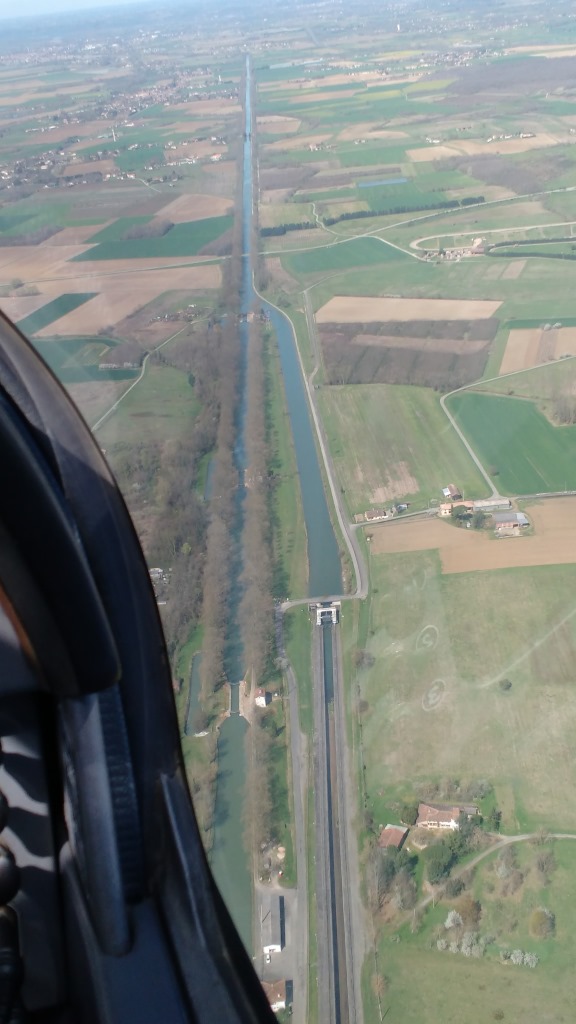
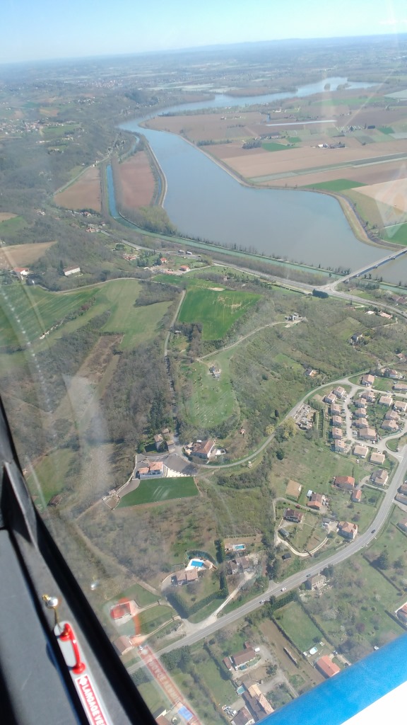
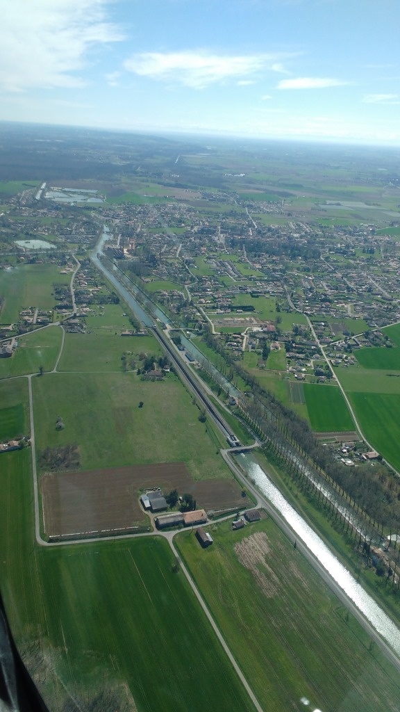
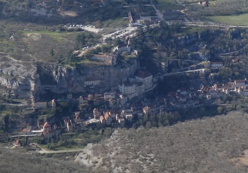
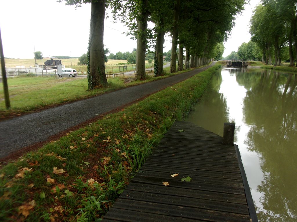
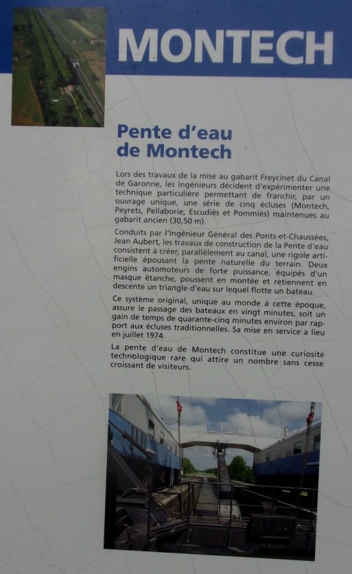
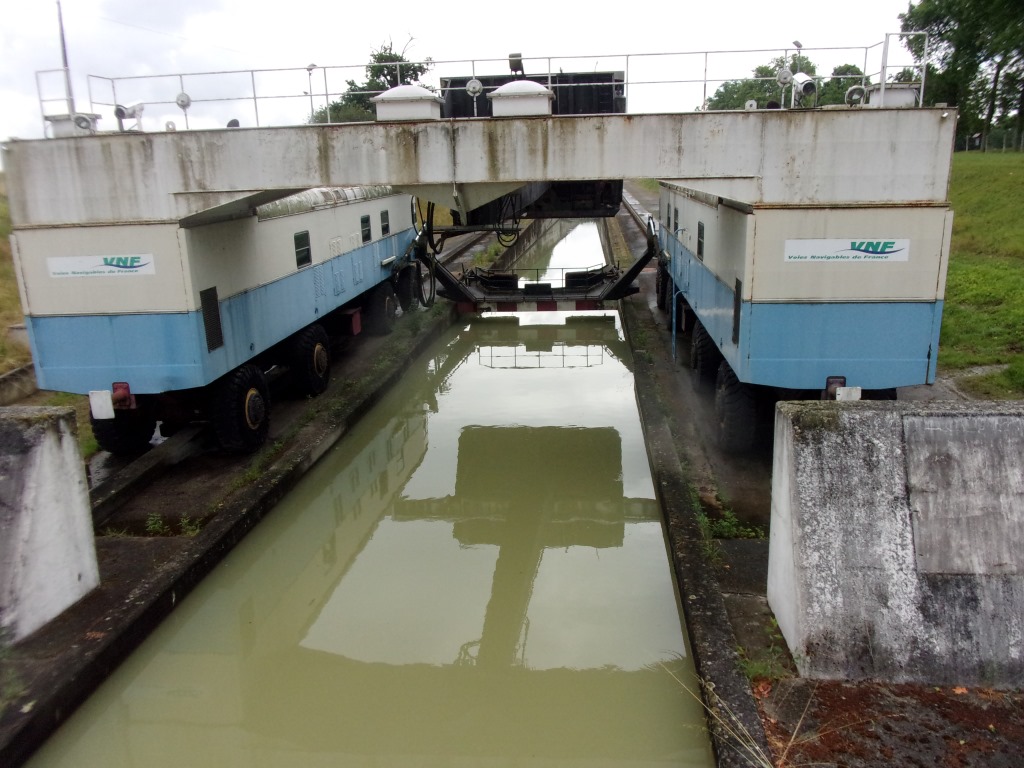
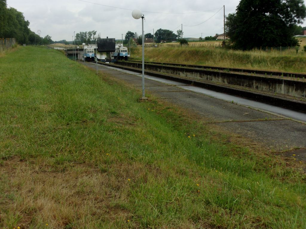
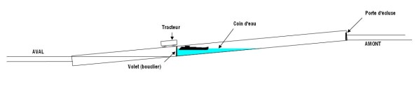
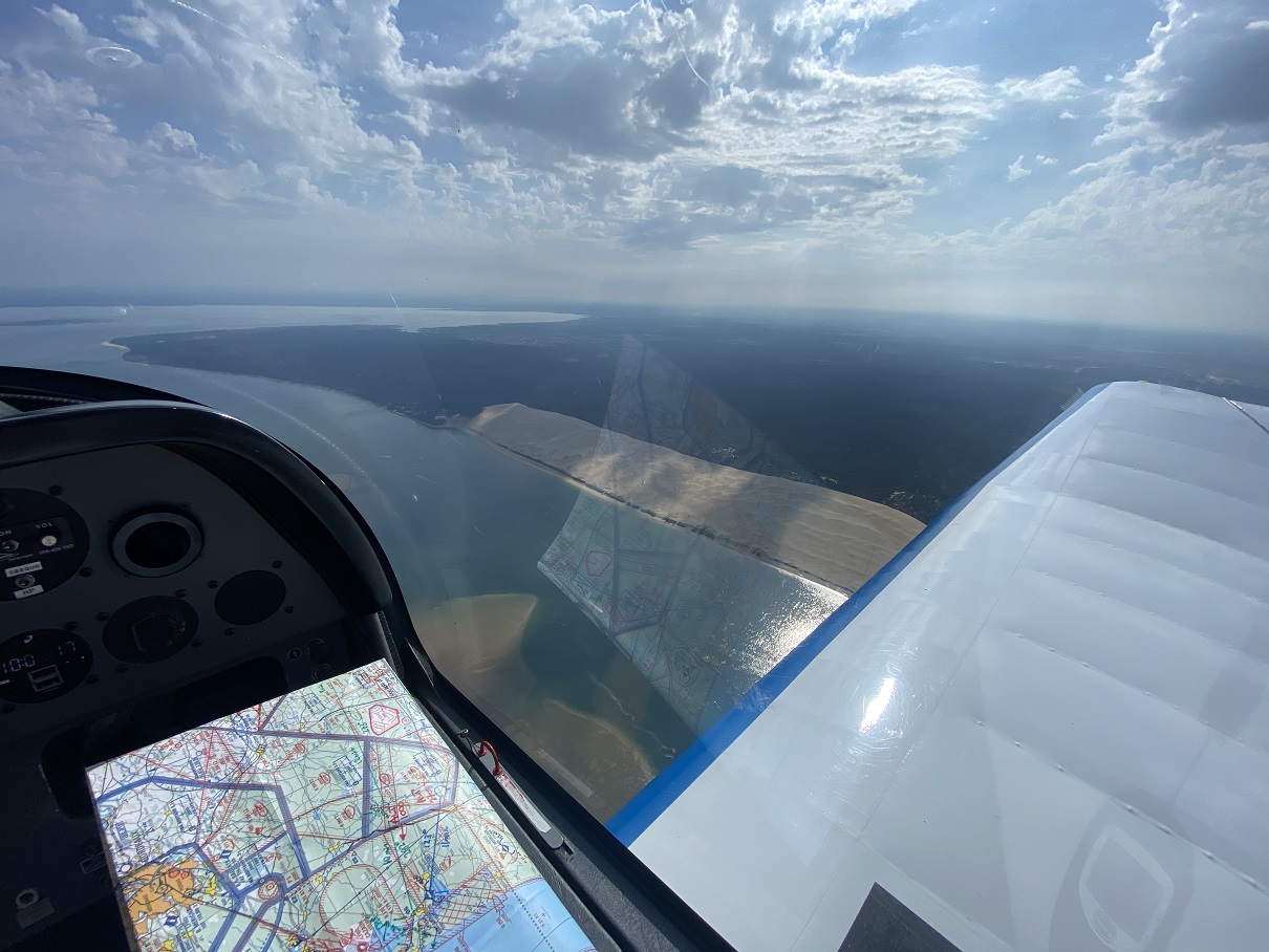
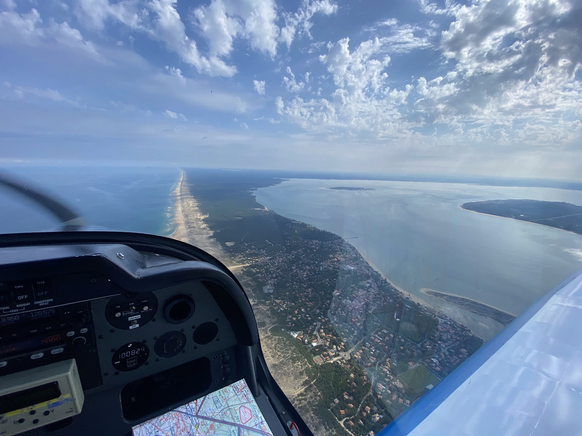
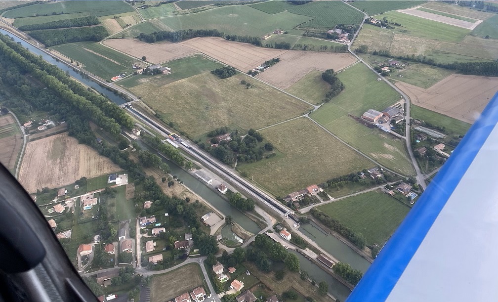
We took the opportunity of the excursion to overfly other interesting landmarks such as the water slope of Montech, the pont-canal of Moissac, the Dune of Pilat and Cap Ferret by the bay of Arcachon.

I will be short in words in this post, thus I will first show here below some of the beautiful pictures of the flight (most taken by Thomas), and at the bottom I will include a few paragraphs with the technical information of the flight in case anyone is interested in planning a similar trip, and then I will briefly comment the museum.

Cap Ferret
Dune of Pilat
Dune of Pilat
Cap Ferret and Arcachon bay
Atlantic ocean
Lakes of Biscarrosse and Cazaux
Water slope at Montech
Aviation Society airplanes parked at Biscarrosse
Thomas and me

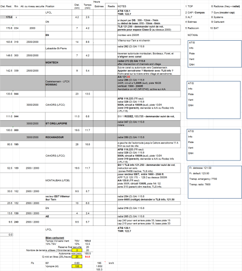
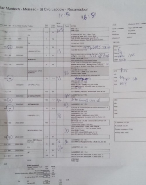
We made two flights. The first one from Toulouse Lasbordes (LFCL) to Biscarrosse Parentis (LFBS) lasted 2h05′ including the excursion to the seaside to overfly the Dune of Pilat and Cap Ferret, a detour of ~20′. The return trip took us 1h48′. Both trips could take somewhat less time if the routes were a bit more direct. We started both flights with the fuel tank full (in theory up to 109l of usable fuel) and after each flight we did refills of ~55 and 43 litres; that would mean a fuel consumption per trip of ~26.4l per hour and 23.9l per hour.

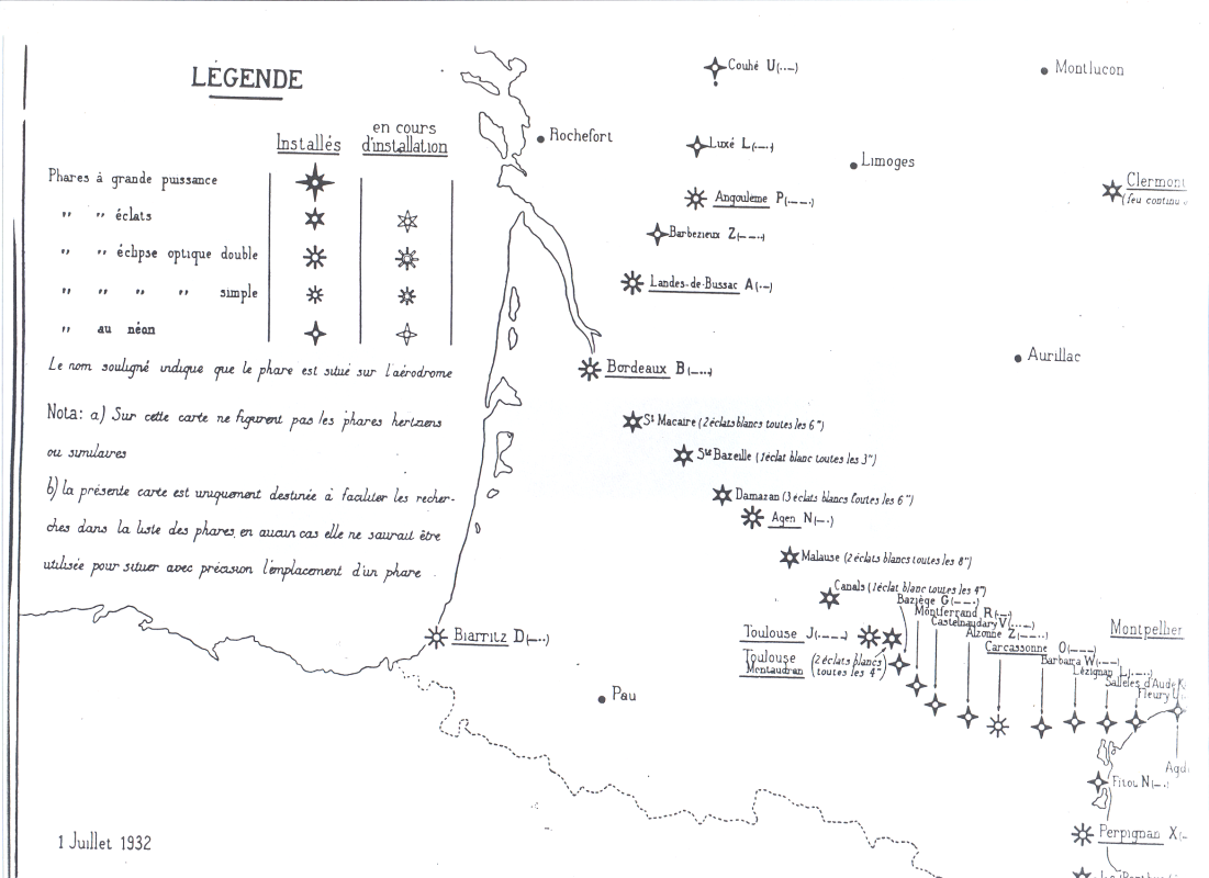
For the first flight we filed a flight plan (calling the BRIA of Bordeaux) even if not required in France (when not flying to the islands or abroad), but that eased the flying through different flight spaces, getting flight information service, traffic information, etc.

Flying around the Dune of Pilat and Arcachon bay was quite busy. We flew in the area at an altitude of ~2,500ft and below us, at around 1,000ft, we saw quite a few airplanes flying by, not all in the same radio frequency. Thus, in days of good weather that is something to watch out.

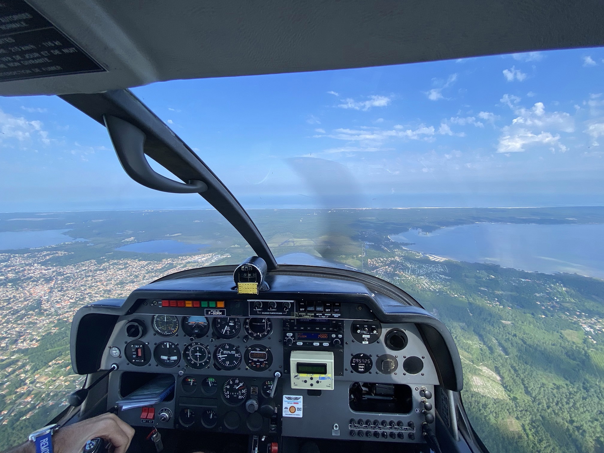
Biscarrosse-Parentis airport was also rather busy, with airplanes, ULMs, autogyros, helicopters and gliders… and seaplanes, some of them departing from the water but others from the paved runway, making use of small wheels installed in their floats. Luckily all the restricted airspace areas in the immediate surroundings of the airport were not active that day, otherwise it would have been trickier to approach the airport and be forced to fly at lower altitude.

The museum is at the other side of the village, not at walking distance. We were taken there by car by the director of the airport and his partner, thanks to their acquaintance with some of our society pilots; that helped a lot with the logistics, otherwise we would have taken taxis. There is a restaurant by the airport and another one by the museum, though we organized a picnic this time.

Musée de l’Hydraviation

At the beginning of the XX century Pierre-Georges Latécoère chose Biscarrosse to set up a seaplane assembly factory with parts coming from Toulouse. Latécoère seaplanes were among the largest French seaplanes produced (Latécoère 631) and from Biscarrosse Les Hourtiquets flying boat base departed air liners piloted by pioneers like Mermoz, Guillaumet or Saint-Exupery. Those were the days when Biscarrosse was destined to be one of the main hubs in aviation until the second world war came and aviation developed in a different path.

To celebrate those days we have this small museum and a bi-annual encounter of seaplanes that takes place in Biscarrosse.

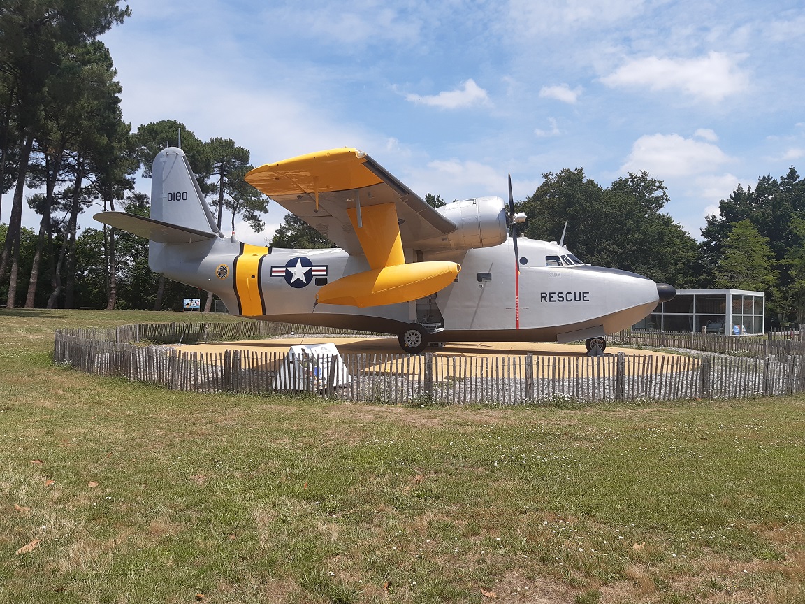
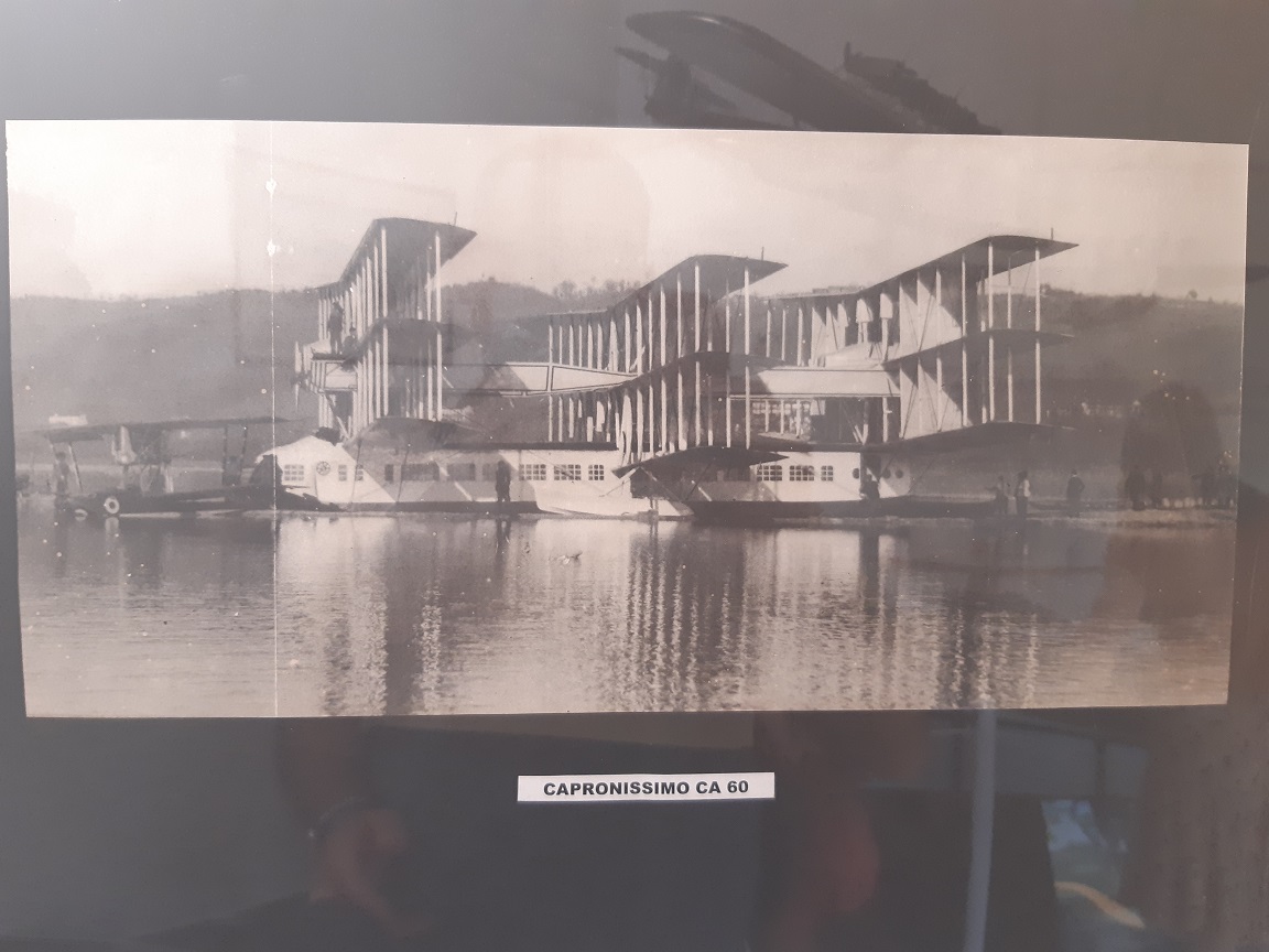
The museum takes less than 1h30′ to visit and it is mainly composed of models of the seaplanes of the early days (including the first attempts by Fabre and Curtis), the development and growth of Latécoère’s business, Boeing Clippers, the luxury of seaplane travel in those days, the role of seaplanes in the war, the dream that led to the single flight of the Hugues H-4 Hercules Spruce Goose, and today’s use of seaplanes in firefighting operations.

Grumman HU-16 Albatross
Fabre Hydravion model
Fabre Hydravion real scale model from recent years
Capronissimo CA 60
Hugues H-4 Hercules

Leave a comment

Filed under Aerospace & Defence

Flight excursion to Malause’s phare aéronautique

Last Sunday, yet again, we took one of the aeroclub’s DR-400 airplanes to make another family flight excursion.

On the occasion of the previous excursion, last week, I introduced the phares aéronautiques, i.e., aeronautic lighthouses that were set up in 1920s to allow night flight navigation for l’Aéropostale courriers. Last week we spotted a couple of them to the South East of Toulouse. This time, we wanted to spot a couple of them to the North West of Toulouse, on the way to Bordeaux, in the villages of Canals and Malause.

Last week, we prepared quite well the spotting, checking in Google maps different views of what we would try to see from the airplane so that we could easily recognise them. This time, we prepared less, just marking a cross in the map with the approximate location of the phares and hoping that we would identify the lighthouses on the ground.

Well, the task proved as difficult as finding a needle in a haystack. We missed the phare of Canals in the first leg. We then continued over flying the Canal Lateral up to the water slop of Montech (1).

montech_1

The navigation of this flight was rather simple, as once over the Canal Lateral we kept flying over it northward up to the Pont-Canal to the East of Moissac (2).

Moissac

We then flew along the river Tarn until it flows into the Garonne and then the Garonne until Malause. We then knew that the phare would be to the North of the river, the canal, the railway and a secondary road. See it below.

Malause_1

If you haven’t been able to spot it, it’s OK. You’re not the only one. We didn’t spot it at first sight. We flew in circle to have a second chance. I reduced the speed from 190 km/h to 150 km/h, to see if at a slower speed we would see it better.

Malause_2

Saw it already? Not yet? Don’t worry, I didn’t either. But you see, I was at the controls, at the left side of the cockpit. But you… you have here a frozen picture, you’ve got no excuse not to see it. In fact, you’ve got the picture because Luca is starting to be a hell of a spotter.

Malause_3

Once at home, I researched a little bit and found this local website about the phare (in French), with a couple of pictures, some data, history of these phares and a nice chart from 1932. It explains that the lighthouses started to be built in 1923 and that by 1932 there were 140 of them across France. This one at Malause was operated by the family Jolly until 1948/1949.

2012_12_30_Cartographie_Phare_St_Exupery_01

On the way back to the aerodrome of Toulouse-Lasbordes we passed by Moissac and Montech again and failed to spot the lighthouse of Canals again. Next time.

Montech_2

Finally, see below the navigation chart with the route followed marked on it. The total engine running time of the excursion: 1h15′.

Mapa

(1) See here a post in which I described the concept of the water slope and a post about another flight excursion in which we took some more pictures of it.

(2) See a post about another flight excursion in which we took some more pictures of it.

Leave a comment

Filed under Aerospace & Defence

Flight excursion to Rocamadour and Saint Cirq Lapopie, via Montech and Moissac

Rocamadour is a small village built in the gorges of a tributary to the Dordogne river. Several of its houses, churches and shops are partially built within the rocks. With about 500 inhabitants it receives 1.5 million of visitors per year, making it one of the most visited places in France and a major attraction for pilgrims, who among other things come to see a black Madonna in a chapel in the rock carved by Saint Amadour, hence the name of the village.

On the way to Rocamdour, flying from Toulouse there is Saint Cirq Lapopie, a small village built on a cliff over the river Lot. Both Rocamadour and Saint Cirq Lapopie are two of the most beautiful villages in the Midi-Pyrénées region and an obvious destination for an excursion, on the ground (which we did years ago) and flying.

Last Saturday, my father in-law and I booked a plane (a DR-400-120) at about 14:10 to fly over those places. In the way we would fly over Montech, to see the “Pente d’eau” from the sky (1), and Moissac, to see the Pont-Canal du Cacor, a bridge over the river Tarn made to allow the canal Lateral (an extension to the canal du Midi) to continue its course towards Bordeaux.

The flight would be over 175 nautical miles (over 320 km) and would last almost 2 hours with the integration to the aerodrome circuit, though in the end we spent 2 hours and 10 minutes with the rounds we made around the different spots. The navigation went rather well with no other help than the chart, compass, heading indicator and VOR (no GPS nor tablets). We had some doubts at a couple of points but we quickly found ourselves, once with the help of the controller.

Navigation log.

Navigation log.

This was the first flight in which we used the GoPRO video camera that I got last Christmas together with the suction pad to stick it to the windshield. With it we were able to have over 90 minutes of videos recorded that I have tried to shorten into the following 7 minutes:

At some points in the video the ground below seems to move slowly: we were flying at between 180 and 200 kilometres per hour, but at some 1,500 to 2,000 feet (500-700 m) above ground that is the way it feels. Be assured that the closer you get to the ground the faster it feels :-).

In the chart below you can see the route we followed: departure from Toulouse-Lasbordes (East of Toulouse), waypoint EN, Labastide-St. Pierre, Montech (South West of Montauban), Moissac (West of Castelsarrasin aerodrome), St.Cirq Lapopie (via Cahors) and Rocamadour (North West of Figeac).

Chart

Lastly, some pictures with the images of both villages and the flight log as used after the flight.

St Cirq Lapopie.

St Cirq Lapopie.

Rocamadour.

Rocamadour.

Rocamadour.

Rocamadour.

Navigation log as used after the flight.

Navigation log as used after the flight.

(1) See here a post I wrote about it.

(2) Actual engine running time: LFCL-LFCL: 2.17 FH (2h10′, with the aircraft registered as F-GORM, with an engine powered with 120 HP) (taking off and landing from runway 15).

1 Comment

Filed under Aerospace & Defence, France, Travelling

Montech water slope (Pente d’eau) at Canal du Midi

The Canal du Midi (1) connects the Mediterranean sea with the Atlantic Ocean. It was built at the end of the XVII century under the supervision of Pierre-Paul Riquet. At the time it was one of the most remarkable civil engineering works and that has deserved its recognition as an UNESCO World Heritage Site.

Along the canal there are plenty of beautiful spots and some oddities. Some weeks ago, we visited one of the latter ones: the Pente d’eau of Montech, that is, a water slope. What is a water slope?

When two water streams at different heights need to be connected we are used to see water locks (think of the Panama Canal, or Suez). In the Canal du Midi there are dozens of locks (65 to be precise). However, engineers in the 1970s employed a time-saving different approach. Instead of having the boats go through 5 such locks at Montech they constructed in parallel a water slope, thus saving 45 minutes in the route.

Canal du Midi to the right, water slope to the left.

Canal du Midi to the right, water slope to the left.

See below the panel with the explanation of the concept at Montech:

Explanation of the water slope (in French).

Explanation of the water slope (in French).

See here the explanation given by the Wikipedia.

See below a couple of pictures showing the diesel locomotives and the canal.

See here a good scheme to ease the visualization of the concept prepared by the L’Association Culture Loisirs Entente Sport (LACLES, see here their blog post with the complete explanation).

Water slope scheme (prepared by L'Association Culture Loisirs Entente Sport)

Water slope scheme (prepared by L’Association Culture Loisirs Entente Sport)

Unfortunately, the water slope is not working nowadays. Nevertheless it’s worth a visit to the place, to get a glimpse of such an engineering feat.

(1) To be precise the Canal du Midi (originally named “Canal royal en Languedoc”) connects the Mediterranean sea with the river Garonne in Toulouse. From there, another canal, the “Canal Latéral de la Garonne” makes the connection to the Garonne itself at Bordeaux, where it is navigable down to the Atlantic Ocean. The combination of both canals is called “Canal des Deux Mers“.

3 Comments

Filed under France